![](/images/other/stat-length.png)
![Randonnée Marche Puymoyen - Puymoyen, vallée des eaux-claires - Photo](https://media.geolcdn.com/t/1900/400/ext.pjpeg?maxdim=2&url=https%3A%2F%2Fservices.sitytrail.com%2FGeolivesWS%2FDownloadMedia.ashx%3FTrailID%3D481379%26Media%3D20151008153312.jpg)
Puymoyen, vallée des eaux-claires
dorcier
Utilisateur
![Longueur](/images/other/stat-length.png)
Longueur
9,6 km
![Altitude max](https://static1.geolcdn.com/siteimages/upload/files/1508320355ic_sort_altitude_max_24dp.png)
Altitude max
141 m
![Dénivelé positif](https://static1.geolcdn.com/siteimages/upload/files/1508320355ic_sort_den_pos_24dp.png)
Dénivelé positif
177 m
![Km-Effort](/images/other/stat-length.png)
Km-Effort
11,9 km
![Altitude min](https://static1.geolcdn.com/siteimages/upload/files/1508320355ic_sort_altitude_min_24dp.png)
Altitude min
61 m
![Dénivelé négatif](https://static1.geolcdn.com/siteimages/upload/files/1508320355ic_sort_den_neg_24dp.png)
Dénivelé négatif
177 m
![Boucle](https://static1.geolcdn.com/siteimages/upload/files/16400158638029165_repeat_loop_refresh_sync_direction_icon.png)
Boucle
Oui
Date de création :
2015-10-12 00:00:00.0
Dernière modification :
2015-10-12 00:00:00.0
![Marche](https://static1.geolcdn.com/sitytour/trail-icons/101.png)
2h50
Difficulté : Facile
![Scannez ce code QR pour ouvrir la randonnée dans l'application SityTrail](https://capi.geolives.com/qq0zvz2zws4bq2lad0pu/sitytour/trails/481379/qr.png?size=200)
Application GPS de randonnée GRATUITE
À propos
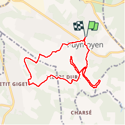
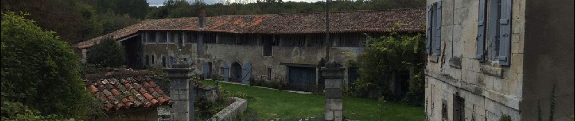
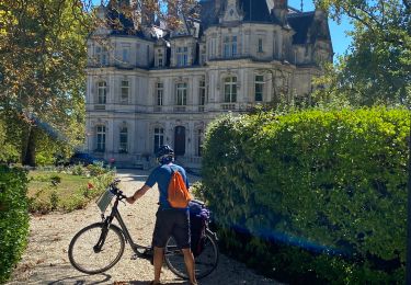
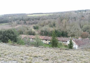
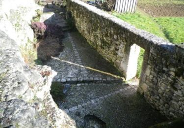
Randonnée Marche de 9,6 km à découvrir à Nouvelle-Aquitaine, Charente, Puymoyen. Cette randonnée est proposée par dorcier.
Description
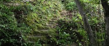
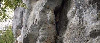
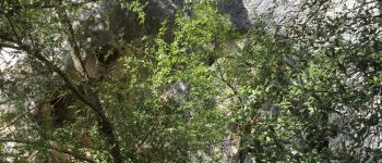
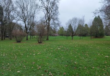
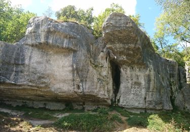
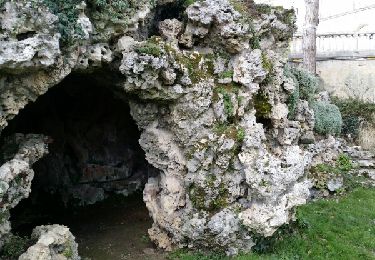
Promenade très agréable, au sommet et au pied des falaises de la vallée des eaux-claires.
Départ parking de la salle des fêtes de Puymoyen
Localisation
Pays :
France
Région :
Nouvelle-Aquitaine
Département/Province :
Charente
Commune :
Puymoyen
Localité :
Unknown
Départ:(Dec)
Départ:(UTM)
280185 ; 5055274 (31T) N.
Commentaires
Randonnées à proximité
![Randonnée Marche Angoulême - La Coulée Verte à Angoulème - Photo](https://media.geolcdn.com/t/375/260/ext.jpg?maxdim=2&url=https%3A%2F%2Fstatic1.geolcdn.com%2Fsiteimages%2Fupload%2Ffiles%2F1553511878bg_sport_marche.png)
![Marche Marche](https://static1.geolcdn.com/sitytour/trail-icons/101.png)
La Coulée Verte à Angoulème
Marche
Moyen
(1)
Angoulême,
Nouvelle-Aquitaine,
Charente,
France
![](/images/other/stat-length.png)
21 km | 25 km-effort
3h 0min
![](https://static1.geolcdn.com/siteimages/upload/files/16400158638029165_repeat_loop_refresh_sync_direction_icon.png)
Oui
![Randonnée Marche Angoulême - La rando d'Angoulême entre ville et campagne - Photo](https://media.geolcdn.com/t/375/260/85816ded-d784-45f0-a081-8c46f463d72d.jpg&format=jpg&maxdim=2)
![Marche Marche](https://static1.geolcdn.com/sitytour/trail-icons/101.png)
La rando d'Angoulême entre ville et campagne
Marche
Moyen
Angoulême,
Nouvelle-Aquitaine,
Charente,
France
![](/images/other/stat-length.png)
8,1 km | 9,9 km-effort
2h 59min
![](https://static1.geolcdn.com/siteimages/upload/files/16400158638029165_repeat_loop_refresh_sync_direction_icon.png)
Oui
![Randonnée Marche Puymoyen - Puymoyen vallée des eaux claires par centre équestre élevage de cerfs - Photo](https://media.geolcdn.com/t/375/260/7be0dd57-0a78-479d-9db8-c66cc47fde9f.jpg&format=jpg&maxdim=2)
![Marche Marche](https://static1.geolcdn.com/sitytour/trail-icons/101.png)
Puymoyen vallée des eaux claires par centre équestre élevage de cerfs
Marche
Facile
(1)
Puymoyen,
Nouvelle-Aquitaine,
Charente,
France
![](/images/other/stat-length.png)
10,2 km | 13,1 km-effort
2h 29min
![](https://static1.geolcdn.com/siteimages/upload/files/16400158638029165_repeat_loop_refresh_sync_direction_icon.png)
Oui
![Randonnée Marche Angoulême - La découverte d'Angoulême en partant du parc de Fregneuil - Photo](https://media.geolcdn.com/t/375/260/ext.jpg?maxdim=2&url=https%3A%2F%2Fservices.sitytrail.com%2FGeolivesWS%2FDownloadMedia.ashx%3FTrailID%3D848534%26Media%3Dfix__20171019161538.jpg)
![Marche Marche](https://static1.geolcdn.com/sitytour/trail-icons/101.png)
La découverte d'Angoulême en partant du parc de Fregneuil
Marche
Facile
Angoulême,
Nouvelle-Aquitaine,
Charente,
France
![](/images/other/stat-length.png)
8,9 km | 10,5 km-effort
2h 58min
![](https://static1.geolcdn.com/siteimages/upload/files/16400158638029165_repeat_loop_refresh_sync_direction_icon.png)
Oui
![Randonnée Autre activité Soyaux - ff - Photo](https://media.geolcdn.com/t/375/260/ext.jpg?maxdim=2&url=https%3A%2F%2Fstatic1.geolcdn.com%2Fsiteimages%2Fupload%2Ffiles%2F1545311037marcheuse_200dpi.jpg)
![Autre activité Autre activité](https://static1.geolcdn.com/sitytour/trail-icons/900.png)
ff
Autre activité
Très facile
(2)
Soyaux,
Nouvelle-Aquitaine,
Charente,
France
![](/images/other/stat-length.png)
12,9 km | 15,5 km-effort
2h 36min
![](https://static1.geolcdn.com/siteimages/upload/files/16400158638029165_repeat_loop_refresh_sync_direction_icon.png)
Oui
![Randonnée Marche Angoulême - De saint Cybard à Fléac - Photo](https://media.geolcdn.com/t/375/260/ext.jpg?maxdim=2&url=https%3A%2F%2Fservices.sitytrail.com%2FGeolivesWS%2FDownloadMedia.ashx%3FTrailID%3D383416%26Media%3Dfix__20150205155304.jpg)
![Marche Marche](https://static1.geolcdn.com/sitytour/trail-icons/101.png)
De saint Cybard à Fléac
Marche
Très facile
Angoulême,
Nouvelle-Aquitaine,
Charente,
France
![](/images/other/stat-length.png)
11,4 km | 13,5 km-effort
2h 55min
![](https://static1.geolcdn.com/siteimages/upload/files/16400158638029165_repeat_loop_refresh_sync_direction_icon.png)
Non
![Randonnée Vélo électrique Angoulême - Angoulême -Cognac 11/09/22 - Photo](https://media.geolcdn.com/t/375/260/60b5f56b-92a8-4b83-9656-8a318617c85e.jpg&format=jpg&maxdim=2)
![Vélo électrique Vélo électrique](https://static1.geolcdn.com/sitytour/trail-icons/205.png)
Angoulême -Cognac 11/09/22
Vélo électrique
Facile
Angoulême,
Nouvelle-Aquitaine,
Charente,
France
![](/images/other/stat-length.png)
68 km | 74 km-effort
4h 54min
![](https://static1.geolcdn.com/siteimages/upload/files/16400158638029165_repeat_loop_refresh_sync_direction_icon.png)
Non
![Randonnée Marche Puymoyen - La vallée des Eaux claires - Photo](https://media.geolcdn.com/t/375/260/ext.jpg?maxdim=2&url=https%3A%2F%2Fservices.sitytrail.com%2FGeolivesWS%2FDownloadMedia.ashx%3FTrailID%3D533119%26Media%3Dfix__20160303145154.jpg)
![Marche Marche](https://static1.geolcdn.com/sitytour/trail-icons/101.png)
La vallée des Eaux claires
Marche
Facile
Puymoyen,
Nouvelle-Aquitaine,
Charente,
France
![](/images/other/stat-length.png)
9,2 km | 11,1 km-effort
2h 36min
![](https://static1.geolcdn.com/siteimages/upload/files/16400158638029165_repeat_loop_refresh_sync_direction_icon.png)
Oui
![Randonnée V.T.T. Soyaux - Vallée de l'Anguienne - Soyaux - Photo](https://media.geolcdn.com/t/375/260/ext.jpg?maxdim=2&url=https%3A%2F%2Fservices.sitytrail.com%2FGeolivesWS%2FDownloadMedia.ashx%3FTrailID%3D172991%26Media%3D14487_2.jpg)
![V.T.T. V.T.T.](https://static1.geolcdn.com/sitytour/trail-icons/202.png)
Vallée de l'Anguienne - Soyaux
V.T.T.
Difficile
Soyaux,
Nouvelle-Aquitaine,
Charente,
France
![](/images/other/stat-length.png)
26 km | 32 km-effort
2h 0min
![](https://static1.geolcdn.com/siteimages/upload/files/16400158638029165_repeat_loop_refresh_sync_direction_icon.png)
Oui