![](/images/other/stat-length.png)
![Randonnée Marche Brestot - Chemin du Val Dallet - Photo](https://media.geolcdn.com/t/1900/400/ext.pjpeg?maxdim=2&url=https%3A%2F%2Fstatic1.geolcdn.com%2Fsiteimages%2Fupload%2Ffiles%2F1553511878bg_sport_marche.png)
Chemin du Val Dallet
dominiquelouis
Utilisateur
![Longueur](/images/other/stat-length.png)
Longueur
16,1 km
![Altitude max](https://static1.geolcdn.com/siteimages/upload/files/1508320355ic_sort_altitude_max_24dp.png)
Altitude max
139 m
![Dénivelé positif](https://static1.geolcdn.com/siteimages/upload/files/1508320355ic_sort_den_pos_24dp.png)
Dénivelé positif
221 m
![Km-Effort](/images/other/stat-length.png)
Km-Effort
19 km
![Altitude min](https://static1.geolcdn.com/siteimages/upload/files/1508320355ic_sort_altitude_min_24dp.png)
Altitude min
51 m
![Dénivelé négatif](https://static1.geolcdn.com/siteimages/upload/files/1508320355ic_sort_den_neg_24dp.png)
Dénivelé négatif
222 m
![Boucle](https://static1.geolcdn.com/siteimages/upload/files/16400158638029165_repeat_loop_refresh_sync_direction_icon.png)
Boucle
Oui
Date de création :
2015-10-06 00:00:00.0
Dernière modification :
2015-10-06 00:00:00.0
![Marche](https://static1.geolcdn.com/sitytour/trail-icons/101.png)
4h10
Difficulté : Difficile
![Scannez ce code QR pour ouvrir la randonnée dans l'application SityTrail](https://capi.geolives.com/qq0zvz2zws4bq2lad0pu/sitytour/trails/479308/qr.png?size=200)
Application GPS de randonnée GRATUITE
À propos
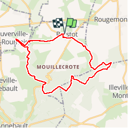
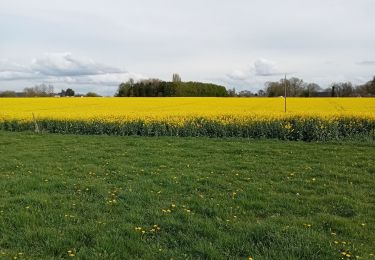
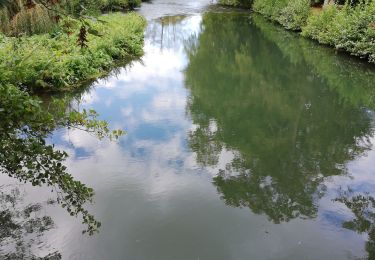
Randonnée Marche de 16,1 km à découvrir à Normandie, Eure, Brestot. Cette randonnée est proposée par dominiquelouis.
Description
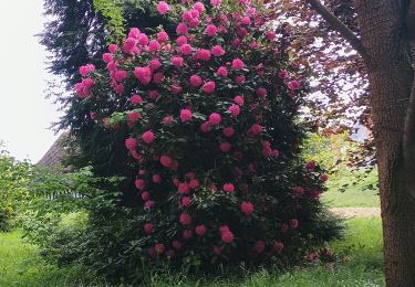
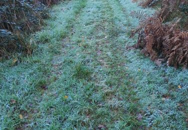
Proche de la vallée de la Risle en Normandie, une randonnée pédestre sportive de 16 km révèle un vallon bocager bien préservé et une partie peu connue de la forêt domaniale de Montfort
Localisation
Pays :
France
Région :
Normandie
Département/Province :
Eure
Commune :
Brestot
Localité :
Unknown
Départ:(Dec)
Départ:(UTM)
331843 ; 5469182 (31U) N.
Commentaires
Randonnées à proximité
![Randonnée Marche Illeville-sur-Montfort - Illeville sur Montfort - Le circuit des Jacinthes - La Ferme de Fourges - Photo](https://media.geolcdn.com/t/375/260/3f49af04-1319-456c-9456-ec8bbc5a3b82.jpg&format=jpg&maxdim=2)
![Marche Marche](https://static1.geolcdn.com/sitytour/trail-icons/101.png)
Illeville sur Montfort - Le circuit des Jacinthes - La Ferme de Fourges
Marche
Difficile
(1)
Illeville-sur-Montfort,
Normandie,
Eure,
France
![](/images/other/stat-length.png)
12,3 km | 14,4 km-effort
3h 13min
![](https://static1.geolcdn.com/siteimages/upload/files/16400158638029165_repeat_loop_refresh_sync_direction_icon.png)
Oui
![Randonnée Marche Illeville-sur-Montfort - Illeville-sur-Monfort - Le circuit des Jacinthes - Photo](https://media.geolcdn.com/t/375/260/4ad22c83-41bc-47e4-95e1-447b2054afca.jpg&format=jpg&maxdim=2)
![Marche Marche](https://static1.geolcdn.com/sitytour/trail-icons/101.png)
Illeville-sur-Monfort - Le circuit des Jacinthes
Marche
Difficile
(2)
Illeville-sur-Montfort,
Normandie,
Eure,
France
![](/images/other/stat-length.png)
12,3 km | 14,5 km-effort
3h 8min
![](https://static1.geolcdn.com/siteimages/upload/files/16400158638029165_repeat_loop_refresh_sync_direction_icon.png)
Oui
![Randonnée Marche La Haye-Aubrée - La Haye Aubrée - Le chemin aux Anes- Version 03-04 - Photo](https://media.geolcdn.com/t/375/260/39d82811-b877-4248-9e61-2979148c8df2.jpg&format=jpg&maxdim=2)
![Marche Marche](https://static1.geolcdn.com/sitytour/trail-icons/101.png)
La Haye Aubrée - Le chemin aux Anes- Version 03-04
Marche
Difficile
La Haye-Aubrée,
Normandie,
Eure,
France
![](/images/other/stat-length.png)
12,7 km | 14,8 km-effort
3h 19min
![](https://static1.geolcdn.com/siteimages/upload/files/16400158638029165_repeat_loop_refresh_sync_direction_icon.png)
Oui
![Randonnée Marche Routot - Routot , Croix - Sainte-Marie , La Haie de Routot - Photo](https://media.geolcdn.com/t/375/260/674acfee-f83f-475c-97db-50c68854b132.jpg&format=jpg&maxdim=2)
![Marche Marche](https://static1.geolcdn.com/sitytour/trail-icons/101.png)
Routot , Croix - Sainte-Marie , La Haie de Routot
Marche
Difficile
Routot,
Normandie,
Eure,
France
![](/images/other/stat-length.png)
13,7 km | 15,6 km-effort
4h 5min
![](https://static1.geolcdn.com/siteimages/upload/files/16400158638029165_repeat_loop_refresh_sync_direction_icon.png)
Oui
![Randonnée Marche Bourneville-Sainte-Croix - Bourneville-sainte-Croix- Le petit Brotonne - Photo](https://media.geolcdn.com/t/375/260/f3ccac4c-21c3-4eb7-b8a8-bd0b0eee06ac.jpg&format=jpg&maxdim=2)
![Marche Marche](https://static1.geolcdn.com/sitytour/trail-icons/101.png)
Bourneville-sainte-Croix- Le petit Brotonne
Marche
Difficile
Bourneville-Sainte-Croix,
Normandie,
Eure,
France
![](/images/other/stat-length.png)
14,1 km | 16,2 km-effort
3h 23min
![](https://static1.geolcdn.com/siteimages/upload/files/16400158638029165_repeat_loop_refresh_sync_direction_icon.png)
Oui
![Randonnée Marche Colletot - Colletot à Corneille sur Risle - Photo](https://media.geolcdn.com/t/375/260/85510aa2-db3d-4ccb-b361-44d57952fb06.jpg&format=jpg&maxdim=2)
![Marche Marche](https://static1.geolcdn.com/sitytour/trail-icons/101.png)
Colletot à Corneille sur Risle
Marche
Difficile
(1)
Colletot,
Normandie,
Eure,
France
![](/images/other/stat-length.png)
11,3 km | 13,4 km-effort
2h 50min
![](https://static1.geolcdn.com/siteimages/upload/files/16400158638029165_repeat_loop_refresh_sync_direction_icon.png)
Oui
![Randonnée Marche Cauverville-en-Roumois - Cauverville en Roumois - Le chemin du chênede la Vierge - Photo](https://media.geolcdn.com/t/375/260/848c1a14-2520-4048-b5ca-f7b5c61c1edf.jpg&format=jpg&maxdim=2)
![Marche Marche](https://static1.geolcdn.com/sitytour/trail-icons/101.png)
Cauverville en Roumois - Le chemin du chênede la Vierge
Marche
Difficile
(1)
Cauverville-en-Roumois,
Normandie,
Eure,
France
![](/images/other/stat-length.png)
11,7 km | 13,9 km-effort
3h 6min
![](https://static1.geolcdn.com/siteimages/upload/files/16400158638029165_repeat_loop_refresh_sync_direction_icon.png)
Oui
![Randonnée Marche Appeville-Annebault - Appeville Annebault - Photo](https://media.geolcdn.com/t/375/260/1129d546-4635-4e2a-ba5f-33c44de23099.jpg&format=jpg&maxdim=2)
![Marche Marche](https://static1.geolcdn.com/sitytour/trail-icons/101.png)
Appeville Annebault
Marche
Moyen
(1)
Appeville-Annebault,
Normandie,
Eure,
France
![](/images/other/stat-length.png)
26 km | 33 km-effort
4h 42min
![](https://static1.geolcdn.com/siteimages/upload/files/16400158638029165_repeat_loop_refresh_sync_direction_icon.png)
Oui
![Randonnée Marche Appeville-Annebault - appeville - Photo](https://media.geolcdn.com/t/375/260/ext.jpg?maxdim=2&url=https%3A%2F%2Fservices.sitytrail.com%2FGeolivesWS%2FDownloadMedia.ashx%3FTrailID%3D1021886%26Media%3Dfix__20180812105811.jpg)
![Marche Marche](https://static1.geolcdn.com/sitytour/trail-icons/101.png)
appeville
Marche
Moyen
Appeville-Annebault,
Normandie,
Eure,
France
![](/images/other/stat-length.png)
23 km | 29 km-effort
5h 6min
![](https://static1.geolcdn.com/siteimages/upload/files/16400158638029165_repeat_loop_refresh_sync_direction_icon.png)
Oui