![](/images/other/stat-length.png)
![Randonnée Marche Pézilla-la-Rivière - 66 PEZILLA-la-Riviere - VILLENEUVE-la-riviere - LE SOLER - vallée de la TÊT - Photo](https://media.geolcdn.com/t/1900/400/ext.pjpeg?maxdim=2&url=https%3A%2F%2Fservices.sitytrail.com%2FGeolivesWS%2FDownloadMedia.ashx%3FTrailID%3D474874%26Media%3D20150923174113.jpg)
66 PEZILLA-la-Riviere - VILLENEUVE-la-riviere - LE SOLER - vallée de la TÊT
jeff66
Utilisateur
![Longueur](/images/other/stat-length.png)
![Altitude max](https://static1.geolcdn.com/siteimages/upload/files/1508320355ic_sort_altitude_max_24dp.png)
![Dénivelé positif](https://static1.geolcdn.com/siteimages/upload/files/1508320355ic_sort_den_pos_24dp.png)
![Km-Effort](/images/other/stat-length.png)
![Altitude min](https://static1.geolcdn.com/siteimages/upload/files/1508320355ic_sort_altitude_min_24dp.png)
![Dénivelé négatif](https://static1.geolcdn.com/siteimages/upload/files/1508320355ic_sort_den_neg_24dp.png)
![Boucle](https://static1.geolcdn.com/siteimages/upload/files/16400158638029165_repeat_loop_refresh_sync_direction_icon.png)
![Marche](https://static1.geolcdn.com/sitytour/trail-icons/101.png)
2h44
Difficulté : Moyen
![Scannez ce code QR pour ouvrir la randonnée dans l'application SityTrail](https://capi.geolives.com/qq0zvz2zws4bq2lad0pu/sitytour/trails/474874/qr.png?size=200)
Application GPS de randonnée GRATUITE
À propos
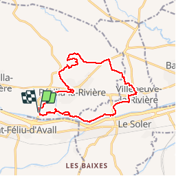
Randonnée Marche de 15,9 km à découvrir à Occitanie, Pyrénées-Orientales, Pézilla-la-Rivière. Cette randonnée est proposée par jeff66.
Description
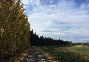
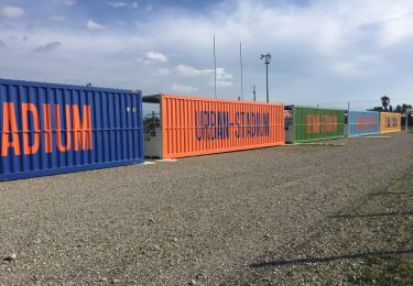
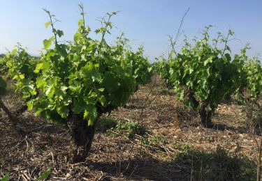
66 PEZILLA-la-Riviere - parking à proximité de la RD16a, promenade entre les serres, stade Louis Blad, chemin de saint Feliu, rue de la serre Montèze, av. de la république, place de la nation, rue portal d'amont, passage sur RD614, route d'Estagel, centre de secours, boulodrome, ancien moulin à eau, entrepôt Camilor, mas conte, le vigné, après la ligne de crête plateau surplombant la vallée de la TÊT avec panorama à 360 degrés - ravin des Gourgues - emprunter la RD614. Au mas Blanes, prendre à gauche la piste bordée de platanes - la Blanère - suivre correc de les Gorges - VILLENEUVE-la-riviere, complexe sportif, Cami. Dels Alous, RD1a, rue de l'hôtel de ville. Espace jean Noé, rue des Caves, RD1, mairie, rosaire, Poney club, rue des mûriers, écuries - route entre les serres - LE SOLER, traverser la RD39, vers réserves ornithologique - chemin en sous bois le long de la TÊT - le grand Riberal, le Riberal, Les Gourgues
Localisation
Commentaires
Randonnées à proximité
![Randonnée A pied Corneilla-la-Rivière - Sentier Lambert Narach - Photo](https://media.geolcdn.com/t/375/260/60aa864b-1f67-4c4d-a42f-3e8c5d1f7ee0.jpeg&format=jpg&maxdim=2)
![A pied A pied](https://static1.geolcdn.com/sitytour/trail-icons/100.png)
A pied
![](/images/other/stat-length.png)
![](https://static1.geolcdn.com/siteimages/upload/files/16400158638029165_repeat_loop_refresh_sync_direction_icon.png)
![Randonnée Marche Corneilla-la-Rivière - 20240316 Corneilla la rivière - Photo](https://media.geolcdn.com/t/375/260/8c5263cf-1cc3-4271-963e-53ddcecf3643.jpg&format=jpg&maxdim=2)
![Marche Marche](https://static1.geolcdn.com/sitytour/trail-icons/101.png)
Marche
![](/images/other/stat-length.png)
![](https://static1.geolcdn.com/siteimages/upload/files/16400158638029165_repeat_loop_refresh_sync_direction_icon.png)
![Randonnée Course à pied Saint-Féliu-d'Avall - Boucle St Feliu Amont -Ill sur Tête - Photo](https://media.geolcdn.com/t/375/260/ext.jpg?maxdim=2&url=https%3A%2F%2Fstatic1.geolcdn.com%2Fsiteimages%2Fupload%2Ffiles%2F1524743154running.jpg)
![Course à pied Course à pied](https://static1.geolcdn.com/sitytour/trail-icons/103.png)
Course à pied
![](/images/other/stat-length.png)
![](https://static1.geolcdn.com/siteimages/upload/files/16400158638029165_repeat_loop_refresh_sync_direction_icon.png)
![Randonnée Marche Saint-Féliu-d'Avall - 66 ST-FELIU-D'AVALL, CORNEILLA DE LA RIVIERE, promenade autour de la Têt - Photo](https://media.geolcdn.com/t/375/260/ext.jpg?maxdim=2&url=https%3A%2F%2Fservices.sitytrail.com%2FGeolivesWS%2FDownloadMedia.ashx%3FTrailID%3D536494%26Media%3D20160310173744.jpg)
![Marche Marche](https://static1.geolcdn.com/sitytour/trail-icons/101.png)
Marche
![](/images/other/stat-length.png)
![](https://static1.geolcdn.com/siteimages/upload/files/16400158638029165_repeat_loop_refresh_sync_direction_icon.png)
![Randonnée Marche Baixas - 66 VILLENEUVE-LA-RIVIÈRE, promenade entre parcs éoliens et vignobles CALCE - Photo](https://media.geolcdn.com/t/375/260/ext.jpg?maxdim=2&url=https%3A%2F%2Fservices.sitytrail.com%2FGeolivesWS%2FDownloadMedia.ashx%3FTrailID%3D503177%26Media%3D20151215145425.jpg)
![Marche Marche](https://static1.geolcdn.com/sitytour/trail-icons/101.png)
Marche
![](/images/other/stat-length.png)
![](https://static1.geolcdn.com/siteimages/upload/files/16400158638029165_repeat_loop_refresh_sync_direction_icon.png)
![Randonnée Marche Pézilla-la-Rivière - 66 CORNEILLA-LA-RIVIERE, promenade sur les hauteurs vallonnées, entre vignes et parc éolien - Photo](https://media.geolcdn.com/t/375/260/ext.jpg?maxdim=2&url=https%3A%2F%2Fservices.sitytrail.com%2FGeolivesWS%2FDownloadMedia.ashx%3FTrailID%3D492847%26Media%3D20151110140148.jpg)
![Marche Marche](https://static1.geolcdn.com/sitytour/trail-icons/101.png)
Marche
![](/images/other/stat-length.png)
![](https://static1.geolcdn.com/siteimages/upload/files/16400158638029165_repeat_loop_refresh_sync_direction_icon.png)
![Randonnée Marche Le Soler - 66 LE SOLER - ST FELIU D'AVALL, promenade le long du Rau du SOLER et de la rivière de CASTELNOU entre canaux et vergers - Photo](https://media.geolcdn.com/t/375/260/ext.jpg?maxdim=2&url=https%3A%2F%2Fservices.sitytrail.com%2FGeolivesWS%2FDownloadMedia.ashx%3FTrailID%3D487086%26Media%3D20151027134105.jpg)
![Marche Marche](https://static1.geolcdn.com/sitytour/trail-icons/101.png)
Marche
![](/images/other/stat-length.png)
![](https://static1.geolcdn.com/siteimages/upload/files/16400158638029165_repeat_loop_refresh_sync_direction_icon.png)
![Randonnée Marche Le Soler - 66 LE SOLER - TOULOUGES, village, jardins, vergers, canaux et la Basse - Photo](https://media.geolcdn.com/t/375/260/ext.jpg?maxdim=2&url=https%3A%2F%2Fservices.sitytrail.com%2FGeolivesWS%2FDownloadMedia.ashx%3FTrailID%3D484347%26Media%3D20151021151755.jpg)
![Marche Marche](https://static1.geolcdn.com/sitytour/trail-icons/101.png)
Marche
![](/images/other/stat-length.png)
![](https://static1.geolcdn.com/siteimages/upload/files/16400158638029165_repeat_loop_refresh_sync_direction_icon.png)
![Randonnée Marche Thuir - THUIR 66 - chapelle VILARMILA - Vinyer Capella, Rei - Photo](https://media.geolcdn.com/t/375/260/ext.jpg?maxdim=2&url=https%3A%2F%2Fservices.sitytrail.com%2FGeolivesWS%2FDownloadMedia.ashx%3FTrailID%3D419591%26Media%3D20150511175110.jpg)
![Marche Marche](https://static1.geolcdn.com/sitytour/trail-icons/101.png)
Marche
![](/images/other/stat-length.png)
![](https://static1.geolcdn.com/siteimages/upload/files/16400158638029165_repeat_loop_refresh_sync_direction_icon.png)