


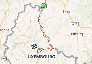


9 km | 12,1 km-effort

Plus vî, plus sot


Application GPS de randonnée GRATUITE
 SityTrail
IGN / Instituts géographiques
SityTrail World
Le monde est à vous
Randonnée V.T.T. de 70 km à découvrir à Wallonie, Liège, Burg-Reuland. Cette randonnée est proposée par Yeyette VTT team.
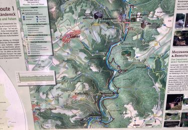
Quelques sentiers difficiles jusque Dasburg. Alternative possible par la K148 en Allemagne ?

Marche

A pied
A pied


Marche
Marche
Marche
Marche