![](/images/other/stat-length.png)
![Randonnée Marche Feldberg - Schluchsee - Photo](https://media.geolcdn.com/t/1900/400/ext.pjpeg?maxdim=2&url=https%3A%2F%2Fstatic1.geolcdn.com%2Fsiteimages%2Fupload%2Ffiles%2F1553511878bg_sport_marche.png)
Schluchsee
michelek
Utilisateur
![Longueur](/images/other/stat-length.png)
Longueur
14,8 km
![Altitude max](https://static1.geolcdn.com/siteimages/upload/files/1508320355ic_sort_altitude_max_24dp.png)
Altitude max
1148 m
![Dénivelé positif](https://static1.geolcdn.com/siteimages/upload/files/1508320355ic_sort_den_pos_24dp.png)
Dénivelé positif
327 m
![Km-Effort](/images/other/stat-length.png)
Km-Effort
19,4 km
![Altitude min](https://static1.geolcdn.com/siteimages/upload/files/1508320355ic_sort_altitude_min_24dp.png)
Altitude min
906 m
![Dénivelé négatif](https://static1.geolcdn.com/siteimages/upload/files/1508320355ic_sort_den_neg_24dp.png)
Dénivelé négatif
414 m
![Boucle](https://static1.geolcdn.com/siteimages/upload/files/16400158638029165_repeat_loop_refresh_sync_direction_icon.png)
Boucle
Non
Date de création :
2018-11-10 10:09:03.685
Dernière modification :
2018-11-10 10:09:03.694
![Marche](https://static1.geolcdn.com/sitytour/trail-icons/101.png)
3h52
Difficulté : Moyen
![Scannez ce code QR pour ouvrir la randonnée dans l'application SityTrail](https://capi.geolives.com/qq0zvz2zws4bq2lad0pu/sitytour/trails/473684/qr.png?size=200)
Application GPS de randonnée GRATUITE
À propos
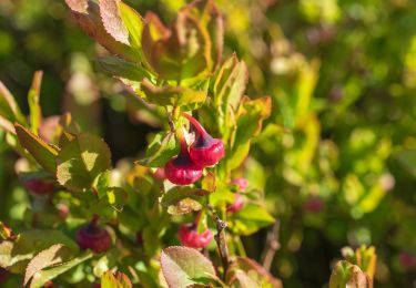
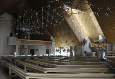
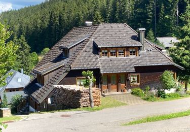
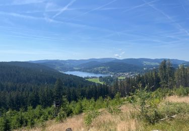
Randonnée Marche de 14,8 km à découvrir à Bade-Wurtemberg, Arrondissement de Brisgau-Haute-Forêt-Noire, Feldberg. Cette randonnée est proposée par michelek.
Description
Belle rando principalement le long du Schuchsee. Retour avec le train gratuit si vous disposez de la Hochschwarzwald Card.
Localisation
Pays :
Allemagne
Région :
Bade-Wurtemberg
Département/Province :
Arrondissement de Brisgau-Haute-Forêt-Noire
Commune :
Feldberg
Localité :
Altglashütten
Départ:(Dec)
Départ:(UTM)
433286 ; 5300631 (32T) N.
Commentaires
Randonnées à proximité
![Randonnée A pied Feldberg - Altglashütten - Feldberg-Caritashaus - Photo](https://media.geolcdn.com/t/375/260/09e36bd8-d689-4eac-b51e-56f2a9bb44ed.jpeg&format=jpg&maxdim=2)
![A pied A pied](https://static1.geolcdn.com/sitytour/trail-icons/100.png)
Altglashütten - Feldberg-Caritashaus
A pied
Facile
Feldberg,
Bade-Wurtemberg,
Arrondissement de Brisgau-Haute-Forêt-Noire,
Allemagne
![](/images/other/stat-length.png)
6,1 km | 9,6 km-effort
2h 11min
![](https://static1.geolcdn.com/siteimages/upload/files/16400158638029165_repeat_loop_refresh_sync_direction_icon.png)
Non
![Randonnée A pied Feldberg - Feldberg (Caritasheim) - Kohlplatz - Bärental - Photo](https://media.geolcdn.com/t/375/260/e19e595e-ef64-4cea-8b0b-35be2d93dd41.jpeg&format=jpg&maxdim=2)
![A pied A pied](https://static1.geolcdn.com/sitytour/trail-icons/100.png)
Feldberg (Caritasheim) - Kohlplatz - Bärental
A pied
Facile
Feldberg,
Bade-Wurtemberg,
Arrondissement de Brisgau-Haute-Forêt-Noire,
Allemagne
![](/images/other/stat-length.png)
4,2 km | 5,2 km-effort
1h 10min
![](https://static1.geolcdn.com/siteimages/upload/files/16400158638029165_repeat_loop_refresh_sync_direction_icon.png)
Non
![Randonnée A pied Schluchsee - Aha - Altglashütten - Photo](https://media.geolcdn.com/t/375/260/fbef3630-0250-410c-a6a1-80448ac48f09.jpeg&format=jpg&maxdim=2)
![A pied A pied](https://static1.geolcdn.com/sitytour/trail-icons/100.png)
Aha - Altglashütten
A pied
Facile
Schluchsee,
Bade-Wurtemberg,
Arrondissement de Brisgau-Haute-Forêt-Noire,
Allemagne
![](/images/other/stat-length.png)
4 km | 5,1 km-effort
1h 9min
![](https://static1.geolcdn.com/siteimages/upload/files/16400158638029165_repeat_loop_refresh_sync_direction_icon.png)
Non
![Randonnée A pied Schluchsee - Jägersteig - Photo](https://media.geolcdn.com/t/375/260/e6618854-799a-4113-a147-f68601b347d5.jpeg&format=jpg&maxdim=2)
![A pied A pied](https://static1.geolcdn.com/sitytour/trail-icons/100.png)
Jägersteig
A pied
Facile
Schluchsee,
Bade-Wurtemberg,
Arrondissement de Brisgau-Haute-Forêt-Noire,
Allemagne
![](/images/other/stat-length.png)
11,6 km | 15,8 km-effort
3h 35min
![](https://static1.geolcdn.com/siteimages/upload/files/16400158638029165_repeat_loop_refresh_sync_direction_icon.png)
Oui
![Randonnée A pied Schluchsee - DE-Ehemalige Krummensäge - Kohlhütte - fixme - Photo](https://media.geolcdn.com/t/375/260/00edd11d-5774-4c7d-84eb-be79de7d632d.jpeg&format=jpg&maxdim=2)
![A pied A pied](https://static1.geolcdn.com/sitytour/trail-icons/100.png)
DE-Ehemalige Krummensäge - Kohlhütte - fixme
A pied
Facile
Schluchsee,
Bade-Wurtemberg,
Arrondissement de Brisgau-Haute-Forêt-Noire,
Allemagne
![](/images/other/stat-length.png)
3,1 km | 3,6 km-effort
49min
![](https://static1.geolcdn.com/siteimages/upload/files/16400158638029165_repeat_loop_refresh_sync_direction_icon.png)
Non
![Randonnée A pied Schluchsee - DE-Muchenländer Brücke - Schubenwald - Photo](https://media.geolcdn.com/t/375/260/3870eac4-99dd-48db-b536-97eebeedc4f9.jpeg&format=jpg&maxdim=2)
![A pied A pied](https://static1.geolcdn.com/sitytour/trail-icons/100.png)
DE-Muchenländer Brücke - Schubenwald
A pied
Facile
Schluchsee,
Bade-Wurtemberg,
Arrondissement de Brisgau-Haute-Forêt-Noire,
Allemagne
![](/images/other/stat-length.png)
4 km | 6,9 km-effort
1h 33min
![](https://static1.geolcdn.com/siteimages/upload/files/16400158638029165_repeat_loop_refresh_sync_direction_icon.png)
Non
![Randonnée A pied St. Blasien - Feldberg - Schluchsee - Photo](https://media.geolcdn.com/t/375/260/5582e00c-6942-431c-81b3-3edf83af516e.jpeg&format=jpg&maxdim=2)
![A pied A pied](https://static1.geolcdn.com/sitytour/trail-icons/100.png)
Feldberg - Schluchsee
A pied
Facile
St. Blasien,
Bade-Wurtemberg,
Landkreis Waldshut,
Allemagne
![](/images/other/stat-length.png)
11,2 km | 14,7 km-effort
3h 20min
![](https://static1.geolcdn.com/siteimages/upload/files/16400158638029165_repeat_loop_refresh_sync_direction_icon.png)
Non
![Randonnée Marche Feldberg - Feldsee & Feldberg - Photo](https://media.geolcdn.com/t/375/260/8f4f5518-8987-4474-9626-9d838368cf80.jpg&format=jpg&maxdim=2)
![Marche Marche](https://static1.geolcdn.com/sitytour/trail-icons/101.png)
Feldsee & Feldberg
Marche
Très difficile
Feldberg,
Bade-Wurtemberg,
Arrondissement de Brisgau-Haute-Forêt-Noire,
Allemagne
![](/images/other/stat-length.png)
15,8 km | 23 km-effort
7h 7min
![](https://static1.geolcdn.com/siteimages/upload/files/16400158638029165_repeat_loop_refresh_sync_direction_icon.png)
Oui
![Randonnée Vélo électrique Titisee-Neustadt - Bärental, Altglashütte, Falkau, Saig, Neustadt Titisee - Photo](https://media.geolcdn.com/t/375/260/b9be378f-8400-4277-b69c-0380f875a18d.jpg&format=jpg&maxdim=2)
![Vélo électrique Vélo électrique](https://static1.geolcdn.com/sitytour/trail-icons/205.png)
Bärental, Altglashütte, Falkau, Saig, Neustadt Titisee
Vélo électrique
Moyen
Titisee-Neustadt,
Bade-Wurtemberg,
Arrondissement de Brisgau-Haute-Forêt-Noire,
Allemagne
![](/images/other/stat-length.png)
29 km | 37 km-effort
4h 43min
![](https://static1.geolcdn.com/siteimages/upload/files/16400158638029165_repeat_loop_refresh_sync_direction_icon.png)
Non