![](/images/other/stat-length.png)
![Randonnée Marche Wolfenschiessen - YHH108 Stans à Ponte (2e jour) - Photo](https://media.geolcdn.com/t/1900/400/ext.pjpeg?maxdim=2&url=https%3A%2F%2Fstatic1.geolcdn.com%2Fsiteimages%2Fupload%2Ffiles%2F1553511878bg_sport_marche.png)
YHH108 Stans à Ponte (2e jour)
yveshumbert
Utilisateur
![Longueur](/images/other/stat-length.png)
Longueur
14,8 km
![Altitude max](https://static1.geolcdn.com/siteimages/upload/files/1508320355ic_sort_altitude_max_24dp.png)
Altitude max
1008 m
![Dénivelé positif](https://static1.geolcdn.com/siteimages/upload/files/1508320355ic_sort_den_pos_24dp.png)
Dénivelé positif
647 m
![Km-Effort](/images/other/stat-length.png)
Km-Effort
22 km
![Altitude min](https://static1.geolcdn.com/siteimages/upload/files/1508320355ic_sort_altitude_min_24dp.png)
Altitude min
504 m
![Dénivelé négatif](https://static1.geolcdn.com/siteimages/upload/files/1508320355ic_sort_den_neg_24dp.png)
Dénivelé négatif
155 m
![Boucle](https://static1.geolcdn.com/siteimages/upload/files/16400158638029165_repeat_loop_refresh_sync_direction_icon.png)
Boucle
Non
Date de création :
2015-09-06 00:00:00.0
Dernière modification :
2015-09-06 00:00:00.0
![Marche](https://static1.geolcdn.com/sitytour/trail-icons/101.png)
3h00
Difficulté : Très difficile
![Scannez ce code QR pour ouvrir la randonnée dans l'application SityTrail](https://capi.geolives.com/qq0zvz2zws4bq2lad0pu/sitytour/trails/468868/qr.png?size=200)
Application GPS de randonnée GRATUITE
À propos
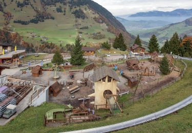
Randonnée Marche de 14,8 km à découvrir à Nidwald, Inconnu, Wolfenschiessen. Cette randonnée est proposée par yveshumbert.
Description
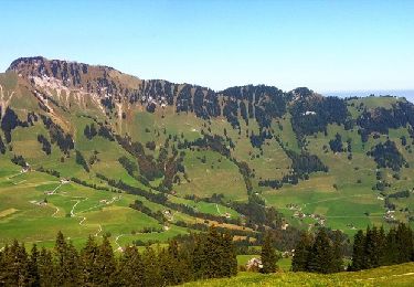
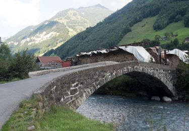
Randonnée de 7 jours au départ de Stans et arrivée à Ponte (Italie). Etape # 2 Wolfenschiessen à Engelberg.
Une étape avec peu de dénivelé. On continue à suivre la rivière jusqu' à Engelberg
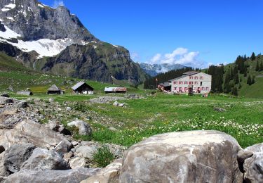
A Engelberg il y a un bon choix d' hôtel pour manger et dormir
Localisation
Pays :
Suisse
Région :
Nidwald
Département/Province :
Inconnu
Commune :
Wolfenschiessen
Localité :
Unknown
Départ:(Dec)
Départ:(UTM)
453971 ; 5195335 (32T) N.
Commentaires
Randonnées à proximité
![Randonnée A pied Dallenwil - Wirzweli - Gummenalp - Photo](https://media.geolcdn.com/t/375/260/22814123-4ae5-4ead-a79a-8a596a7474e1.jpeg&format=jpg&maxdim=2)
![A pied A pied](https://static1.geolcdn.com/sitytour/trail-icons/100.png)
Wirzweli - Gummenalp
A pied
Facile
Dallenwil,
Nidwald,
Inconnu,
Suisse
![](/images/other/stat-length.png)
3 km | 6,7 km-effort
1h 31min
![](https://static1.geolcdn.com/siteimages/upload/files/16400158638029165_repeat_loop_refresh_sync_direction_icon.png)
Non
![Randonnée A pied Dallenwil - Dominikpfad - Photo](https://media.geolcdn.com/t/375/260/02cd09a1-c950-4c1e-87d5-0b204c8f863f.jpeg&format=jpg&maxdim=2)
![A pied A pied](https://static1.geolcdn.com/sitytour/trail-icons/100.png)
![Randonnée A pied Wolfenschiessen - Banalp / Chrüzhütte - Bannalper Schonegg - Photo](https://media.geolcdn.com/t/375/260/94f97db1-820b-4474-87da-97768985a57e.jpeg&format=jpg&maxdim=2)
![A pied A pied](https://static1.geolcdn.com/sitytour/trail-icons/100.png)
Banalp / Chrüzhütte - Bannalper Schonegg
A pied
Facile
Wolfenschiessen,
Nidwald,
Inconnu,
Suisse
![](/images/other/stat-length.png)
3,3 km | 8,5 km-effort
1h 56min
![](https://static1.geolcdn.com/siteimages/upload/files/16400158638029165_repeat_loop_refresh_sync_direction_icon.png)
Non
![Randonnée A pied Engelberg - Grafenort - Obermatt - Photo](https://media.geolcdn.com/t/375/260/bafa5a1b-5de4-4ea0-984e-312abafce2e5.jpeg&format=jpg&maxdim=2)
![A pied A pied](https://static1.geolcdn.com/sitytour/trail-icons/100.png)
Grafenort - Obermatt
A pied
Facile
Engelberg,
Obwald,
Inconnu,
Suisse
![](/images/other/stat-length.png)
3,6 km | 5,1 km-effort
1h 8min
![](https://static1.geolcdn.com/siteimages/upload/files/16400158638029165_repeat_loop_refresh_sync_direction_icon.png)
Non
![Randonnée A pied Wolfenschiessen - Diegischbalm - Nechimatt - Photo](https://media.geolcdn.com/t/375/260/730f9f5c-202d-4254-a2ca-569e3eeac4c9.jpeg&format=jpg&maxdim=2)
![A pied A pied](https://static1.geolcdn.com/sitytour/trail-icons/100.png)
Diegischbalm - Nechimatt
A pied
Facile
Wolfenschiessen,
Nidwald,
Inconnu,
Suisse
![](/images/other/stat-length.png)
4,1 km | 7,6 km-effort
1h 44min
![](https://static1.geolcdn.com/siteimages/upload/files/16400158638029165_repeat_loop_refresh_sync_direction_icon.png)
Non
![Randonnée A pied Wolfenschiessen - Kapellenweg - Photo](https://media.geolcdn.com/t/375/260/bafa5a1b-5de4-4ea0-984e-312abafce2e5.jpeg&format=jpg&maxdim=2)
![A pied A pied](https://static1.geolcdn.com/sitytour/trail-icons/100.png)
Kapellenweg
A pied
Facile
Wolfenschiessen,
Nidwald,
Inconnu,
Suisse
![](/images/other/stat-length.png)
4,3 km | 5,3 km-effort
1h 11min
![](https://static1.geolcdn.com/siteimages/upload/files/16400158638029165_repeat_loop_refresh_sync_direction_icon.png)
Non
![Randonnée A pied Dallenwil - Langboden - Gummenalp - Photo](https://media.geolcdn.com/t/375/260/ext.jpg?maxdim=2&url=https%3A%2F%2Fstatic1.geolcdn.com%2Fsiteimages%2Fupload%2Ffiles%2F1545311037marcheuse_200dpi.jpg)
![A pied A pied](https://static1.geolcdn.com/sitytour/trail-icons/100.png)
Langboden - Gummenalp
A pied
Facile
Dallenwil,
Nidwald,
Inconnu,
Suisse
![](/images/other/stat-length.png)
3,4 km | 6,2 km-effort
1h 24min
![](https://static1.geolcdn.com/siteimages/upload/files/16400158638029165_repeat_loop_refresh_sync_direction_icon.png)
Non
![Randonnée A pied Stans - Luegeren - Ägertli - fixme - Photo](https://media.geolcdn.com/t/375/260/ext.jpg?maxdim=2&url=https%3A%2F%2Fstatic1.geolcdn.com%2Fsiteimages%2Fupload%2Ffiles%2F1545311037marcheuse_200dpi.jpg)
![A pied A pied](https://static1.geolcdn.com/sitytour/trail-icons/100.png)
Luegeren - Ägertli - fixme
A pied
Facile
Stans,
Nidwald,
Inconnu,
Suisse
![](/images/other/stat-length.png)
3,3 km | 5,1 km-effort
1h 9min
![](https://static1.geolcdn.com/siteimages/upload/files/16400158638029165_repeat_loop_refresh_sync_direction_icon.png)
Non
![Randonnée A pied Dallenwil - Ächerli - Wirzweli - Photo](https://media.geolcdn.com/t/375/260/ext.jpg?maxdim=2&url=https%3A%2F%2Fstatic1.geolcdn.com%2Fsiteimages%2Fupload%2Ffiles%2F1545311037marcheuse_200dpi.jpg)
![A pied A pied](https://static1.geolcdn.com/sitytour/trail-icons/100.png)