![](/images/other/stat-length.png)
Marche Adeps à Villers-deux-Eglises
Desrumaux
Utilisateur GUIDE
![Longueur](/images/other/stat-length.png)
Longueur
10,4 km
![Altitude max](https://static1.geolcdn.com/siteimages/upload/files/1508320355ic_sort_altitude_max_24dp.png)
Altitude max
266 m
![Dénivelé positif](https://static1.geolcdn.com/siteimages/upload/files/1508320355ic_sort_den_pos_24dp.png)
Dénivelé positif
117 m
![Km-Effort](/images/other/stat-length.png)
Km-Effort
11,9 km
![Altitude min](https://static1.geolcdn.com/siteimages/upload/files/1508320355ic_sort_altitude_min_24dp.png)
Altitude min
233 m
![Dénivelé négatif](https://static1.geolcdn.com/siteimages/upload/files/1508320355ic_sort_den_neg_24dp.png)
Dénivelé négatif
112 m
![Boucle](https://static1.geolcdn.com/siteimages/upload/files/16400158638029165_repeat_loop_refresh_sync_direction_icon.png)
Boucle
Oui
Date de création :
2015-09-02 00:00:00.0
Dernière modification :
2015-09-02 00:00:00.0
![Marche](https://static1.geolcdn.com/sitytour/trail-icons/101.png)
2h38
Difficulté : Facile
![Scannez ce code QR pour ouvrir la randonnée dans l'application SityTrail](https://capi.geolives.com/qq0zvz2zws4bq2lad0pu/sitytour/trails/467029/qr.png?size=200)
Application GPS de randonnée GRATUITE
À propos
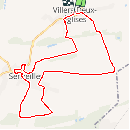
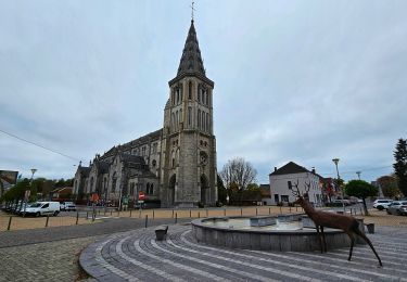
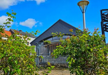
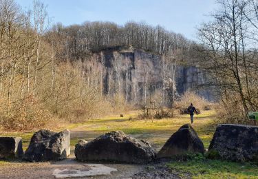
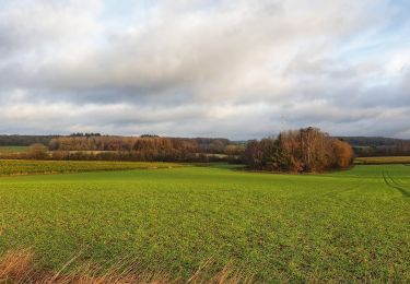
Randonnée Marche de 10,4 km à découvrir à Wallonie, Namur, Cerfontaine. Cette randonnée est proposée par Desrumaux.
Description
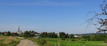
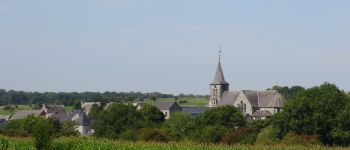
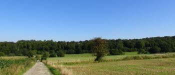
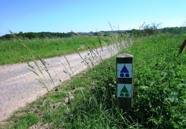
Agréable balade dans la belle campagne de l'Entre-Sambre et Meuse, du village de Villers-Deux-Eglises au village de Senzeilles dans la belle entité de Cerfontaine.
Localisation
Pays :
Belgique
Région :
Wallonie
Département/Province :
Namur
Commune :
Cerfontaine
Localité :
Villers-Deux-Églises
Départ:(Dec)
Départ:(UTM)
605816 ; 5560803 (31U) N.
Commentaires
Randonnées à proximité
![Marche Marche](https://static1.geolcdn.com/sitytour/trail-icons/101.png)
RB-Na-18_Philippeville
Marche
Très difficile
(8)
Philippeville,
Wallonie,
Namur,
Belgique
![](/images/other/stat-length.png)
25 km | 30 km-effort
6h 49min
![](https://static1.geolcdn.com/siteimages/upload/files/16400158638029165_repeat_loop_refresh_sync_direction_icon.png)
Oui
![Randonnée Marche Cerfontaine - Balade au village de la source de l'eau d'Heure Cerfontaine - Photo](https://media.geolcdn.com/t/375/260/ext.jpg?maxdim=2&url=https%3A%2F%2Fservices.sitytrail.com%2FGeolivesWS%2FDownloadMedia.ashx%3FTrailID%3D479710%26Media%3D2fce6745-f1ff-4853-9950-93fb7818c454.JPG)
![Marche Marche](https://static1.geolcdn.com/sitytour/trail-icons/101.png)
Balade au village de la source de l'eau d'Heure Cerfontaine
Marche
Facile
(3)
Cerfontaine,
Wallonie,
Namur,
Belgique
![](/images/other/stat-length.png)
11,6 km | 14,7 km-effort
3h 11min
![](https://static1.geolcdn.com/siteimages/upload/files/16400158638029165_repeat_loop_refresh_sync_direction_icon.png)
Oui
![Randonnée Marche Cerfontaine - Balade à Cerfontaine - Photo](https://media.geolcdn.com/t/375/260/2eef0e24-fd5d-49ba-9ea4-39eb5a2f7225.jpg&format=jpg&maxdim=2)
![Marche Marche](https://static1.geolcdn.com/sitytour/trail-icons/101.png)
Balade à Cerfontaine
Marche
Moyen
Cerfontaine,
Wallonie,
Namur,
Belgique
![](/images/other/stat-length.png)
6,9 km | 8,9 km-effort
3h 41min
![](https://static1.geolcdn.com/siteimages/upload/files/16400158638029165_repeat_loop_refresh_sync_direction_icon.png)
Oui
![Randonnée Marche Philippeville - Balade à Jamagne - Photo](https://media.geolcdn.com/t/375/260/ce171ec7-b1dd-4723-988d-0840c5fff04b.jpeg&format=jpg&maxdim=2)
![Marche Marche](https://static1.geolcdn.com/sitytour/trail-icons/101.png)
Balade à Jamagne
Marche
Facile
Philippeville,
Wallonie,
Namur,
Belgique
![](/images/other/stat-length.png)
5 km | 5,9 km-effort
1h 20min
![](https://static1.geolcdn.com/siteimages/upload/files/16400158638029165_repeat_loop_refresh_sync_direction_icon.png)
Oui
![Randonnée Marche Cerfontaine - Balade à Senzeilles - Photo](https://media.geolcdn.com/t/375/260/889aef67-7733-498d-b260-5760cb6b4d9f.jpeg&format=jpg&maxdim=2)
![Marche Marche](https://static1.geolcdn.com/sitytour/trail-icons/101.png)
Balade à Senzeilles
Marche
Moyen
Cerfontaine,
Wallonie,
Namur,
Belgique
![](/images/other/stat-length.png)
7,7 km | 9,2 km-effort
2h 5min
![](https://static1.geolcdn.com/siteimages/upload/files/16400158638029165_repeat_loop_refresh_sync_direction_icon.png)
Oui
![Randonnée Marche Philippeville - Balade à Jamiolle - Photo](https://media.geolcdn.com/t/375/260/06c8177c-21a1-421c-9fc3-909bbee83463.jpeg&format=jpg&maxdim=2)
![Marche Marche](https://static1.geolcdn.com/sitytour/trail-icons/101.png)
Balade à Jamiolle
Marche
Moyen
Philippeville,
Wallonie,
Namur,
Belgique
![](/images/other/stat-length.png)
6 km | 6,9 km-effort
1h 46min
![](https://static1.geolcdn.com/siteimages/upload/files/16400158638029165_repeat_loop_refresh_sync_direction_icon.png)
Oui
![Randonnée V.T.T. Cerfontaine - Les Hauts de Cerfontaine - Photo](https://media.geolcdn.com/t/375/260/ext.jpg?maxdim=2&url=https%3A%2F%2Fpivotmedia.tourismewallonie.be%2FOTH-A0-004F-3144%2FOTH-A0-004F-3144.jpg)
![V.T.T. V.T.T.](https://static1.geolcdn.com/sitytour/trail-icons/202.png)
Les Hauts de Cerfontaine
V.T.T.
Facile
Cerfontaine,
Wallonie,
Namur,
Belgique
![](/images/other/stat-length.png)
16 km | 19,7 km-effort
1h 21min
![](https://static1.geolcdn.com/siteimages/upload/files/16400158638029165_repeat_loop_refresh_sync_direction_icon.png)
Oui
![V.T.T. V.T.T.](https://static1.geolcdn.com/sitytour/trail-icons/202.png)
VTT sur Silenrieux et les lacs.
V.T.T.
Très facile
Cerfontaine,
Wallonie,
Namur,
Belgique
![](/images/other/stat-length.png)
40 km | 49 km-effort
Inconnu
![](https://static1.geolcdn.com/siteimages/upload/files/16400158638029165_repeat_loop_refresh_sync_direction_icon.png)
Oui
![V.T.T. V.T.T.](https://static1.geolcdn.com/sitytour/trail-icons/202.png)
VTT de Cerfontaine à Lompret
V.T.T.
Difficile
(1)
Cerfontaine,
Wallonie,
Namur,
Belgique
![](/images/other/stat-length.png)
52 km | 63 km-effort
Inconnu
![](https://static1.geolcdn.com/siteimages/upload/files/16400158638029165_repeat_loop_refresh_sync_direction_icon.png)
Oui
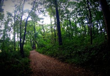
Bonjour, Il me semble qu'il y a un problème d'accessibilité du tracé au niveau de Senzeilles... Le petit chemin qui passe derrière l'école est inaccessible... Cordialement