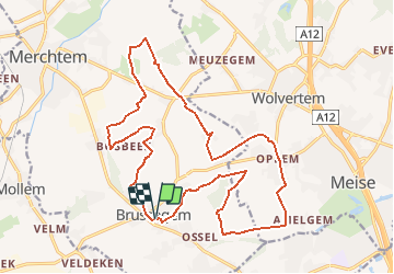
![](/images/other/stat-length.png)
![Randonnée Marche Merchtem - Brabantse Kouters - Photo](https://media.geolcdn.com/t/1900/400/ext.pjpeg?maxdim=2&url=https%3A%2F%2Fstatic1.geolcdn.com%2Fsiteimages%2Fupload%2Ffiles%2F1553511878bg_sport_marche.png)
Brabantse Kouters
elsdewilde
Utilisateur
![Longueur](/images/other/stat-length.png)
![Altitude max](https://static1.geolcdn.com/siteimages/upload/files/1508320355ic_sort_altitude_max_24dp.png)
![Dénivelé positif](https://static1.geolcdn.com/siteimages/upload/files/1508320355ic_sort_den_pos_24dp.png)
![Km-Effort](/images/other/stat-length.png)
![Altitude min](https://static1.geolcdn.com/siteimages/upload/files/1508320355ic_sort_altitude_min_24dp.png)
![Dénivelé négatif](https://static1.geolcdn.com/siteimages/upload/files/1508320355ic_sort_den_neg_24dp.png)
![Boucle](https://static1.geolcdn.com/siteimages/upload/files/16400158638029165_repeat_loop_refresh_sync_direction_icon.png)
![Marche](https://static1.geolcdn.com/sitytour/trail-icons/101.png)
6h00
Difficulté : Moyen
![Scannez ce code QR pour ouvrir la randonnée dans l'application SityTrail](https://capi.geolives.com/qq0zvz2zws4bq2lad0pu/sitytour/trails/463986/qr.png?size=200)
Application GPS de randonnée GRATUITE
À propos
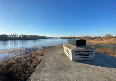
Randonnée Marche de 19,9 km à découvrir à Flandre, Brabant flamand, Merchtem. Cette randonnée est proposée par elsdewilde.
Description
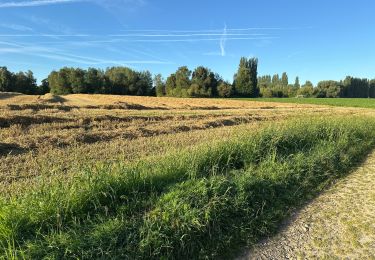
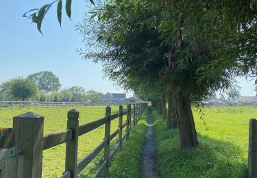
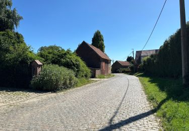
De Brabantse Kouters situeren zich vlakbij Brussel, in het noordwestelijke deel van de Groene Gordel. De invloed van de stad is uiteraard voelbaar: de vliegtuigen, het autoverkeer, de vele pylonen in het landschap. Toch bieden deze kouters nog veel ruimte om te bewegen. Je loopt in een glooiend landschap van velden en weiden en voorbij het gehucht Oppem heb je de hoofdstad letterlijk aan je voeten liggen. In het laatste kwart van de wandeling kom je langs drie kastelen.
Points d'intérêt
Localisation
Commentaires
Randonnées à proximité
![Randonnée Marche Meysse - Meise 2 - 7,3 Km - Photo](https://media.geolcdn.com/t/375/260/5b2154f2-ba55-4513-bd2f-9db37eb5ea90.jpg&format=jpg&maxdim=2)
![Marche Marche](https://static1.geolcdn.com/sitytour/trail-icons/101.png)
Marche
![](/images/other/stat-length.png)
![](https://static1.geolcdn.com/siteimages/upload/files/16400158638029165_repeat_loop_refresh_sync_direction_icon.png)
![Randonnée Marche Wemmel - Wemmel Beverbos 6 km - Photo](https://media.geolcdn.com/t/375/260/3be3b710-42f6-4600-9f48-b1342818e945.jpg&format=jpg&maxdim=2)
![Marche Marche](https://static1.geolcdn.com/sitytour/trail-icons/101.png)
Marche
![](/images/other/stat-length.png)
![](https://static1.geolcdn.com/siteimages/upload/files/16400158638029165_repeat_loop_refresh_sync_direction_icon.png)
![Randonnée Marche Asse - Asse 25 km - Photo](https://media.geolcdn.com/t/375/260/93373654-1789-4a22-a980-4e4078e012f6.jpg&format=jpg&maxdim=2)
![Marche Marche](https://static1.geolcdn.com/sitytour/trail-icons/101.png)
![Randonnée Marche Merchtem - Brussegem nord 7,3 km - Photo](https://media.geolcdn.com/t/375/260/c2a2b302-b3fd-44e8-9488-687c48558849.jpg&format=jpg&maxdim=2)
![Marche Marche](https://static1.geolcdn.com/sitytour/trail-icons/101.png)
Marche
![](/images/other/stat-length.png)
![](https://static1.geolcdn.com/siteimages/upload/files/16400158638029165_repeat_loop_refresh_sync_direction_icon.png)
![Randonnée Marche Merchtem - GR126 : Merchtem - Mariekerke - Photo](https://media.geolcdn.com/t/375/260/be036740-a01c-42d1-b024-7439497fcebd.jpeg&format=jpg&maxdim=2)
![Marche Marche](https://static1.geolcdn.com/sitytour/trail-icons/101.png)
Marche
![](/images/other/stat-length.png)
![](https://static1.geolcdn.com/siteimages/upload/files/16400158638029165_repeat_loop_refresh_sync_direction_icon.png)
![Randonnée Marche Asse - Kobbegem 9,5 km - Photo](https://media.geolcdn.com/t/375/260/2de11148-734b-4827-acd5-5954d6fd231a.jpg&format=jpg&maxdim=2)
![Marche Marche](https://static1.geolcdn.com/sitytour/trail-icons/101.png)
Marche
![](/images/other/stat-length.png)
![](https://static1.geolcdn.com/siteimages/upload/files/16400158638029165_repeat_loop_refresh_sync_direction_icon.png)
![Randonnée Marche Asse - Relegem 6,7 km - Photo](https://media.geolcdn.com/t/375/260/1ab31170-f8b5-400f-8065-9451c1820ffd.jpg&format=jpg&maxdim=2)
![Marche Marche](https://static1.geolcdn.com/sitytour/trail-icons/101.png)
Marche
![](/images/other/stat-length.png)
![](https://static1.geolcdn.com/siteimages/upload/files/16400158638029165_repeat_loop_refresh_sync_direction_icon.png)
![Randonnée Marche Asse - S-GR Groene Gordel: Mollem - Ternat - Photo](https://media.geolcdn.com/t/375/260/6faef7af-0d0f-4faa-bb47-f1d7e98a3199.jpeg&format=jpg&maxdim=2)
![Marche Marche](https://static1.geolcdn.com/sitytour/trail-icons/101.png)
Marche
![](/images/other/stat-length.png)
![](https://static1.geolcdn.com/siteimages/upload/files/16400158638029165_repeat_loop_refresh_sync_direction_icon.png)
![Randonnée Marche Asse - Relegem 5 Km - Photo](https://media.geolcdn.com/t/375/260/e168bf9f-6b4e-4cfd-93d0-12a9f360e713.jpg&format=jpg&maxdim=2)
![Marche Marche](https://static1.geolcdn.com/sitytour/trail-icons/101.png)
Marche
![](/images/other/stat-length.png)
![](https://static1.geolcdn.com/siteimages/upload/files/16400158638029165_repeat_loop_refresh_sync_direction_icon.png)