![](/images/other/stat-length.png)
Tour des ruisseaux du Goul et de l'Embernat
destras
Utilisateur
![Longueur](/images/other/stat-length.png)
Longueur
47 km
![Altitude max](https://static1.geolcdn.com/siteimages/upload/files/1508320355ic_sort_altitude_max_24dp.png)
Altitude max
805 m
![Dénivelé positif](https://static1.geolcdn.com/siteimages/upload/files/1508320355ic_sort_den_pos_24dp.png)
Dénivelé positif
1037 m
![Km-Effort](/images/other/stat-length.png)
Km-Effort
61 km
![Altitude min](https://static1.geolcdn.com/siteimages/upload/files/1508320355ic_sort_altitude_min_24dp.png)
Altitude min
390 m
![Dénivelé négatif](https://static1.geolcdn.com/siteimages/upload/files/1508320355ic_sort_den_neg_24dp.png)
Dénivelé négatif
1037 m
![Boucle](https://static1.geolcdn.com/siteimages/upload/files/16400158638029165_repeat_loop_refresh_sync_direction_icon.png)
Boucle
Oui
Date de création :
2016-03-21 00:00:00.0
Dernière modification :
2016-03-21 00:00:00.0
![Vélo](https://static1.geolcdn.com/sitytour/trail-icons/200.png)
3h01
Difficulté : Difficile
![Scannez ce code QR pour ouvrir la randonnée dans l'application SityTrail](https://capi.geolives.com/qq0zvz2zws4bq2lad0pu/sitytour/trails/459615/qr.png?size=200)
Application GPS de randonnée GRATUITE
À propos
Randonnée Vélo de 47 km à découvrir à Occitanie, Aveyron, Taussac. Cette randonnée est proposée par destras.
Description
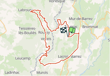
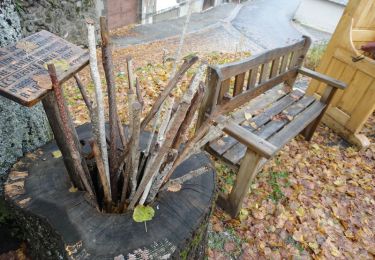
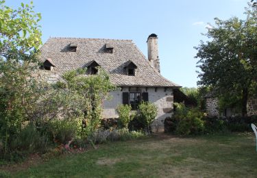
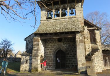
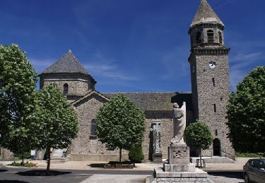
Départ du hameau de Masclat vers le pied du rocher de Ronesque (Bazaygues). Montée vers Vezel-Roussy par Labrousse puis descente vers Manhiaval. Grimpette difficile vers Murols-Soubeyre. Vous fermez la boucle par Lacroix-Barrez, c'est presque plat !
Localisation
Pays :
France
Région :
Occitanie
Département/Province :
Aveyron
Commune :
Taussac
Localité :
Unknown
Départ:(Dec)
Départ:(UTM)
471129 ; 4962147 (31T) N.
Commentaires
Randonnées à proximité
![Randonnée Marche Lacroix-Barrez - Chateau Vallon au depart de Bars - Photo](https://media.geolcdn.com/t/375/260/8a86948c-26ca-4fee-a76f-3b6a9360d40c.jpg&format=jpg&maxdim=2)
![Marche Marche](https://static1.geolcdn.com/sitytour/trail-icons/101.png)
Chateau Vallon au depart de Bars
Marche
Moyen
Lacroix-Barrez,
Occitanie,
Aveyron,
France
![](/images/other/stat-length.png)
19,2 km | 27 km-effort
6h 31min
![](https://static1.geolcdn.com/siteimages/upload/files/16400158638029165_repeat_loop_refresh_sync_direction_icon.png)
Oui
![Randonnée Chiens de traîneau Cros-de-Ronesque - J2 Volcans4 Ronesque-Pailherols 23k - Photo](https://media.geolcdn.com/t/375/260/ext.jpg?maxdim=2&url=https%3A%2F%2Fstatic1.geolcdn.com%2Fsiteimages%2Fupload%2Ffiles%2F1524743153ski.jpg)
![Chiens de traîneau Chiens de traîneau](https://static1.geolcdn.com/sitytour/trail-icons/505.png)
J2 Volcans4 Ronesque-Pailherols 23k
Chiens de traîneau
Très facile
(1)
Cros-de-Ronesque,
Auvergne-Rhône-Alpes,
Cantal,
France
![](/images/other/stat-length.png)
20 km | 29 km-effort
Inconnu
![](https://static1.geolcdn.com/siteimages/upload/files/16400158638029165_repeat_loop_refresh_sync_direction_icon.png)
Non
![Randonnée Marche Taussac - Taussac vers le tour du rocher de Ronesque et retour - Photo](https://media.geolcdn.com/t/375/260/ext.jpg?maxdim=2&url=https%3A%2F%2Fservices.sitytrail.com%2FGeolivesWS%2FDownloadMedia.ashx%3FTrailID%3D506807%26Media%3D5ccf2cf4-9246-4fae-a180-af5ad0e8cf54.jpg)
![Marche Marche](https://static1.geolcdn.com/sitytour/trail-icons/101.png)
Taussac vers le tour du rocher de Ronesque et retour
Marche
Difficile
Taussac,
Occitanie,
Aveyron,
France
![](/images/other/stat-length.png)
17,8 km | 28 km-effort
5h 10min
![](https://static1.geolcdn.com/siteimages/upload/files/16400158638029165_repeat_loop_refresh_sync_direction_icon.png)
Oui
![Randonnée Marche Taussac - Taussac le tour du ru de Combellou - Photo](https://media.geolcdn.com/t/375/260/ext.jpg?maxdim=2&url=https%3A%2F%2Fservices.sitytrail.com%2FGeolivesWS%2FDownloadMedia.ashx%3FTrailID%3D502560%26Media%3D6c4af51d-8b7d-4417-8f71-85fe9449fd3c.jpg)
![Marche Marche](https://static1.geolcdn.com/sitytour/trail-icons/101.png)
Taussac le tour du ru de Combellou
Marche
Moyen
Taussac,
Occitanie,
Aveyron,
France
![](/images/other/stat-length.png)
15 km | 21 km-effort
4h 28min
![](https://static1.geolcdn.com/siteimages/upload/files/16400158638029165_repeat_loop_refresh_sync_direction_icon.png)
Oui
![Randonnée Marche Taussac - la forêt magique - Photo](https://media.geolcdn.com/t/375/260/ext.jpg?maxdim=2&url=https%3A%2F%2Fservices.sitytrail.com%2FGeolivesWS%2FDownloadMedia.ashx%3FTrailID%3D410958%26Media%3Dfix__20150422111330.jpg)
![Marche Marche](https://static1.geolcdn.com/sitytour/trail-icons/101.png)
la forêt magique
Marche
Facile
Taussac,
Occitanie,
Aveyron,
France
![](/images/other/stat-length.png)
4,1 km | 6,1 km-effort
1h 28min
![](https://static1.geolcdn.com/siteimages/upload/files/16400158638029165_repeat_loop_refresh_sync_direction_icon.png)
Oui
![Randonnée Marche Lacroix-Barrez - a effacer - Photo](https://media.geolcdn.com/t/375/260/9554424e-083b-46ea-b23c-fd7cb951c49e.jpg&format=jpg&maxdim=2)
![Marche Marche](https://static1.geolcdn.com/sitytour/trail-icons/101.png)
![Randonnée Marche Taussac - Taussac vers Manhiaval, retour par Vezel - Photo](https://media.geolcdn.com/t/375/260/ext.jpg?maxdim=2&url=https%3A%2F%2Fservices.sitytrail.com%2FGeolivesWS%2FDownloadMedia.ashx%3FTrailID%3D507438%26Media%3D45131c03-744c-435f-816c-b3e838140dcf.JPG)
![Marche Marche](https://static1.geolcdn.com/sitytour/trail-icons/101.png)
Taussac vers Manhiaval, retour par Vezel
Marche
Difficile
Taussac,
Occitanie,
Aveyron,
France
![](/images/other/stat-length.png)
23 km | 34 km-effort
6h 30min
![](https://static1.geolcdn.com/siteimages/upload/files/16400158638029165_repeat_loop_refresh_sync_direction_icon.png)
Oui
![Randonnée Marche Lacroix-Barrez - Boucle Bars, château de Vallon, Fraysse - Photo](https://media.geolcdn.com/t/375/260/ext.jpg?maxdim=2&url=https%3A%2F%2Fservices.sitytrail.com%2FGeolivesWS%2FDownloadMedia.ashx%3FTrailID%3D506787%26Media%3D7783da0a-de07-47b6-8071-fb0ea76c7492.JPG)
![Marche Marche](https://static1.geolcdn.com/sitytour/trail-icons/101.png)
Boucle Bars, château de Vallon, Fraysse
Marche
Moyen
(1)
Lacroix-Barrez,
Occitanie,
Aveyron,
France
![](/images/other/stat-length.png)
18,6 km | 27 km-effort
4h 58min
![](https://static1.geolcdn.com/siteimages/upload/files/16400158638029165_repeat_loop_refresh_sync_direction_icon.png)
Oui
![Randonnée Marche Taussac - le tour du ruisseau d'Embernat - Photo](https://media.geolcdn.com/t/375/260/ext.jpg?maxdim=2&url=https%3A%2F%2Fservices.sitytrail.com%2FGeolivesWS%2FDownloadMedia.ashx%3FTrailID%3D458531%26Media%3D14e8d4cb-a652-48ea-808e-9d791a1f1f31.jpg)
![Marche Marche](https://static1.geolcdn.com/sitytour/trail-icons/101.png)
le tour du ruisseau d'Embernat
Marche
Moyen
Taussac,
Occitanie,
Aveyron,
France
![](/images/other/stat-length.png)
21 km | 27 km-effort
5h 48min
![](https://static1.geolcdn.com/siteimages/upload/files/16400158638029165_repeat_loop_refresh_sync_direction_icon.png)
Oui