![](/images/other/stat-length.png)
![Randonnée Marche Landévennec - Landévennec - Photo](https://media.geolcdn.com/t/1900/400/ext.pjpeg?maxdim=2&url=https%3A%2F%2Fservices.sitytrail.com%2FGeolivesWS%2FDownloadMedia.ashx%3FTrailID%3D458091%26Media%3Dfix__20150812161059.jpg)
Landévennec
Bobol
Utilisateur
![Longueur](/images/other/stat-length.png)
Longueur
15,1 km
![Altitude max](https://static1.geolcdn.com/siteimages/upload/files/1508320355ic_sort_altitude_max_24dp.png)
Altitude max
110 m
![Dénivelé positif](https://static1.geolcdn.com/siteimages/upload/files/1508320355ic_sort_den_pos_24dp.png)
Dénivelé positif
333 m
![Km-Effort](/images/other/stat-length.png)
Km-Effort
19,6 km
![Altitude min](https://static1.geolcdn.com/siteimages/upload/files/1508320355ic_sort_altitude_min_24dp.png)
Altitude min
0 m
![Dénivelé négatif](https://static1.geolcdn.com/siteimages/upload/files/1508320355ic_sort_den_neg_24dp.png)
Dénivelé négatif
333 m
![Boucle](https://static1.geolcdn.com/siteimages/upload/files/16400158638029165_repeat_loop_refresh_sync_direction_icon.png)
Boucle
Oui
Date de création :
2016-03-09 00:00:00.0
Dernière modification :
2016-03-09 00:00:00.0
![Marche](https://static1.geolcdn.com/sitytour/trail-icons/101.png)
4h13
Difficulté : Moyen
![Scannez ce code QR pour ouvrir la randonnée dans l'application SityTrail](https://capi.geolives.com/qq0zvz2zws4bq2lad0pu/sitytour/trails/458091/qr.png?size=200)
Application GPS de randonnée GRATUITE
À propos
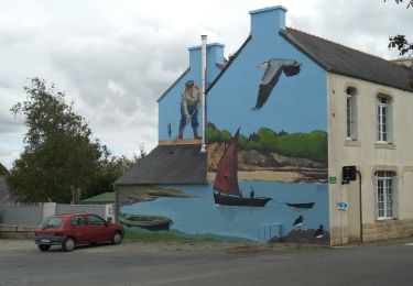
Randonnée Marche de 15,1 km à découvrir à Bretagne, Finistère, Landévennec. Cette randonnée est proposée par Bobol.
Description
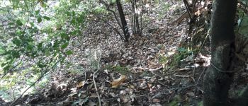
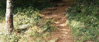
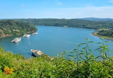
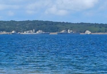
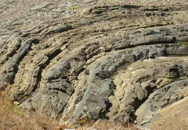
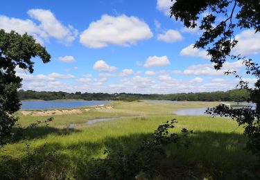
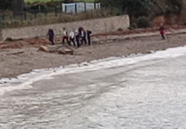
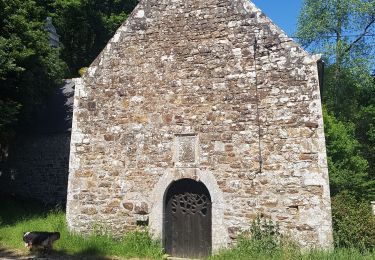
Ballade qui commence sur un parking, puis une ascension de marches. Ensuite des bois pour finir à Landévennec. Un seul point noir, le passage en bas de l'Abbaye par le talus mais ça vaut le coup pour la vue sur le cimetière de bateaux. Ensuite retour.
Localisation
Pays :
France
Région :
Bretagne
Département/Province :
Finistère
Commune :
Landévennec
Localité :
Unknown
Départ:(Dec)
Départ:(UTM)
400843 ; 5348931 (30U) N.
Commentaires
Randonnées à proximité
![Randonnée Marche Landévennec - Le tour de Landévennec Boucle 21 km - Photo](https://media.geolcdn.com/t/375/260/b342935f-f644-482b-a93d-00e8e9a2fff9.jpg&format=jpg&maxdim=2)
![Marche Marche](https://static1.geolcdn.com/sitytour/trail-icons/101.png)
Le tour de Landévennec Boucle 21 km
Marche
Très difficile
Landévennec,
Bretagne,
Finistère,
France
![](/images/other/stat-length.png)
21 km | 28 km-effort
5h 10min
![](https://static1.geolcdn.com/siteimages/upload/files/16400158638029165_repeat_loop_refresh_sync_direction_icon.png)
Oui
![Randonnée Marche Landévennec - GR34 Rangoulic -- Lanvéoc - Photo](https://media.geolcdn.com/t/375/260/daf82018-5a85-440e-a8c3-587f360996b8.jpg&format=jpg&maxdim=2)
![Marche Marche](https://static1.geolcdn.com/sitytour/trail-icons/101.png)
GR34 Rangoulic -- Lanvéoc
Marche
Très difficile
Landévennec,
Bretagne,
Finistère,
France
![](/images/other/stat-length.png)
25 km | 33 km-effort
7h 26min
![](https://static1.geolcdn.com/siteimages/upload/files/16400158638029165_repeat_loop_refresh_sync_direction_icon.png)
Non
![Randonnée A pied Logonna-Daoulas - Sentier Côtier - Photo](https://media.geolcdn.com/t/375/260/5cd226de-ab15-485c-ad56-76bdfb355d74.jpeg&format=jpg&maxdim=2)
![A pied A pied](https://static1.geolcdn.com/sitytour/trail-icons/100.png)
Sentier Côtier
A pied
Facile
Logonna-Daoulas,
Bretagne,
Finistère,
France
![](/images/other/stat-length.png)
9,7 km | 11,6 km-effort
2h 38min
![](https://static1.geolcdn.com/siteimages/upload/files/16400158638029165_repeat_loop_refresh_sync_direction_icon.png)
Non
![Randonnée Marche Logonna-Daoulas - Circuit de l'anse de Pen Foul. Logona. 06/07/20 - Photo](https://media.geolcdn.com/t/375/260/1dda4c52-fb47-4e06-aa03-a8ba7d97f79b.jpg&format=jpg&maxdim=2)
![Marche Marche](https://static1.geolcdn.com/sitytour/trail-icons/101.png)
Circuit de l'anse de Pen Foul. Logona. 06/07/20
Marche
Très facile
(1)
Logonna-Daoulas,
Bretagne,
Finistère,
France
![](/images/other/stat-length.png)
5,6 km | 7 km-effort
1h 33min
![](https://static1.geolcdn.com/siteimages/upload/files/16400158638029165_repeat_loop_refresh_sync_direction_icon.png)
Non
![Randonnée Marche Logonna-Daoulas - LOGONNA-DAOULAS - Photo](https://media.geolcdn.com/t/375/260/90d43e46-0b3b-4ab9-a3e1-4c10b9b223a5.jpg&format=jpg&maxdim=2)
![Marche Marche](https://static1.geolcdn.com/sitytour/trail-icons/101.png)
LOGONNA-DAOULAS
Marche
Difficile
Logonna-Daoulas,
Bretagne,
Finistère,
France
![](/images/other/stat-length.png)
26 km | 30 km-effort
6h 6min
![](https://static1.geolcdn.com/siteimages/upload/files/16400158638029165_repeat_loop_refresh_sync_direction_icon.png)
Oui
![Randonnée Marche nordique - moulin mer bendy - Photo](https://media.geolcdn.com/t/375/260/53928aa6-df00-43c7-b8d4-ba995dfeffc4.jpg&format=jpg&maxdim=2)
![Marche nordique Marche nordique](https://static1.geolcdn.com/sitytour/trail-icons/102.png)
![Randonnée Marche Logonna-Daoulas - LOGONNA-DAOULAS - Photo](https://media.geolcdn.com/t/375/260/7cfa10a8-1b3c-4d11-ad74-4f80eeb47299.jpg&format=jpg&maxdim=2)
![Marche Marche](https://static1.geolcdn.com/sitytour/trail-icons/101.png)
LOGONNA-DAOULAS
Marche
Difficile
(1)
Logonna-Daoulas,
Bretagne,
Finistère,
France
![](/images/other/stat-length.png)
22 km | 26 km-effort
5h 8min
![](https://static1.geolcdn.com/siteimages/upload/files/16400158638029165_repeat_loop_refresh_sync_direction_icon.png)
Oui
![Randonnée Marche Logonna-Daoulas - LOGONNA-DAOULAS - Photo](https://media.geolcdn.com/t/375/260/ec4ee729-029d-4287-95ab-383030499c62.jpg&format=jpg&maxdim=2)
![Marche Marche](https://static1.geolcdn.com/sitytour/trail-icons/101.png)
LOGONNA-DAOULAS
Marche
Facile
Logonna-Daoulas,
Bretagne,
Finistère,
France
![](/images/other/stat-length.png)
9,2 km | 11,2 km-effort
2h 20min
![](https://static1.geolcdn.com/siteimages/upload/files/16400158638029165_repeat_loop_refresh_sync_direction_icon.png)
Oui
![Randonnée Marche Landévennec - foret de Folgpat - Photo](https://media.geolcdn.com/t/375/260/e32469b4-d308-4f35-a0b4-40c3dcf7de6c.jpg&format=jpg&maxdim=2)
![Marche Marche](https://static1.geolcdn.com/sitytour/trail-icons/101.png)
foret de Folgpat
Marche
Très facile
Landévennec,
Bretagne,
Finistère,
France
![](/images/other/stat-length.png)
3,9 km | 5,4 km-effort
52min
![](https://static1.geolcdn.com/siteimages/upload/files/16400158638029165_repeat_loop_refresh_sync_direction_icon.png)
Oui
très beau parcours merci pour le partage