![](/images/other/stat-length.png)
![Randonnée Marche La Chapelle-Gauthier - La chapelle gauthier contreforts villefermoy - Photo](https://media.geolcdn.com/t/1900/400/ext.pjpeg?maxdim=2&url=https%3A%2F%2Fstatic1.geolcdn.com%2Fsiteimages%2Fupload%2Ffiles%2F1553511878bg_sport_marche.png)
La chapelle gauthier contreforts villefermoy
jctinchebray
Utilisateur
![Longueur](/images/other/stat-length.png)
Longueur
15,8 km
![Altitude max](https://static1.geolcdn.com/siteimages/upload/files/1508320355ic_sort_altitude_max_24dp.png)
Altitude max
132 m
![Dénivelé positif](https://static1.geolcdn.com/siteimages/upload/files/1508320355ic_sort_den_pos_24dp.png)
Dénivelé positif
178 m
![Km-Effort](/images/other/stat-length.png)
Km-Effort
18,2 km
![Altitude min](https://static1.geolcdn.com/siteimages/upload/files/1508320355ic_sort_altitude_min_24dp.png)
Altitude min
89 m
![Dénivelé négatif](https://static1.geolcdn.com/siteimages/upload/files/1508320355ic_sort_den_neg_24dp.png)
Dénivelé négatif
173 m
![Boucle](https://static1.geolcdn.com/siteimages/upload/files/16400158638029165_repeat_loop_refresh_sync_direction_icon.png)
Boucle
Oui
Date de création :
2017-02-23 00:00:00.0
Dernière modification :
2017-02-23 00:00:00.0
![Marche](https://static1.geolcdn.com/sitytour/trail-icons/101.png)
3h59
Difficulté : Facile
![Scannez ce code QR pour ouvrir la randonnée dans l'application SityTrail](https://capi.geolives.com/qq0zvz2zws4bq2lad0pu/sitytour/trails/454532/qr.png?size=200)
Application GPS de randonnée GRATUITE
À propos
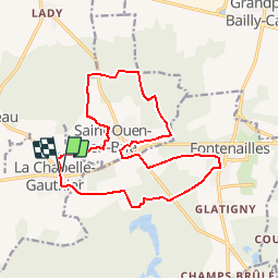
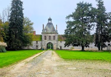
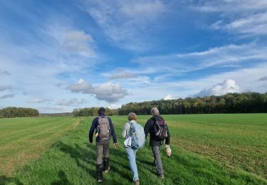
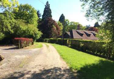
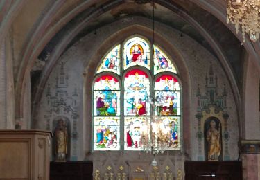
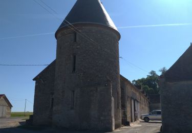
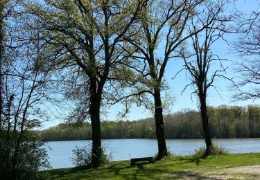
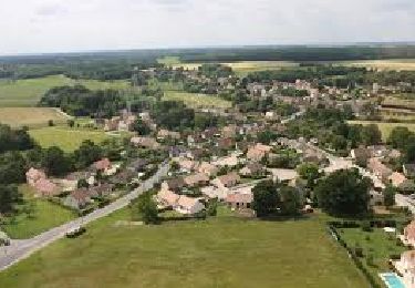
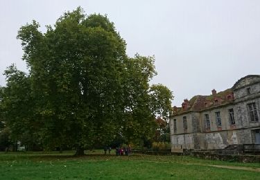
Randonnée Marche de 15,8 km à découvrir à Île-de-France, Seine-et-Marne, La Chapelle-Gauthier. Cette randonnée est proposée par jctinchebray.
Description
Randonnée de 16 km passant par la chapelle gauthier, Saint ouen en brie,les bois de bonbons, Fontenailles, Villefermoy.
Localisation
Pays :
France
Région :
Île-de-France
Département/Province :
Seine-et-Marne
Commune :
La Chapelle-Gauthier
Localité :
Unknown
Départ:(Dec)
Départ:(UTM)
492698 ; 5377478 (31U) N.
Commentaires
Randonnées à proximité
![Randonnée A pied Bombon - Boucle 30 km autour de Bombon - Photo](https://media.geolcdn.com/t/375/260/3c20580b-5dc5-4b7b-ad19-7338a4cd3174.jpg&format=jpg&maxdim=2)
![A pied A pied](https://static1.geolcdn.com/sitytour/trail-icons/100.png)
Boucle 30 km autour de Bombon
A pied
Moyen
Bombon,
Île-de-France,
Seine-et-Marne,
France
![](/images/other/stat-length.png)
30 km | 34 km-effort
7h 42min
![](https://static1.geolcdn.com/siteimages/upload/files/16400158638029165_repeat_loop_refresh_sync_direction_icon.png)
Oui
![Randonnée Marche La Chapelle-Gauthier - Boucle La Chapelle Gauthier par François - Photo](https://media.geolcdn.com/t/375/260/e0c121e5-9a23-476f-ab87-de90523b1e27.jpg&format=jpg&maxdim=2)
![Marche Marche](https://static1.geolcdn.com/sitytour/trail-icons/101.png)
Boucle La Chapelle Gauthier par François
Marche
Facile
La Chapelle-Gauthier,
Île-de-France,
Seine-et-Marne,
France
![](/images/other/stat-length.png)
20 km | 23 km-effort
4h 35min
![](https://static1.geolcdn.com/siteimages/upload/files/16400158638029165_repeat_loop_refresh_sync_direction_icon.png)
Oui
![Randonnée Marche Fontenailles - Les vallons de Fontenailles - Photo](https://media.geolcdn.com/t/375/260/25c28c20-59d3-48bc-849f-b1de09e21cc2.jpg&format=jpg&maxdim=2)
![Marche Marche](https://static1.geolcdn.com/sitytour/trail-icons/101.png)
Les vallons de Fontenailles
Marche
Fontenailles,
Île-de-France,
Seine-et-Marne,
France
![](/images/other/stat-length.png)
8,1 km | 9,4 km-effort
Inconnu
![](https://static1.geolcdn.com/siteimages/upload/files/16400158638029165_repeat_loop_refresh_sync_direction_icon.png)
Oui
![Randonnée Marche Bombon - Bombon 2023 - Photo](https://media.geolcdn.com/t/375/260/c3a1b84c-b69d-45b3-8086-587b8bb5cc10.jpg&format=jpg&maxdim=2)
![Marche Marche](https://static1.geolcdn.com/sitytour/trail-icons/101.png)
Bombon 2023
Marche
Difficile
Bombon,
Île-de-France,
Seine-et-Marne,
France
![](/images/other/stat-length.png)
13,8 km | 15,5 km-effort
3h 23min
![](https://static1.geolcdn.com/siteimages/upload/files/16400158638029165_repeat_loop_refresh_sync_direction_icon.png)
Oui
![Randonnée Marche La Chapelle-Gauthier - Grand Grippon.2 - Photo](https://media.geolcdn.com/t/375/260/5cc0d26a-74ee-4ba0-bee0-7f43777f46c3.jpg&format=jpg&maxdim=2)
![Marche Marche](https://static1.geolcdn.com/sitytour/trail-icons/101.png)
Grand Grippon.2
Marche
Très difficile
La Chapelle-Gauthier,
Île-de-France,
Seine-et-Marne,
France
![](/images/other/stat-length.png)
22 km | 24 km-effort
4h 48min
![](https://static1.geolcdn.com/siteimages/upload/files/16400158638029165_repeat_loop_refresh_sync_direction_icon.png)
Oui
![Randonnée Marche Fontenailles - Villefermoy - Photo](https://media.geolcdn.com/t/375/260/6e596718-3977-45ab-b48e-962eb2b8b1b2.jpg&format=jpg&maxdim=2)
![Marche Marche](https://static1.geolcdn.com/sitytour/trail-icons/101.png)
Villefermoy
Marche
Moyen
Fontenailles,
Île-de-France,
Seine-et-Marne,
France
![](/images/other/stat-length.png)
14,9 km | 16,4 km-effort
3h 10min
![](https://static1.geolcdn.com/siteimages/upload/files/16400158638029165_repeat_loop_refresh_sync_direction_icon.png)
Oui
![Randonnée Marche Saint-Ouen-en-Brie - JC 04 23 km St Ouen en Brie - Photo](https://media.geolcdn.com/t/375/260/cfb519b1-a6a9-4bde-998b-7f7d546b43ca.jpg&format=jpg&maxdim=2)
![Marche Marche](https://static1.geolcdn.com/sitytour/trail-icons/101.png)
JC 04 23 km St Ouen en Brie
Marche
Difficile
Saint-Ouen-en-Brie,
Île-de-France,
Seine-et-Marne,
France
![](/images/other/stat-length.png)
23 km | 25 km-effort
5h 37min
![](https://static1.geolcdn.com/siteimages/upload/files/16400158638029165_repeat_loop_refresh_sync_direction_icon.png)
Oui
![Randonnée Marche Fontenailles - BMF-161029 - Fontenailles-ChapelleGauthier - Photo](https://media.geolcdn.com/t/375/260/ext.jpg?maxdim=2&url=https%3A%2F%2Fservices.sitytrail.com%2FGeolivesWS%2FDownloadMedia.ashx%3FTrailID%3D653840%26Media%3Dfix__20161029121925.jpg)
![Marche Marche](https://static1.geolcdn.com/sitytour/trail-icons/101.png)
BMF-161029 - Fontenailles-ChapelleGauthier
Marche
Très facile
Fontenailles,
Île-de-France,
Seine-et-Marne,
France
![](/images/other/stat-length.png)
16 km | 18,3 km-effort
5h 30min
![](https://static1.geolcdn.com/siteimages/upload/files/16400158638029165_repeat_loop_refresh_sync_direction_icon.png)
Oui
![Randonnée Marche Bombon - Rando Ru d'Ancoeur - château de Bombon - 6 km - Photo](https://media.geolcdn.com/t/375/260/ext.jpg?maxdim=2&url=https%3A%2F%2Fstatic1.geolcdn.com%2Fsiteimages%2Fupload%2Ffiles%2F1553511878bg_sport_marche.png)
![Marche Marche](https://static1.geolcdn.com/sitytour/trail-icons/101.png)
Rando Ru d'Ancoeur - château de Bombon - 6 km
Marche
Moyen
Bombon,
Île-de-France,
Seine-et-Marne,
France
![](/images/other/stat-length.png)
5,9 km | 6,8 km-effort
1h 32min
![](https://static1.geolcdn.com/siteimages/upload/files/16400158638029165_repeat_loop_refresh_sync_direction_icon.png)
Oui