![](/images/other/stat-length.png)
![Randonnée Marche Brion - LA CHALDETTE 48 - Le Fau - Le Truc du Cheylaret - Reyrac - Photo](https://media.geolcdn.com/t/1900/400/ext.pjpeg?maxdim=2&url=https%3A%2F%2Fservices.sitytrail.com%2FGeolivesWS%2FDownloadMedia.ashx%3FTrailID%3D443955%26Media%3D20150711173422.jpg)
LA CHALDETTE 48 - Le Fau - Le Truc du Cheylaret - Reyrac
jeff66
Utilisateur
![Longueur](/images/other/stat-length.png)
Longueur
10,5 km
![Altitude max](https://static1.geolcdn.com/siteimages/upload/files/1508320355ic_sort_altitude_max_24dp.png)
Altitude max
1116 m
![Dénivelé positif](https://static1.geolcdn.com/siteimages/upload/files/1508320355ic_sort_den_pos_24dp.png)
Dénivelé positif
252 m
![Km-Effort](/images/other/stat-length.png)
Km-Effort
13,9 km
![Altitude min](https://static1.geolcdn.com/siteimages/upload/files/1508320355ic_sort_altitude_min_24dp.png)
Altitude min
1005 m
![Dénivelé négatif](https://static1.geolcdn.com/siteimages/upload/files/1508320355ic_sort_den_neg_24dp.png)
Dénivelé négatif
249 m
![Boucle](https://static1.geolcdn.com/siteimages/upload/files/16400158638029165_repeat_loop_refresh_sync_direction_icon.png)
Boucle
Oui
Date de création :
2015-07-17 00:00:00.0
Dernière modification :
2015-07-17 00:00:00.0
![Marche](https://static1.geolcdn.com/sitytour/trail-icons/101.png)
2h44
Difficulté : Moyen
![Scannez ce code QR pour ouvrir la randonnée dans l'application SityTrail](https://capi.geolives.com/qq0zvz2zws4bq2lad0pu/sitytour/trails/443955/qr.png?size=200)
Application GPS de randonnée GRATUITE
À propos
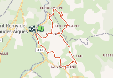
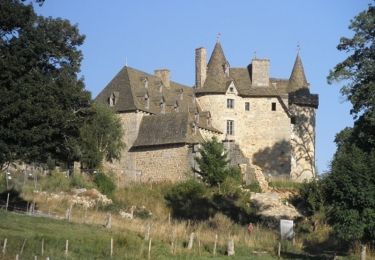
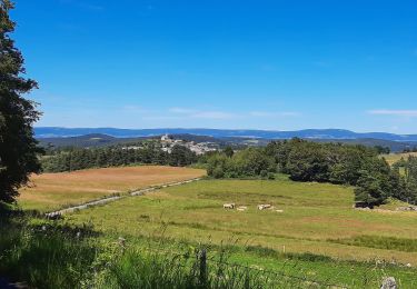
Randonnée Marche de 10,5 km à découvrir à Occitanie, Lozère, Brion. Cette randonnée est proposée par jeff66.
Description
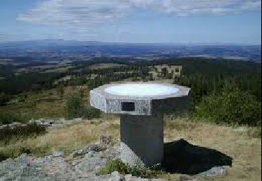
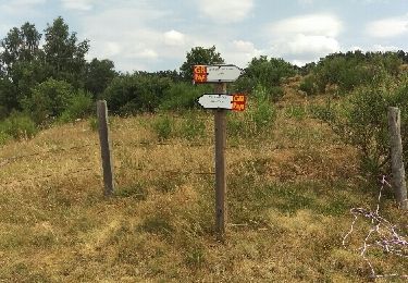
LA CHALDETTE 48 - D12 - la Prugne - Puech de la Chios - la Valentine - le Fau - Reyrac - le Cheylaret - rocher du Cheylaret vierge table d'orientation - vue panoramique a 360 degrés - GR de pays du tour des monts d'Aubrac - vue sur le truc du Cheylaret - Reyrac -
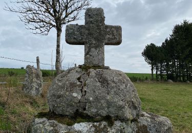
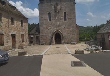
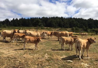
Localisation
Pays :
France
Région :
Occitanie
Département/Province :
Lozère
Commune :
Brion
Localité :
Unknown
Départ:(Dec)
Départ:(UTM)
503582 ; 4957694 (31T) N.
Commentaires
Randonnées à proximité
![Randonnée Marche Brion - Ussels Veyres Luxal - Photo](https://media.geolcdn.com/t/375/260/8a168454-3d88-4877-a192-36f206d6cec4.jpg&format=jpg&maxdim=2)
![Marche Marche](https://static1.geolcdn.com/sitytour/trail-icons/101.png)
Ussels Veyres Luxal
Marche
Moyen
Brion,
Occitanie,
Lozère,
France
![](/images/other/stat-length.png)
18,4 km | 24 km-effort
4h 55min
![](https://static1.geolcdn.com/siteimages/upload/files/16400158638029165_repeat_loop_refresh_sync_direction_icon.png)
Oui
![Randonnée Marche Brion - chaldette termes - Photo](https://media.geolcdn.com/t/375/260/2dde7403-42bc-4118-abad-e778b513b691.jpg&format=jpg&maxdim=2)
![Marche Marche](https://static1.geolcdn.com/sitytour/trail-icons/101.png)
![Randonnée Marche Brion - La chaldette - Photo](https://media.geolcdn.com/t/375/260/4f2e1336-1b40-4d1d-94fc-05aa2e8e5ce4.jpg&format=jpg&maxdim=2)
![Marche Marche](https://static1.geolcdn.com/sitytour/trail-icons/101.png)
![Randonnée Marche Brion - De La Chaldette à Fournels - Photo](https://media.geolcdn.com/t/375/260/ext.jpg?maxdim=2&url=https%3A%2F%2Fservices.sitytrail.com%2FGeolivesWS%2FDownloadMedia.ashx%3FTrailID%3D172922%26Media%3D14390_4.jpg)
![Marche Marche](https://static1.geolcdn.com/sitytour/trail-icons/101.png)
De La Chaldette à Fournels
Marche
Difficile
Brion,
Occitanie,
Lozère,
France
![](/images/other/stat-length.png)
14,8 km | 19,6 km-effort
3h 16min
![](https://static1.geolcdn.com/siteimages/upload/files/16400158638029165_repeat_loop_refresh_sync_direction_icon.png)
Non
![Randonnée Marche Brion - la chaldette - termes - Photo](https://media.geolcdn.com/t/375/260/10974816-103e-4962-8997-c049dab312fc.jpg&format=jpg&maxdim=2)
![Marche Marche](https://static1.geolcdn.com/sitytour/trail-icons/101.png)
la chaldette - termes
Marche
Moyen
Brion,
Occitanie,
Lozère,
France
![](/images/other/stat-length.png)
26 km | 35 km-effort
5h 57min
![](https://static1.geolcdn.com/siteimages/upload/files/16400158638029165_repeat_loop_refresh_sync_direction_icon.png)
Non
![Randonnée Marche Deux-Verges - Le Puy de la Tuile - Photo](https://media.geolcdn.com/t/375/260/8c8e0d8f-973f-4cd5-97ab-09ffcd850d61.jpg&format=jpg&maxdim=2)
![Marche Marche](https://static1.geolcdn.com/sitytour/trail-icons/101.png)
Le Puy de la Tuile
Marche
Moyen
Deux-Verges,
Auvergne-Rhône-Alpes,
Cantal,
France
![](/images/other/stat-length.png)
8,9 km | 12,5 km-effort
3h 0min
![](https://static1.geolcdn.com/siteimages/upload/files/16400158638029165_repeat_loop_refresh_sync_direction_icon.png)
Oui
![Randonnée Marche Brion - la chaldette - termes - Photo](https://media.geolcdn.com/t/375/260/ext.jpg?maxdim=2&url=https%3A%2F%2Fservices.sitytrail.com%2FGeolivesWS%2FDownloadMedia.ashx%3FTrailID%3D447033%26Media%3Dfix__20150718125204.jpg)
![Marche Marche](https://static1.geolcdn.com/sitytour/trail-icons/101.png)
la chaldette - termes
Marche
Très facile
Brion,
Occitanie,
Lozère,
France
![](/images/other/stat-length.png)
29 km | 39 km-effort
7h 1min
![](https://static1.geolcdn.com/siteimages/upload/files/16400158638029165_repeat_loop_refresh_sync_direction_icon.png)
Non
![Marche Marche](https://static1.geolcdn.com/sitytour/trail-icons/101.png)
Jeudi 9 mai
Marche
Très difficile
Brion,
Occitanie,
Lozère,
France
![](/images/other/stat-length.png)
19 km | 24 km-effort
5h 27min
![](https://static1.geolcdn.com/siteimages/upload/files/16400158638029165_repeat_loop_refresh_sync_direction_icon.png)
Non
![Randonnée Marche Brion - Le Puech de Brion - Photo](https://media.geolcdn.com/t/375/260/ext.jpg?maxdim=2&url=https%3A%2F%2Fstatic1.geolcdn.com%2Fsiteimages%2Fupload%2Ffiles%2F1553511878bg_sport_marche.png)
![Marche Marche](https://static1.geolcdn.com/sitytour/trail-icons/101.png)
Le Puech de Brion
Marche
Facile
Brion,
Occitanie,
Lozère,
France
![](/images/other/stat-length.png)
7,4 km | 10,1 km-effort
1h 56min
![](https://static1.geolcdn.com/siteimages/upload/files/16400158638029165_repeat_loop_refresh_sync_direction_icon.png)
Oui