![](/images/other/stat-length.png)
Libramont - 8. La promenade des Tchèts - LB011
La Grande Forêt de Saint-Hubert
Randonnées de la Grande Forêt de Saint-Hubert GUIDE+
![Longueur](/images/other/stat-length.png)
Longueur
10,6 km
![Altitude max](https://static1.geolcdn.com/siteimages/upload/files/1508320355ic_sort_altitude_max_24dp.png)
Altitude max
501 m
![Dénivelé positif](https://static1.geolcdn.com/siteimages/upload/files/1508320355ic_sort_den_pos_24dp.png)
Dénivelé positif
186 m
![Km-Effort](/images/other/stat-length.png)
Km-Effort
13,1 km
![Altitude min](https://static1.geolcdn.com/siteimages/upload/files/1508320355ic_sort_altitude_min_24dp.png)
Altitude min
418 m
![Dénivelé négatif](https://static1.geolcdn.com/siteimages/upload/files/1508320355ic_sort_den_neg_24dp.png)
Dénivelé négatif
184 m
![Boucle](https://static1.geolcdn.com/siteimages/upload/files/16400158638029165_repeat_loop_refresh_sync_direction_icon.png)
Boucle
Oui
![Balise](https://services.sitytrail.com/GeolivesWS/DownloadMedia.ashx?TrailID=442633&Media=balise.png)
Balise
Date de création :
2017-11-06 00:00:00.0
Dernière modification :
2017-11-06 00:00:00.0
![Marche](https://static1.geolcdn.com/sitytour/trail-icons/101.png)
3h09
Difficulté : Difficile
![Scannez ce code QR pour ouvrir la randonnée dans l'application SityTrail](https://capi.geolives.com/qq0zvz2zws4bq2lad0pu/sitytour/trails/442633/qr.png?size=200)
Application GPS de randonnée GRATUITE
À propos
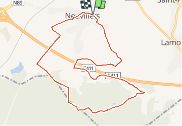
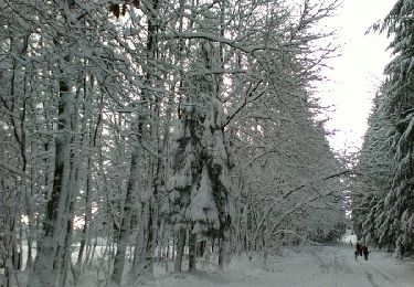
Randonnée Marche de 10,6 km à découvrir à Wallonie, Luxembourg, Libramont-Chevigny. Cette randonnée est proposée par La Grande Forêt de Saint-Hubert.
Description
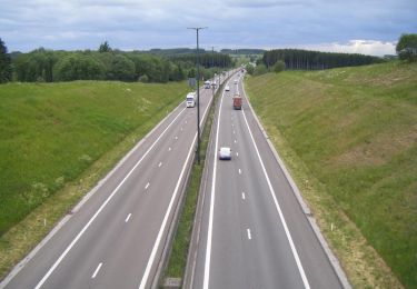
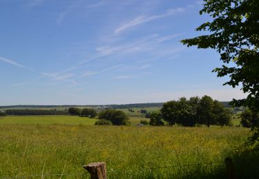
Promenade balisée dont le tracé a légèrement été modifié à la demande d'un avis de la DNF.
Localisation
Pays :
Belgique
Région :
Wallonie
Département/Province :
Luxembourg
Commune :
Libramont-Chevigny
Localité :
Recogne
Départ:(Dec)
Départ:(UTM)
669300 ; 5530325 (31U) N.
Commentaires
Randonnées à proximité
![Randonnée Marche Libramont-Chevigny - Libramont - 5.Promenade de la Briqueterie - LB008 - Photo](https://media.geolcdn.com/t/375/260/ext.jpg?maxdim=2&url=https%3A%2F%2Fservices.sitytrail.com%2FGeolivesWS%2FDownloadMedia.ashx%3FTrailID%3D436759%26Media%3D1d95f13b-efa7-4e6b-8acb-d65f62fe27d3.JPG)
![Marche Marche](https://static1.geolcdn.com/sitytour/trail-icons/101.png)
Libramont - 5.Promenade de la Briqueterie - LB008
Marche
Moyen
(6)
Libramont-Chevigny,
Wallonie,
Luxembourg,
Belgique
![](/images/other/stat-length.png)
6,8 km | 8,5 km-effort
2h 1min
![](https://static1.geolcdn.com/siteimages/upload/files/16400158638029165_repeat_loop_refresh_sync_direction_icon.png)
Oui
![Randonnée Marche Libramont-Chevigny - 5. Promenade non balisée au départ du village de Lamouline - Photo](https://media.geolcdn.com/t/375/260/ext.jpg?maxdim=2&url=https%3A%2F%2Fservices.sitytrail.com%2FGeolivesWS%2FDownloadMedia.ashx%3FTrailID%3D537894%26Media%3Dd4f09763-3f4e-4f58-b9ef-7a20178fcd7b.jpg)
![Marche Marche](https://static1.geolcdn.com/sitytour/trail-icons/101.png)
5. Promenade non balisée au départ du village de Lamouline
Marche
Facile
(2)
Libramont-Chevigny,
Wallonie,
Luxembourg,
Belgique
![](/images/other/stat-length.png)
5 km | 6,1 km-effort
1h 21min
![](https://static1.geolcdn.com/siteimages/upload/files/16400158638029165_repeat_loop_refresh_sync_direction_icon.png)
Oui
![Randonnée Marche Libramont-Chevigny - Libramont - 3.Voie Saint-Antoine - LB006 - Photo](https://media.geolcdn.com/t/375/260/ext.jpg?maxdim=2&url=https%3A%2F%2Fservices.sitytrail.com%2FGeolivesWS%2FDownloadMedia.ashx%3FTrailID%3D435461%26Media%3D9c2a9845-3837-4f3e-afd6-579a4ed1754d.JPG)
![Marche Marche](https://static1.geolcdn.com/sitytour/trail-icons/101.png)
Libramont - 3.Voie Saint-Antoine - LB006
Marche
Très difficile
(2)
Libramont-Chevigny,
Wallonie,
Luxembourg,
Belgique
![](/images/other/stat-length.png)
17,9 km | 22 km-effort
6h 21min
![](https://static1.geolcdn.com/siteimages/upload/files/16400158638029165_repeat_loop_refresh_sync_direction_icon.png)
Oui
![Randonnée Marche Libramont-Chevigny - marche ADEPS Libramont - Photo](https://media.geolcdn.com/t/375/260/335bd56e-e2bf-45e7-9e07-2e37ce966e5f.jpg&format=jpg&maxdim=2)
![Marche Marche](https://static1.geolcdn.com/sitytour/trail-icons/101.png)
marche ADEPS Libramont
Marche
Moyen
(1)
Libramont-Chevigny,
Wallonie,
Luxembourg,
Belgique
![](/images/other/stat-length.png)
9,6 km | 12,2 km-effort
2h 8min
![](https://static1.geolcdn.com/siteimages/upload/files/16400158638029165_repeat_loop_refresh_sync_direction_icon.png)
Oui
![Randonnée Marche Libramont-Chevigny - Nuit du scoutisme - Libramont - Photo](https://media.geolcdn.com/t/375/260/1ae90a2d-2bc2-4abc-86f6-3db7cf44d5c2.jpg&format=jpg&maxdim=2)
![Marche Marche](https://static1.geolcdn.com/sitytour/trail-icons/101.png)
Nuit du scoutisme - Libramont
Marche
Facile
(2)
Libramont-Chevigny,
Wallonie,
Luxembourg,
Belgique
![](/images/other/stat-length.png)
4,9 km | 5,8 km-effort
1h 18min
![](https://static1.geolcdn.com/siteimages/upload/files/16400158638029165_repeat_loop_refresh_sync_direction_icon.png)
Oui
![Randonnée Marche Libramont-Chevigny - Promenade pédagogique celtique - Photo](https://media.geolcdn.com/t/375/260/ext.jpg?maxdim=2&url=https%3A%2F%2Fservices.sitytrail.com%2FGeolivesWS%2FDownloadMedia.ashx%3FTrailID%3D767953%26Media%3Da77e25ec-09c3-43b4-9a1e-08e7083c9c0f.jpg)
![Marche Marche](https://static1.geolcdn.com/sitytour/trail-icons/101.png)
Promenade pédagogique celtique
Marche
Facile
(3)
Libramont-Chevigny,
Wallonie,
Luxembourg,
Belgique
![](/images/other/stat-length.png)
3 km | 3,7 km-effort
49min
![](https://static1.geolcdn.com/siteimages/upload/files/16400158638029165_repeat_loop_refresh_sync_direction_icon.png)
Oui
![Randonnée Marche Libramont-Chevigny - Libramont - marche des flocons 10 km - Photo](https://media.geolcdn.com/t/375/260/ext.jpg?maxdim=2&url=https%3A%2F%2Fservices.sitytrail.com%2FGeolivesWS%2FDownloadMedia.ashx%3FTrailID%3D684571%26Media%3Dfix__20170115102402.jpg)
![Marche Marche](https://static1.geolcdn.com/sitytour/trail-icons/101.png)
Libramont - marche des flocons 10 km
Marche
Facile
(1)
Libramont-Chevigny,
Wallonie,
Luxembourg,
Belgique
![](/images/other/stat-length.png)
10,2 km | 13 km-effort
2h 6min
![](https://static1.geolcdn.com/siteimages/upload/files/16400158638029165_repeat_loop_refresh_sync_direction_icon.png)
Oui
![Randonnée Marche Libramont-Chevigny - Bonance - Photo](https://media.geolcdn.com/t/375/260/ext.jpg?maxdim=2&url=https%3A%2F%2Fservices.sitytrail.com%2FGeolivesWS%2FDownloadMedia.ashx%3FTrailID%3D156107%26Media%3D20120930171822.jpeg)
![Marche Marche](https://static1.geolcdn.com/sitytour/trail-icons/101.png)
Bonance
Marche
Facile
(1)
Libramont-Chevigny,
Wallonie,
Luxembourg,
Belgique
![](/images/other/stat-length.png)
9,4 km | 11,7 km-effort
2h 28min
![](https://static1.geolcdn.com/siteimages/upload/files/16400158638029165_repeat_loop_refresh_sync_direction_icon.png)
Oui
![Randonnée Vélo Libramont-Chevigny - Libramont - Villages de Libramont 35 km - Parcours non balisé - Photo](https://media.geolcdn.com/t/375/260/ext.jpg?maxdim=2&url=https%3A%2F%2Fstatic1.geolcdn.com%2Fsiteimages%2Fupload%2Ffiles%2F1524743154velo.jpg)
![Vélo Vélo](https://static1.geolcdn.com/sitytour/trail-icons/200.png)
Libramont - Villages de Libramont 35 km - Parcours non balisé
Vélo
Difficile
(1)
Libramont-Chevigny,
Wallonie,
Luxembourg,
Belgique
![](/images/other/stat-length.png)
38 km | 45 km-effort
2h 23min
![](https://static1.geolcdn.com/siteimages/upload/files/16400158638029165_repeat_loop_refresh_sync_direction_icon.png)
Oui