![](/images/other/stat-length.png)
![Randonnée Marche Brussieu - La Giraudière à Vaugneray - Photo](https://media.geolcdn.com/t/1900/400/ext.pjpeg?maxdim=2&url=https%3A%2F%2Fservices.sitytrail.com%2FGeolivesWS%2FDownloadMedia.ashx%3FTrailID%3D434796%26Media%3Dfix__20150619121730.jpg)
La Giraudière à Vaugneray
Trotte-menu
Utilisateur
![Longueur](/images/other/stat-length.png)
Longueur
15,2 km
![Altitude max](https://static1.geolcdn.com/siteimages/upload/files/1508320355ic_sort_altitude_max_24dp.png)
Altitude max
859 m
![Dénivelé positif](https://static1.geolcdn.com/siteimages/upload/files/1508320355ic_sort_den_pos_24dp.png)
Dénivelé positif
625 m
![Km-Effort](/images/other/stat-length.png)
Km-Effort
23 km
![Altitude min](https://static1.geolcdn.com/siteimages/upload/files/1508320355ic_sort_altitude_min_24dp.png)
Altitude min
305 m
![Dénivelé négatif](https://static1.geolcdn.com/siteimages/upload/files/1508320355ic_sort_den_neg_24dp.png)
Dénivelé négatif
515 m
![Boucle](https://static1.geolcdn.com/siteimages/upload/files/16400158638029165_repeat_loop_refresh_sync_direction_icon.png)
Boucle
Non
Date de création :
2015-06-19 00:00:00.0
Dernière modification :
2015-06-19 00:00:00.0
![Marche](https://static1.geolcdn.com/sitytour/trail-icons/101.png)
4h52
Difficulté : Moyen
![Scannez ce code QR pour ouvrir la randonnée dans l'application SityTrail](https://capi.geolives.com/qq0zvz2zws4bq2lad0pu/sitytour/trails/434796/qr.png?size=200)
Application GPS de randonnée GRATUITE
À propos
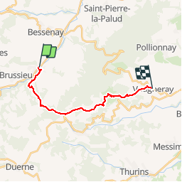
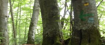
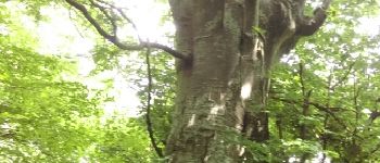
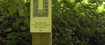
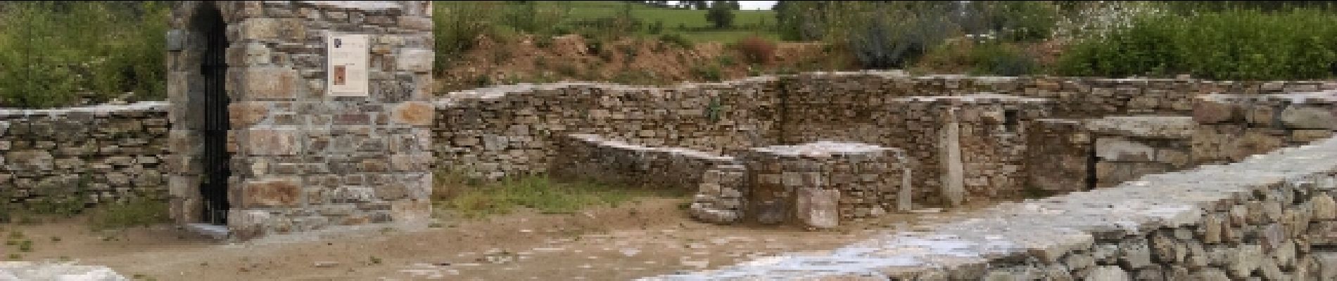
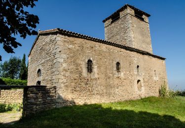
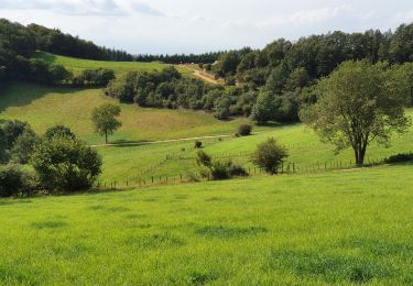
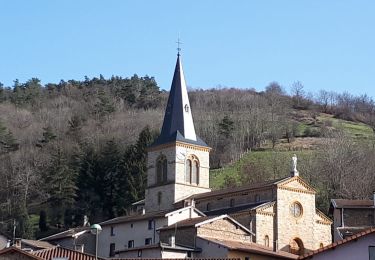
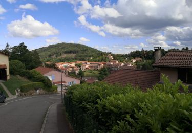
Randonnée Marche de 15,2 km à découvrir à Auvergne-Rhône-Alpes, Rhône, Brussieu. Cette randonnée est proposée par Trotte-menu.
Description
Ce parcours s'effectue au départ de Lyon avec les bus du Rhône.
Départ Gorge de Loup Ligne 42 arrêt la Giraudière.
Retour Ligne 47 arrêt Craponne centre puis TCL, ligne C24 jusqu'à Gorge de Loup.
Points d'intérêt
Localisation
Pays :
France
Région :
Auvergne-Rhône-Alpes
Département/Province :
Rhône
Commune :
Brussieu
Localité :
Unknown
Départ:(Dec)
Départ:(UTM)
620345 ; 5067675 (31T) N.
Commentaires
Randonnées à proximité
![Randonnée Marche Courzieu - Courzieu - Fiche Verte n°5 - Photo](https://media.geolcdn.com/t/375/260/ext.jpg?maxdim=2&url=https%3A%2F%2Fstatic1.geolcdn.com%2Fsiteimages%2Fupload%2Ffiles%2F1553511878bg_sport_marche.png)
![Marche Marche](https://static1.geolcdn.com/sitytour/trail-icons/101.png)
Courzieu - Fiche Verte n°5
Marche
Difficile
(1)
Courzieu,
Auvergne-Rhône-Alpes,
Rhône,
France
![](/images/other/stat-length.png)
9 km | 15 km-effort
3h 23min
![](https://static1.geolcdn.com/siteimages/upload/files/16400158638029165_repeat_loop_refresh_sync_direction_icon.png)
Oui
![Randonnée A pied Yzeron - Circuit de Py Froid - Photo](https://media.geolcdn.com/t/375/260/ccee4352-98a6-4537-9c22-39e022d07a15.jpeg&format=jpg&maxdim=2)
![A pied A pied](https://static1.geolcdn.com/sitytour/trail-icons/100.png)
Circuit de Py Froid
A pied
Facile
Yzeron,
Auvergne-Rhône-Alpes,
Rhône,
France
![](/images/other/stat-length.png)
7,8 km | 10,9 km-effort
2h 27min
![](https://static1.geolcdn.com/siteimages/upload/files/16400158638029165_repeat_loop_refresh_sync_direction_icon.png)
Oui
![Randonnée Marche Yzeron - Yzeron - Les hauteurs d'Yzeron - Photo](https://media.geolcdn.com/t/375/260/fe23a6b9-b1ae-4dda-a2e4-aaa2928b61dc.jpg&format=jpg&maxdim=2)
![Marche Marche](https://static1.geolcdn.com/sitytour/trail-icons/101.png)
Yzeron - Les hauteurs d'Yzeron
Marche
Facile
Yzeron,
Auvergne-Rhône-Alpes,
Rhône,
France
![](/images/other/stat-length.png)
7,4 km | 10,3 km-effort
2h 3min
![](https://static1.geolcdn.com/siteimages/upload/files/16400158638029165_repeat_loop_refresh_sync_direction_icon.png)
Oui
![Randonnée Marche Montromant - Montromant la Croix des brosses (12 km - D. 504 m) - Photo](https://media.geolcdn.com/t/375/260/bb66d250-ab70-4c3d-a805-7e16eb84f6b1.jpeg&format=jpg&maxdim=2)
![Marche Marche](https://static1.geolcdn.com/sitytour/trail-icons/101.png)
Montromant la Croix des brosses (12 km - D. 504 m)
Marche
Moyen
Montromant,
Auvergne-Rhône-Alpes,
Rhône,
France
![](/images/other/stat-length.png)
12,1 km | 18,8 km-effort
4h 17min
![](https://static1.geolcdn.com/siteimages/upload/files/16400158638029165_repeat_loop_refresh_sync_direction_icon.png)
Oui
![Randonnée Marche Brullioles - De Bruliolles à Montrottier - Photo](https://media.geolcdn.com/t/375/260/d54c0e2f-8752-4353-ad10-a1122f6fa51d.jpg&format=jpg&maxdim=2)
![Marche Marche](https://static1.geolcdn.com/sitytour/trail-icons/101.png)
De Bruliolles à Montrottier
Marche
Facile
Brullioles,
Auvergne-Rhône-Alpes,
Rhône,
France
![](/images/other/stat-length.png)
11,8 km | 16,8 km-effort
2h 52min
![](https://static1.geolcdn.com/siteimages/upload/files/16400158638029165_repeat_loop_refresh_sync_direction_icon.png)
Oui
![Randonnée Marche Yzeron - Izeron - Des cascades à la Madonne - Photo](https://media.geolcdn.com/t/375/260/308041cb-9d39-412d-a6ff-b34a3371db68.jpg&format=jpg&maxdim=2)
![Marche Marche](https://static1.geolcdn.com/sitytour/trail-icons/101.png)
Izeron - Des cascades à la Madonne
Marche
Facile
Yzeron,
Auvergne-Rhône-Alpes,
Rhône,
France
![](/images/other/stat-length.png)
7,1 km | 10,8 km-effort
3h 33min
![](https://static1.geolcdn.com/siteimages/upload/files/16400158638029165_repeat_loop_refresh_sync_direction_icon.png)
Oui
![Randonnée Marche Yzeron - Yzeron - Photo](https://media.geolcdn.com/t/375/260/ext.jpg?maxdim=2&url=https%3A%2F%2Fstatic1.geolcdn.com%2Fsiteimages%2Fupload%2Ffiles%2F1553511878bg_sport_marche.png)
![Marche Marche](https://static1.geolcdn.com/sitytour/trail-icons/101.png)
Yzeron
Marche
Difficile
(1)
Yzeron,
Auvergne-Rhône-Alpes,
Rhône,
France
![](/images/other/stat-length.png)
12,5 km | 20 km-effort
3h 40min
![](https://static1.geolcdn.com/siteimages/upload/files/16400158638029165_repeat_loop_refresh_sync_direction_icon.png)
Oui
![Randonnée Marche Brussieu - 3 brussieu 17.6 km +570m - Photo](https://media.geolcdn.com/t/375/260/ext.jpg?maxdim=2&url=https%3A%2F%2Fstatic1.geolcdn.com%2Fsiteimages%2Fupload%2Ffiles%2F1553511878bg_sport_marche.png)
![Marche Marche](https://static1.geolcdn.com/sitytour/trail-icons/101.png)
3 brussieu 17.6 km +570m
Marche
Très facile
(1)
Brussieu,
Auvergne-Rhône-Alpes,
Rhône,
France
![](/images/other/stat-length.png)
17,6 km | 25 km-effort
5h 47min
![](https://static1.geolcdn.com/siteimages/upload/files/16400158638029165_repeat_loop_refresh_sync_direction_icon.png)
Oui
![Randonnée V.T.T. Yzeron - Rando Yseron 35 km - Photo](https://media.geolcdn.com/t/375/260/ext.jpg?maxdim=2&url=https%3A%2F%2Fstatic1.geolcdn.com%2Fsiteimages%2Fupload%2Ffiles%2F1524743154velo.jpg)
![V.T.T. V.T.T.](https://static1.geolcdn.com/sitytour/trail-icons/202.png)
Rando Yseron 35 km
V.T.T.
Difficile
(1)
Yzeron,
Auvergne-Rhône-Alpes,
Rhône,
France
![](/images/other/stat-length.png)
34 km | 51 km-effort
3h 14min
![](https://static1.geolcdn.com/siteimages/upload/files/16400158638029165_repeat_loop_refresh_sync_direction_icon.png)
Oui