![](/images/other/stat-length.png)
![Randonnée A pied Unknown - Nacionalni park Paklenica - Photo](https://media.geolcdn.com/t/1900/400/afedae5b-4209-4d66-bdba-6cfba3f997ff.jpeg&format=pjpeg&maxdim=2)
Nacionalni park Paklenica
SityTrail - itinéraires balisés pédestres
Tous les sentiers balisés d’Europe GUIDE+
![Longueur](/images/other/stat-length.png)
![Altitude max](https://static1.geolcdn.com/siteimages/upload/files/1508320355ic_sort_altitude_max_24dp.png)
![Dénivelé positif](https://static1.geolcdn.com/siteimages/upload/files/1508320355ic_sort_den_pos_24dp.png)
![Km-Effort](/images/other/stat-length.png)
![Altitude min](https://static1.geolcdn.com/siteimages/upload/files/1508320355ic_sort_altitude_min_24dp.png)
![Dénivelé négatif](https://static1.geolcdn.com/siteimages/upload/files/1508320355ic_sort_den_neg_24dp.png)
![Boucle](https://static1.geolcdn.com/siteimages/upload/files/16400158638029165_repeat_loop_refresh_sync_direction_icon.png)
![A pied](https://static1.geolcdn.com/sitytour/trail-icons/100.png)
4h46
Difficulté : Moyen
![Scannez ce code QR pour ouvrir la randonnée dans l'application SityTrail](https://capi.geolives.com/qq0zvz2zws4bq2lad0pu/sitytour/trails/4346147/qr.png?size=200)
Application GPS de randonnée GRATUITE
À propos
Randonnée A pied de 11,7 km à découvrir à Inconnu, Comitat de Lika-Senj. Cette randonnée est proposée par SityTrail - itinéraires balisés pédestres.
Description
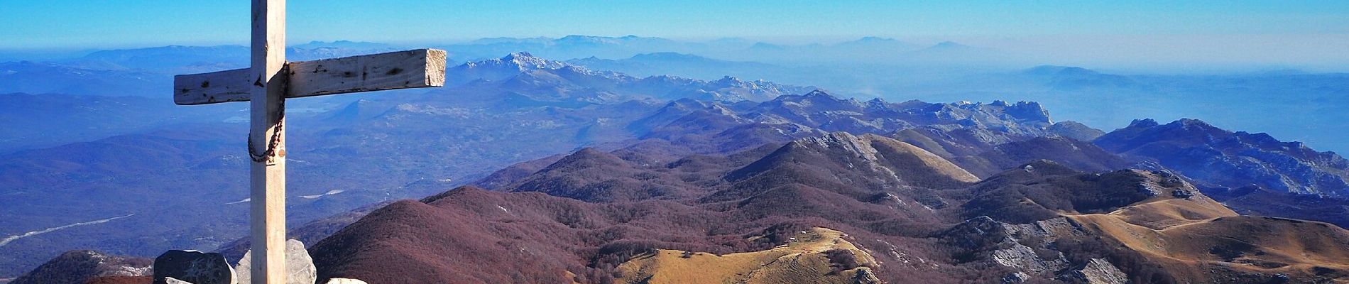
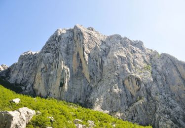
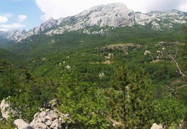
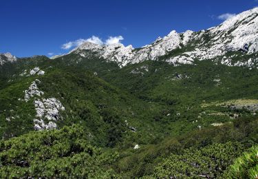
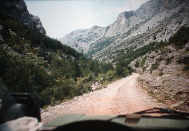
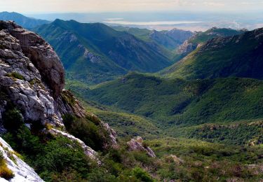
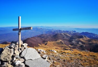
The area of Paklenica is one of the most interesting karst areas of Velebit and Croatia. At the base of the series of the highest peaks of Velebit, torrents have created two deep canyons representing a combination of longitudinal and deeply cut valleys in geomorphological terms. The most ...
Site web: https://trail.viadinarica.com/tour/hiking/15966852/
Localisation
Commentaires
Randonnées à proximité
![Randonnée A pied - Bukova staza - Photo](https://media.geolcdn.com/t/375/260/0293162d-3a5f-4b15-b737-440dbc2c1183.jpeg&format=jpg&maxdim=2)
![A pied A pied](https://static1.geolcdn.com/sitytour/trail-icons/100.png)
![Randonnée A pied - Dom u Velikoj Paklenici - Krajni brig - Photo](https://media.geolcdn.com/t/375/260/9b12ad8e-78b9-402d-9026-622d8b2790f2.jpeg&format=jpg&maxdim=2)
![A pied A pied](https://static1.geolcdn.com/sitytour/trail-icons/100.png)
A pied
![](/images/other/stat-length.png)
![](https://static1.geolcdn.com/siteimages/upload/files/16400158638029165_repeat_loop_refresh_sync_direction_icon.png)
![Randonnée A pied - Golić - Stražbenica - Photo](https://media.geolcdn.com/t/375/260/1fb005e9-31bf-41ad-b0c1-91bb8d8fb8c4.jpeg&format=jpg&maxdim=2)
![A pied A pied](https://static1.geolcdn.com/sitytour/trail-icons/100.png)
A pied
![](/images/other/stat-length.png)
![](https://static1.geolcdn.com/siteimages/upload/files/16400158638029165_repeat_loop_refresh_sync_direction_icon.png)
![Randonnée A pied - Dom u Velikoj Paklenici - Stražbenica - Photo](https://media.geolcdn.com/t/375/260/74943b82-bfa9-49f1-8ba4-6b0b9dfe9937.jpeg&format=jpg&maxdim=2)
![A pied A pied](https://static1.geolcdn.com/sitytour/trail-icons/100.png)
A pied
![](/images/other/stat-length.png)
![](https://static1.geolcdn.com/siteimages/upload/files/16400158638029165_repeat_loop_refresh_sync_direction_icon.png)
![Randonnée A pied - Lipa staza - Photo](https://media.geolcdn.com/t/375/260/cd3917a8-4228-43c8-9d12-c2fc6fd497bd.jpeg&format=jpg&maxdim=2)
![A pied A pied](https://static1.geolcdn.com/sitytour/trail-icons/100.png)
![Randonnée A pied - Struge - Vaganski vrh - Photo](https://media.geolcdn.com/t/375/260/3896feef-29ff-4652-b14a-a616281106d1.jpeg&format=jpg&maxdim=2)
![A pied A pied](https://static1.geolcdn.com/sitytour/trail-icons/100.png)
A pied
![](/images/other/stat-length.png)
![](https://static1.geolcdn.com/siteimages/upload/files/16400158638029165_repeat_loop_refresh_sync_direction_icon.png)
![Randonnée A pied - Vaganski vrh - Sveto Brdo - Photo](https://media.geolcdn.com/t/375/260/afedae5b-4209-4d66-bdba-6cfba3f997ff.jpeg&format=jpg&maxdim=2)
![A pied A pied](https://static1.geolcdn.com/sitytour/trail-icons/100.png)
A pied
![](/images/other/stat-length.png)
![](https://static1.geolcdn.com/siteimages/upload/files/16400158638029165_repeat_loop_refresh_sync_direction_icon.png)
![Randonnée A pied - Dom u Velikoj Paklenici - Vlaški grad - Photo](https://media.geolcdn.com/t/375/260/afedae5b-4209-4d66-bdba-6cfba3f997ff.jpeg&format=jpg&maxdim=2)
![A pied A pied](https://static1.geolcdn.com/sitytour/trail-icons/100.png)
A pied
![](/images/other/stat-length.png)
![](https://static1.geolcdn.com/siteimages/upload/files/16400158638029165_repeat_loop_refresh_sync_direction_icon.png)
![Randonnée A pied - Dom Paklenica - Jurline - Photo](https://media.geolcdn.com/t/375/260/74943b82-bfa9-49f1-8ba4-6b0b9dfe9937.jpeg&format=jpg&maxdim=2)
![A pied A pied](https://static1.geolcdn.com/sitytour/trail-icons/100.png)
A pied
![](/images/other/stat-length.png)
![](https://static1.geolcdn.com/siteimages/upload/files/16400158638029165_repeat_loop_refresh_sync_direction_icon.png)