![](/images/other/stat-length.png)
![Randonnée A pied Kryry - [M] Nepomyšl - Kryry - Photo](https://media.geolcdn.com/t/1900/400/a2408f13-d402-4160-be99-95020e040a2f.jpeg&format=pjpeg&maxdim=2)
[M] Nepomyšl - Kryry
SityTrail - itinéraires balisés pédestres
Tous les sentiers balisés d’Europe GUIDE+
![Longueur](/images/other/stat-length.png)
Longueur
15,2 km
![Altitude max](https://static1.geolcdn.com/siteimages/upload/files/1508320355ic_sort_altitude_max_24dp.png)
Altitude max
536 m
![Dénivelé positif](https://static1.geolcdn.com/siteimages/upload/files/1508320355ic_sort_den_pos_24dp.png)
Dénivelé positif
343 m
![Km-Effort](/images/other/stat-length.png)
Km-Effort
19,4 km
![Altitude min](https://static1.geolcdn.com/siteimages/upload/files/1508320355ic_sort_altitude_min_24dp.png)
Altitude min
304 m
![Dénivelé négatif](https://static1.geolcdn.com/siteimages/upload/files/1508320355ic_sort_den_neg_24dp.png)
Dénivelé négatif
223 m
![Boucle](https://static1.geolcdn.com/siteimages/upload/files/16400158638029165_repeat_loop_refresh_sync_direction_icon.png)
Boucle
Non
Balise
Date de création :
2025-02-07 15:43:13.837
Dernière modification :
2025-02-07 15:43:13.837
![A pied](https://static1.geolcdn.com/sitytour/trail-icons/100.png)
4h24
Difficulté : Facile
![Scannez ce code QR pour ouvrir la randonnée dans l'application SityTrail](https://capi.geolives.com/qq0zvz2zws4bq2lad0pu/sitytour/trails/4346052/qr.png?size=200)
Application GPS de randonnée GRATUITE
À propos
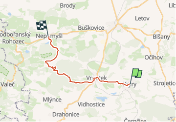
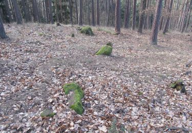
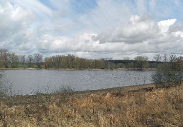
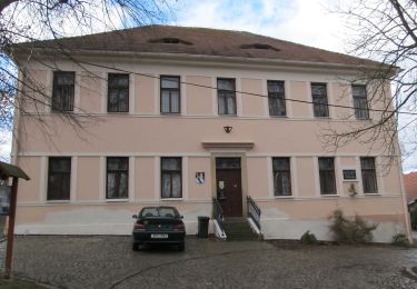
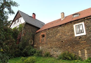
Randonnée A pied de 15,2 km à découvrir à Severozápad, Ústecký kraj, Kryry. Cette randonnée est proposée par SityTrail - itinéraires balisés pédestres.
Description
Randonnée créée par cz:KČT.
Localisation
Pays :
République Tchèque
Région :
Severozápad
Département/Province :
Ústecký kraj
Commune :
Kryry
Localité :
Unknown
Départ:(Dec)
Départ:(UTM)
387666 ; 5559214 (33U) N.
Commentaires
Randonnées à proximité
![Randonnée A pied Lubná - [Ž] Rakovník - Senecká hora - Photo](https://media.geolcdn.com/t/375/260/dff3753f-98a3-47a5-8521-cd2a1a4dd151.jpeg&format=jpg&maxdim=2)
![A pied A pied](https://static1.geolcdn.com/sitytour/trail-icons/100.png)
[Ž] Rakovník - Senecká hora
A pied
Facile
Lubná,
Střední Čechy,
Inconnu,
République Tchèque
![](/images/other/stat-length.png)
10,9 km | 13,5 km-effort
3h 3min
![](https://static1.geolcdn.com/siteimages/upload/files/16400158638029165_repeat_loop_refresh_sync_direction_icon.png)
Non
![Randonnée A pied Žlutice - CZ-6716 - Photo](https://media.geolcdn.com/t/375/260/c68eaa98-333f-47f8-8f76-5ea6902bcb6f.jpeg&format=jpg&maxdim=2)
![A pied A pied](https://static1.geolcdn.com/sitytour/trail-icons/100.png)
CZ-6716
A pied
Facile
Žlutice,
Severozápad,
Karlovarský kraj,
République Tchèque
![](/images/other/stat-length.png)
14,6 km | 18,7 km-effort
4h 14min
![](https://static1.geolcdn.com/siteimages/upload/files/16400158638029165_repeat_loop_refresh_sync_direction_icon.png)
Non
![Randonnée A pied Krásný Dvůr - [Č] 0378 Červený okruh - Photo](https://media.geolcdn.com/t/375/260/a2237453-12a7-4014-acf3-8544ee4986a4.jpeg&format=jpg&maxdim=2)
![A pied A pied](https://static1.geolcdn.com/sitytour/trail-icons/100.png)
[Č] 0378 Červený okruh
A pied
Facile
Krásný Dvůr,
Severozápad,
Ústecký kraj,
République Tchèque
![](/images/other/stat-length.png)
4,6 km | 5,8 km-effort
1h 18min
![](https://static1.geolcdn.com/siteimages/upload/files/16400158638029165_repeat_loop_refresh_sync_direction_icon.png)
Oui
![Randonnée A pied Vroutek - NS Stezka lesů ČR - Photo](https://media.geolcdn.com/t/375/260/4eae7e88-1dbb-4dab-bcf0-c5b4aff92986.jpeg&format=jpg&maxdim=2)
![A pied A pied](https://static1.geolcdn.com/sitytour/trail-icons/100.png)
NS Stezka lesů ČR
A pied
Facile
Vroutek,
Severozápad,
Ústecký kraj,
République Tchèque
![](/images/other/stat-length.png)
5,1 km | 6,2 km-effort
1h 25min
![](https://static1.geolcdn.com/siteimages/upload/files/16400158638029165_repeat_loop_refresh_sync_direction_icon.png)
Non
![Randonnée A pied Hřivice - NS U Petra a Pavla - Photo](https://media.geolcdn.com/t/375/260/888ad7c4-476a-403e-90e7-fa2f3be1c1e7.jpeg&format=jpg&maxdim=2)
![A pied A pied](https://static1.geolcdn.com/sitytour/trail-icons/100.png)
NS U Petra a Pavla
A pied
Facile
Hřivice,
Severozápad,
Ústecký kraj,
République Tchèque
![](/images/other/stat-length.png)
3,3 km | 4,3 km-effort
59min
![](https://static1.geolcdn.com/siteimages/upload/files/16400158638029165_repeat_loop_refresh_sync_direction_icon.png)
Non
![Randonnée A pied Holedeč - NS Holedeč u Žatce - Photo](https://media.geolcdn.com/t/375/260/0e1b084f-c1b3-4063-8ccf-37123692082a.jpeg&format=jpg&maxdim=2)
![A pied A pied](https://static1.geolcdn.com/sitytour/trail-icons/100.png)
NS Holedeč u Žatce
A pied
Facile
Holedeč,
Severozápad,
Ústecký kraj,
République Tchèque
![](/images/other/stat-length.png)
7,2 km | 8,9 km-effort
2h 1min
![](https://static1.geolcdn.com/siteimages/upload/files/16400158638029165_repeat_loop_refresh_sync_direction_icon.png)
Non
![Randonnée A pied Jesenice - naučná stezka Ve stopách žuly - Photo](https://media.geolcdn.com/t/375/260/22be0a17-3f37-4b86-b3e3-70d9bf346fe4.jpeg&format=jpg&maxdim=2)
![A pied A pied](https://static1.geolcdn.com/sitytour/trail-icons/100.png)
naučná stezka Ve stopách žuly
A pied
Facile
Jesenice,
Střední Čechy,
Inconnu,
République Tchèque
![](/images/other/stat-length.png)
4 km | 4,7 km-effort
1h 4min
![](https://static1.geolcdn.com/siteimages/upload/files/16400158638029165_repeat_loop_refresh_sync_direction_icon.png)
Oui
![Randonnée A pied Kožlany - NS Kožlany - Photo](https://media.geolcdn.com/t/375/260/608a6e94-b07b-4fe2-ae56-314f4d347e78.jpeg&format=jpg&maxdim=2)
![A pied A pied](https://static1.geolcdn.com/sitytour/trail-icons/100.png)
NS Kožlany
A pied
Facile
Kožlany,
Jihozápad,
Plzeňský kraj,
République Tchèque
![](/images/other/stat-length.png)
9,7 km | 11,3 km-effort
2h 34min
![](https://static1.geolcdn.com/siteimages/upload/files/16400158638029165_repeat_loop_refresh_sync_direction_icon.png)
Oui
![Randonnée A pied Manětín - naučná stezka Rabštejn – Střela - Photo](https://media.geolcdn.com/t/375/260/3d46c099-b11b-45d7-9480-d28c6a189409.jpeg&format=jpg&maxdim=2)
![A pied A pied](https://static1.geolcdn.com/sitytour/trail-icons/100.png)
naučná stezka Rabštejn – Střela
A pied
Facile
Manětín,
Jihozápad,
Plzeňský kraj,
République Tchèque
![](/images/other/stat-length.png)
5,4 km | 7,3 km-effort
1h 40min
![](https://static1.geolcdn.com/siteimages/upload/files/16400158638029165_repeat_loop_refresh_sync_direction_icon.png)
Non