


13,5 km | 16,3 km-effort
![Randonnée A pied Mirovice - [Č] Mirovice - Myštice - Photo](https://media.geolcdn.com/t/1900/400/d3747ad6-e92e-467a-a3e2-927858ab059c.jpeg&format=pjpeg&maxdim=2)

Tous les sentiers balisés d’Europe GUIDE+


Application GPS de randonnée GRATUITE
 SityTrail
IGN / Instituts géographiques
SityTrail World
Le monde est à vous
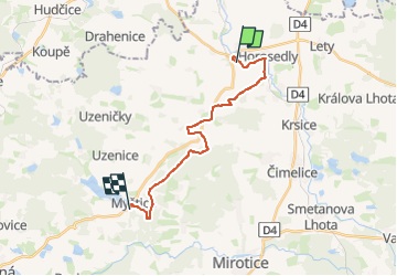
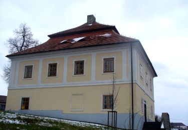
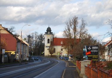
Randonnée A pied de 15,9 km à découvrir à Jihozápad, Jihočeský kraj, Mirovice. Cette randonnée est proposée par SityTrail - itinéraires balisés pédestres.
Randonnée créée par cz:KČT.
![Randonnée A pied Mirovice - [Č] Mirovice - Myštice - Photo 1](https://media.geolcdn.com/t/2048/auto/725b3bfe-130e-477b-8c48-2762d7b07422.jpeg&format=jpg&maxdim=0 "Randonnée A pied Mirovice - [Č] Mirovice - Myštice - Photo 1")
![Randonnée A pied Mirovice - [Č] Mirovice - Myštice - Photo 2](https://media.geolcdn.com/t/2048/auto/83a766ee-5cd6-46b3-b0e4-e117108630b8.jpeg&format=jpg&maxdim=0 "Randonnée A pied Mirovice - [Č] Mirovice - Myštice - Photo 2")
![Randonnée A pied Mirovice - [Č] Mirovice - Myštice - Photo 3](https://media.geolcdn.com/t/2048/auto/b6c50681-a948-4414-a26f-0a6d4504a118.jpeg&format=jpg&maxdim=0 "Randonnée A pied Mirovice - [Č] Mirovice - Myštice - Photo 3")
![Randonnée A pied Mirovice - [Č] Mirovice - Myštice - Photo 4](https://media.geolcdn.com/t/2048/auto/6d3913e4-be17-4ba4-a916-c2cbbfa4a6c7.jpeg&format=jpg&maxdim=0 "Randonnée A pied Mirovice - [Č] Mirovice - Myštice - Photo 4")
![Randonnée A pied Mirovice - [Č] Mirovice - Myštice - Photo 5](https://media.geolcdn.com/t/2048/auto/660e24ef-81d7-4fa3-9888-cd0cef394c22.jpeg&format=jpg&maxdim=0 "Randonnée A pied Mirovice - [Č] Mirovice - Myštice - Photo 5")
![Randonnée A pied Mirovice - [Č] Mirovice - Myštice - Photo 6](https://media.geolcdn.com/t/2048/auto/f1172093-3604-4ea6-9569-b6a08ace039c.jpeg&format=jpg&maxdim=0 "Randonnée A pied Mirovice - [Č] Mirovice - Myštice - Photo 6")
![Randonnée A pied Mirovice - [Č] Mirovice - Myštice - Photo 7](https://media.geolcdn.com/t/2048/auto/1222b514-cfdf-44d8-810a-0bff46efb00e.jpeg&format=jpg&maxdim=0 "Randonnée A pied Mirovice - [Č] Mirovice - Myštice - Photo 7")
![Randonnée A pied Mirovice - [Č] Mirovice - Myštice - Photo 8](https://media.geolcdn.com/t/2048/auto/ffa84a82-4350-4eda-9ca8-f8a5dcd6b576.jpeg&format=jpg&maxdim=0 "Randonnée A pied Mirovice - [Č] Mirovice - Myštice - Photo 8")
![Randonnée A pied Mirovice - [Č] Mirovice - Myštice - Photo 9](https://media.geolcdn.com/t/2048/auto/703fcbae-bb2e-4030-90c8-ab4dc3f81c96.jpeg&format=jpg&maxdim=0 "Randonnée A pied Mirovice - [Č] Mirovice - Myštice - Photo 9")
![Randonnée A pied Mirovice - [Č] Mirovice - Myštice - Photo 10](https://media.geolcdn.com/t/2048/auto/d3747ad6-e92e-467a-a3e2-927858ab059c.jpeg&format=jpg&maxdim=0 "Randonnée A pied Mirovice - [Č] Mirovice - Myštice - Photo 10")
A pied
![Randonnée A pied Rožmitál pod Třemšínem - [Z] Hutě pod Třemšínem - Břízkovec - Photo](https://media.geolcdn.com/t/375/260/995d403a-75fd-4dbb-a506-7766fe4a4a40.jpeg&format=jpg&maxdim=2)
A pied
A pied
![Randonnée A pied Sedlice - [Ž] Láz - Milavy - sedlická obora - Photo](https://media.geolcdn.com/t/375/260/6a91fed6-3737-44c3-9d07-3733ec90ba53.jpeg&format=jpg&maxdim=2)
A pied
A pied
A pied
A pied
![Randonnée A pied Kozárovice - [M] Podholušice - Radětice - Photo](https://media.geolcdn.com/t/375/260/06738f6d-ebdd-4b18-bb71-097ad4c3e145.jpeg&format=jpg&maxdim=2)
A pied
![Randonnée A pied Příbram - [Ž] Milín - Pod Vojnou - Photo](https://media.geolcdn.com/t/375/260/eb1c89b2-21a4-46c0-8042-a47d7af0f887.jpeg&format=jpg&maxdim=2)
A pied