![](/images/other/stat-length.png)
![Randonnée A pied Unknown - Slani dol - Noršić Selo - Photo](https://media.geolcdn.com/t/1900/400/360e921b-97d3-4b67-9f69-dac3c02b0938.jpeg&format=pjpeg&maxdim=2)
Slani dol - Noršić Selo
SityTrail - itinéraires balisés pédestres
Tous les sentiers balisés d’Europe GUIDE+
![Longueur](/images/other/stat-length.png)
![Altitude max](https://static1.geolcdn.com/siteimages/upload/files/1508320355ic_sort_altitude_max_24dp.png)
![Dénivelé positif](https://static1.geolcdn.com/siteimages/upload/files/1508320355ic_sort_den_pos_24dp.png)
![Km-Effort](/images/other/stat-length.png)
![Altitude min](https://static1.geolcdn.com/siteimages/upload/files/1508320355ic_sort_altitude_min_24dp.png)
![Dénivelé négatif](https://static1.geolcdn.com/siteimages/upload/files/1508320355ic_sort_den_neg_24dp.png)
![Boucle](https://static1.geolcdn.com/siteimages/upload/files/16400158638029165_repeat_loop_refresh_sync_direction_icon.png)
![A pied](https://static1.geolcdn.com/sitytour/trail-icons/100.png)
2h22
Difficulté : Facile
![Scannez ce code QR pour ouvrir la randonnée dans l'application SityTrail](https://capi.geolives.com/qq0zvz2zws4bq2lad0pu/sitytour/trails/4345323/qr.png?size=200)
Application GPS de randonnée GRATUITE
À propos
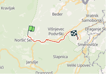
Randonnée A pied de 6,6 km à découvrir à Inconnu, Comitat de Zagreb. Cette randonnée est proposée par SityTrail - itinéraires balisés pédestres.
Description
Randonnée créée par HPD Japetić, Samobor.
Slani Dol (a.p.) - Breganica - odvojak do špilje Vilinske jame (2 min) -Tušini - (X) s 61 Grdanjci -Sitna draga - Križić - (X) Višnjevac - a.p. Noršić selo - (X) s 54za Japetić - Noršić Selo (Kapelišće) - (X) Beder
Localisation
Commentaires
Randonnées à proximité
![Randonnée A pied - Osredek - Beder - Photo](https://media.geolcdn.com/t/375/260/02f74ee7-f7a8-4cd6-a4f4-99b06a677f3c.jpeg&format=jpg&maxdim=2)
![A pied A pied](https://static1.geolcdn.com/sitytour/trail-icons/100.png)
A pied
![](/images/other/stat-length.png)
![](https://static1.geolcdn.com/siteimages/upload/files/16400158638029165_repeat_loop_refresh_sync_direction_icon.png)
![Randonnée A pied - Grdanjci - Noršić selo - Photo](https://media.geolcdn.com/t/375/260/360e921b-97d3-4b67-9f69-dac3c02b0938.jpeg&format=jpg&maxdim=2)
![A pied A pied](https://static1.geolcdn.com/sitytour/trail-icons/100.png)
A pied
![](/images/other/stat-length.png)
![](https://static1.geolcdn.com/siteimages/upload/files/16400158638029165_repeat_loop_refresh_sync_direction_icon.png)
![Randonnée A pied - Koretići - Poklek - Photo](https://media.geolcdn.com/t/375/260/d7fc09e4-b763-4816-8be1-38bb077973f8.jpeg&format=jpg&maxdim=2)
![A pied A pied](https://static1.geolcdn.com/sitytour/trail-icons/100.png)
A pied
![](/images/other/stat-length.png)
![](https://static1.geolcdn.com/siteimages/upload/files/16400158638029165_repeat_loop_refresh_sync_direction_icon.png)
![Randonnée A pied - Koretići - Kravljak - Photo](https://media.geolcdn.com/t/375/260/d7fc09e4-b763-4816-8be1-38bb077973f8.jpeg&format=jpg&maxdim=2)
![A pied A pied](https://static1.geolcdn.com/sitytour/trail-icons/100.png)
A pied
![](/images/other/stat-length.png)
![](https://static1.geolcdn.com/siteimages/upload/files/16400158638029165_repeat_loop_refresh_sync_direction_icon.png)
![Randonnée A pied - Gabrovica - Kravljak - Photo](https://media.geolcdn.com/t/375/260/052fddf2-4498-409b-a8ab-f02cb8a90db8.jpeg&format=jpg&maxdim=2)
![A pied A pied](https://static1.geolcdn.com/sitytour/trail-icons/100.png)
A pied
![](/images/other/stat-length.png)
![](https://static1.geolcdn.com/siteimages/upload/files/16400158638029165_repeat_loop_refresh_sync_direction_icon.png)
![Randonnée A pied - Noršić Selo - Katin krč - Photo](https://media.geolcdn.com/t/375/260/b167355c-57af-49c1-ae87-931613543d0f.jpeg&format=jpg&maxdim=2)
![A pied A pied](https://static1.geolcdn.com/sitytour/trail-icons/100.png)
A pied
![](/images/other/stat-length.png)
![](https://static1.geolcdn.com/siteimages/upload/files/16400158638029165_repeat_loop_refresh_sync_direction_icon.png)
![Randonnée A pied - Slani dol - Gostinjac Sv. Bernard - Photo](https://media.geolcdn.com/t/375/260/c97b8dc0-0e3a-4e26-bef6-8556ac70acf5.jpeg&format=jpg&maxdim=2)
![A pied A pied](https://static1.geolcdn.com/sitytour/trail-icons/100.png)
A pied
![](/images/other/stat-length.png)
![](https://static1.geolcdn.com/siteimages/upload/files/16400158638029165_repeat_loop_refresh_sync_direction_icon.png)
![Randonnée A pied - Grgosova špilja - Slani dol - Photo](https://media.geolcdn.com/t/375/260/e1d74823-4105-4a56-acd7-4a4d2d506da5.jpeg&format=jpg&maxdim=2)
![A pied A pied](https://static1.geolcdn.com/sitytour/trail-icons/100.png)
A pied
![](/images/other/stat-length.png)
![](https://static1.geolcdn.com/siteimages/upload/files/16400158638029165_repeat_loop_refresh_sync_direction_icon.png)
![Randonnée A pied - Koretići - Gornja Vas - Photo](https://media.geolcdn.com/t/375/260/ee1b2247-18e5-488b-8e88-33333aefa699.jpeg&format=jpg&maxdim=2)
![A pied A pied](https://static1.geolcdn.com/sitytour/trail-icons/100.png)
A pied
![](/images/other/stat-length.png)
![](https://static1.geolcdn.com/siteimages/upload/files/16400158638029165_repeat_loop_refresh_sync_direction_icon.png)