![](/images/other/stat-length.png)
![Randonnée A pied Hrádek nad Nisou - NS Pašerácká stezka - Photo](https://media.geolcdn.com/t/1900/400/33e0b3d7-a061-4075-ad06-68f770b3455c.jpeg&format=pjpeg&maxdim=2)
NS Pašerácká stezka
SityTrail - itinéraires balisés pédestres
Tous les sentiers balisés d’Europe GUIDE+
![Longueur](/images/other/stat-length.png)
Longueur
41 km
![Altitude max](https://static1.geolcdn.com/siteimages/upload/files/1508320355ic_sort_altitude_max_24dp.png)
Altitude max
586 m
![Dénivelé positif](https://static1.geolcdn.com/siteimages/upload/files/1508320355ic_sort_den_pos_24dp.png)
Dénivelé positif
651 m
![Km-Effort](/images/other/stat-length.png)
Km-Effort
49 km
![Altitude min](https://static1.geolcdn.com/siteimages/upload/files/1508320355ic_sort_altitude_min_24dp.png)
Altitude min
227 m
![Dénivelé négatif](https://static1.geolcdn.com/siteimages/upload/files/1508320355ic_sort_den_neg_24dp.png)
Dénivelé négatif
585 m
![Boucle](https://static1.geolcdn.com/siteimages/upload/files/16400158638029165_repeat_loop_refresh_sync_direction_icon.png)
Boucle
Non
Balise
Date de création :
2025-02-07 09:42:35.525
Dernière modification :
2025-02-07 09:42:35.525
![A pied](https://static1.geolcdn.com/sitytour/trail-icons/100.png)
11h09
Difficulté : Très difficile
![Scannez ce code QR pour ouvrir la randonnée dans l'application SityTrail](https://capi.geolives.com/qq0zvz2zws4bq2lad0pu/sitytour/trails/4345123/qr.png?size=200)
Application GPS de randonnée GRATUITE
À propos
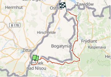
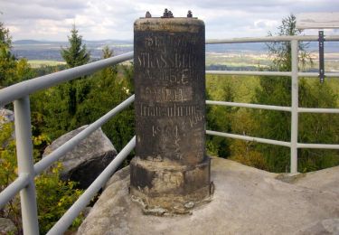
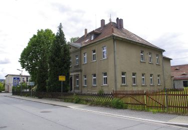
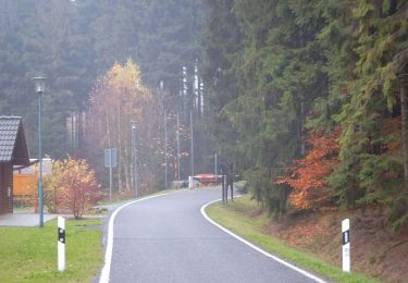
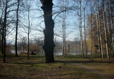
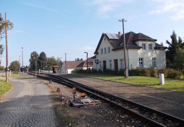
Randonnée A pied de 41 km à découvrir à Severovýchod, Liberecký kraj, Hrádek nad Nisou. Cette randonnée est proposée par SityTrail - itinéraires balisés pédestres.
Description
Randonnée créée par cz:KČT.
Localisation
Pays :
République Tchèque
Région :
Severovýchod
Département/Province :
Liberecký kraj
Commune :
Hrádek nad Nisou
Localité :
Unknown
Départ:(Dec)
Départ:(UTM)
487441 ; 5633712 (33U) N.
Commentaires
Randonnées à proximité
![Randonnée A pied Hrádek nad Nisou - NS Stezka stromů - Photo](https://media.geolcdn.com/t/375/260/06a5c462-d3f3-4f6f-8c94-d426dae5c68c.jpeg&format=jpg&maxdim=2)
![A pied A pied](https://static1.geolcdn.com/sitytour/trail-icons/100.png)
NS Stezka stromů
A pied
Moyen
Hrádek nad Nisou,
Severovýchod,
Liberecký kraj,
République Tchèque
![](/images/other/stat-length.png)
22 km | 25 km-effort
5h 37min
![](https://static1.geolcdn.com/siteimages/upload/files/16400158638029165_repeat_loop_refresh_sync_direction_icon.png)
Non
![Randonnée A pied Oybin - Hartau-Forsthaus Lückendorf - Photo](https://media.geolcdn.com/t/375/260/967585d3-12d0-4868-97ea-3911345dfbb9.jpeg&format=jpg&maxdim=2)
![A pied A pied](https://static1.geolcdn.com/sitytour/trail-icons/100.png)
Hartau-Forsthaus Lückendorf
A pied
Facile
Oybin,
Saxe,
Görlitz,
Allemagne
![](/images/other/stat-length.png)
7,3 km | 8,4 km-effort
1h 53min
![](https://static1.geolcdn.com/siteimages/upload/files/16400158638029165_repeat_loop_refresh_sync_direction_icon.png)
Non
![Randonnée A pied Hrádek nad Nisou - [M] Hrádek nad Nisou (okruh) - Photo](https://media.geolcdn.com/t/375/260/6f4bfcbc-88e0-401e-bed7-00090c8df757.jpeg&format=jpg&maxdim=2)
![A pied A pied](https://static1.geolcdn.com/sitytour/trail-icons/100.png)
[M] Hrádek nad Nisou (okruh)
A pied
Facile
Hrádek nad Nisou,
Severovýchod,
Liberecký kraj,
République Tchèque
![](/images/other/stat-length.png)
14,3 km | 19,4 km-effort
4h 24min
![](https://static1.geolcdn.com/siteimages/upload/files/16400158638029165_repeat_loop_refresh_sync_direction_icon.png)
Oui
![Randonnée A pied Oybin - LG-Gelber Punkt - Photo](https://media.geolcdn.com/t/375/260/e020b87b-e555-479a-b5b4-0b494c08279a.jpeg&format=jpg&maxdim=2)
![A pied A pied](https://static1.geolcdn.com/sitytour/trail-icons/100.png)
![Randonnée A pied Oybin - Rund um Lückendorf - Photo](https://media.geolcdn.com/t/375/260/8f72f9c2-6eb7-4a56-95d4-3425b9299246.jpeg&format=jpg&maxdim=2)
![A pied A pied](https://static1.geolcdn.com/sitytour/trail-icons/100.png)
Rund um Lückendorf
A pied
Difficile
Oybin,
Saxe,
Görlitz,
Allemagne
![](/images/other/stat-length.png)
26 km | 34 km-effort
7h 50min
![](https://static1.geolcdn.com/siteimages/upload/files/16400158638029165_repeat_loop_refresh_sync_direction_icon.png)
Non
![Randonnée A pied Oybin - LG-Lückendorf-Rundweg (Grüner Punkt) - Photo](https://media.geolcdn.com/t/375/260/fbb1edbe-9877-43c6-8573-565b71a30a55.jpeg&format=jpg&maxdim=2)
![A pied A pied](https://static1.geolcdn.com/sitytour/trail-icons/100.png)
LG-Lückendorf-Rundweg (Grüner Punkt)
A pied
Facile
Oybin,
Saxe,
Görlitz,
Allemagne
![](/images/other/stat-length.png)
8,4 km | 11,3 km-effort
2h 33min
![](https://static1.geolcdn.com/siteimages/upload/files/16400158638029165_repeat_loop_refresh_sync_direction_icon.png)
Oui
![Randonnée A pied Zittau - LG-Gelber Punkt - Photo](https://media.geolcdn.com/t/375/260/7e907ef6-dea7-42f1-ab70-3bbad4381fa5.jpeg&format=jpg&maxdim=2)
![A pied A pied](https://static1.geolcdn.com/sitytour/trail-icons/100.png)
LG-Gelber Punkt
A pied
Facile
Zittau,
Saxe,
Görlitz,
Allemagne
![](/images/other/stat-length.png)
10,5 km | 12,8 km-effort
2h 55min
![](https://static1.geolcdn.com/siteimages/upload/files/16400158638029165_repeat_loop_refresh_sync_direction_icon.png)
Non
![Randonnée A pied Olbersdorf - LG-Grüner Strich - Photo](https://media.geolcdn.com/t/375/260/c89cd6c2-9617-48bf-83f7-cf972c093b9a.jpeg&format=jpg&maxdim=2)
![A pied A pied](https://static1.geolcdn.com/sitytour/trail-icons/100.png)
LG-Grüner Strich
A pied
Facile
Olbersdorf,
Saxe,
Görlitz,
Allemagne
![](/images/other/stat-length.png)
3,8 km | 4,7 km-effort
1h 3min
![](https://static1.geolcdn.com/siteimages/upload/files/16400158638029165_repeat_loop_refresh_sync_direction_icon.png)
Non
![Randonnée A pied Olbersdorf - LG-Grüner Punkt - Photo](https://media.geolcdn.com/t/375/260/53b209a5-25ca-4a34-ae8e-5ab4fef2111e.jpeg&format=jpg&maxdim=2)
![A pied A pied](https://static1.geolcdn.com/sitytour/trail-icons/100.png)
LG-Grüner Punkt
A pied
Facile
Olbersdorf,
Saxe,
Görlitz,
Allemagne
![](/images/other/stat-length.png)
4,4 km | 4,8 km-effort
1h 5min
![](https://static1.geolcdn.com/siteimages/upload/files/16400158638029165_repeat_loop_refresh_sync_direction_icon.png)
Non