![](/images/other/stat-length.png)
![Randonnée A pied Chotilsko - NS Vymyšlenská pěšina - Photo](https://media.geolcdn.com/t/1900/400/ext.pjpeg?maxdim=2&url=https%3A%2F%2Fstatic1.geolcdn.com%2Fsiteimages%2Fupload%2Ffiles%2F1545311037marcheuse_200dpi.jpg)
NS Vymyšlenská pěšina
SityTrail - itinéraires balisés pédestres
Tous les sentiers balisés d’Europe GUIDE+
![Longueur](/images/other/stat-length.png)
Longueur
4,1 km
![Altitude max](https://static1.geolcdn.com/siteimages/upload/files/1508320355ic_sort_altitude_max_24dp.png)
Altitude max
462 m
![Dénivelé positif](https://static1.geolcdn.com/siteimages/upload/files/1508320355ic_sort_den_pos_24dp.png)
Dénivelé positif
16 m
![Km-Effort](/images/other/stat-length.png)
Km-Effort
4,9 km
![Altitude min](https://static1.geolcdn.com/siteimages/upload/files/1508320355ic_sort_altitude_min_24dp.png)
Altitude min
288 m
![Dénivelé négatif](https://static1.geolcdn.com/siteimages/upload/files/1508320355ic_sort_den_neg_24dp.png)
Dénivelé négatif
185 m
![Boucle](https://static1.geolcdn.com/siteimages/upload/files/16400158638029165_repeat_loop_refresh_sync_direction_icon.png)
Boucle
Non
Balise
Date de création :
2025-02-07 09:37:59.141
Dernière modification :
2025-02-07 09:37:59.141
![A pied](https://static1.geolcdn.com/sitytour/trail-icons/100.png)
1h06
Difficulté : Facile
![Scannez ce code QR pour ouvrir la randonnée dans l'application SityTrail](https://capi.geolives.com/qq0zvz2zws4bq2lad0pu/sitytour/trails/4345117/qr.png?size=200)
Application GPS de randonnée GRATUITE
À propos
Randonnée A pied de 4,1 km à découvrir à Střední Čechy, Inconnu, Chotilsko. Cette randonnée est proposée par SityTrail - itinéraires balisés pédestres.
Description
Randonnée créée par cz:KČT.
Localisation
Pays :
République Tchèque
Région :
Střední Čechy
Département/Province :
Inconnu
Commune :
Chotilsko
Localité :
Unknown
Départ:(Dec)
Départ:(UTM)
452862 ; 5510602 (33U) N.
Commentaires
Randonnées à proximité
![Randonnée A pied Radíč - CZ-6035 - Photo](https://media.geolcdn.com/t/375/260/a7e4ef27-b1b9-446e-871f-6a0a782428a3.jpeg&format=jpg&maxdim=2)
![A pied A pied](https://static1.geolcdn.com/sitytour/trail-icons/100.png)
CZ-6035
A pied
Facile
Radíč,
Střední Čechy,
Inconnu,
République Tchèque
![](/images/other/stat-length.png)
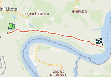
12,6 km | 16,3 km-effort
3h 42min
![](https://static1.geolcdn.com/siteimages/upload/files/16400158638029165_repeat_loop_refresh_sync_direction_icon.png)
Non
![Randonnée A pied Nalžovice - CZ-6035 - Photo](https://media.geolcdn.com/t/375/260/c20361bb-e243-426a-b85a-368efdf65b8b.jpeg&format=jpg&maxdim=2)
![A pied A pied](https://static1.geolcdn.com/sitytour/trail-icons/100.png)
CZ-6035
A pied
Facile
Nalžovice,
Střední Čechy,
Inconnu,
République Tchèque
![](/images/other/stat-length.png)
5,2 km | 7,5 km-effort
1h 42min
![](https://static1.geolcdn.com/siteimages/upload/files/16400158638029165_repeat_loop_refresh_sync_direction_icon.png)
Non
![Randonnée A pied Chotilsko - [Z] Nahoruby - Živohošťský most - Photo](https://media.geolcdn.com/t/375/260/fa260171-e240-419e-a8d3-5f7efb5b52f4.jpeg&format=jpg&maxdim=2)
![A pied A pied](https://static1.geolcdn.com/sitytour/trail-icons/100.png)
[Z] Nahoruby - Živohošťský most
A pied
Facile
Chotilsko,
Střední Čechy,
Inconnu,
République Tchèque
![](/images/other/stat-length.png)
7,1 km | 10,3 km-effort
2h 19min
![](https://static1.geolcdn.com/siteimages/upload/files/16400158638029165_repeat_loop_refresh_sync_direction_icon.png)
Non
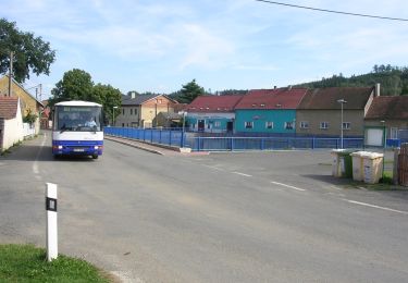
![Randonnée A pied Nový Knín - [Z] Stožec - Malá Hraštice - Photo](https://media.geolcdn.com/t/375/260/9257ad78-48c4-4122-a68f-6fad4853c234.jpeg&format=jpg&maxdim=2)
![A pied A pied](https://static1.geolcdn.com/sitytour/trail-icons/100.png)
[Z] Stožec - Malá Hraštice
A pied
Moyen
Nový Knín,
Střední Čechy,
Inconnu,
République Tchèque
![](/images/other/stat-length.png)
15,5 km | 20 km-effort
4h 36min
![](https://static1.geolcdn.com/siteimages/upload/files/16400158638029165_repeat_loop_refresh_sync_direction_icon.png)
Non
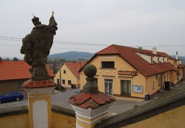
![Randonnée A pied Čím - [Z] Štěchovice-Čím - Photo](https://media.geolcdn.com/t/375/260/011f8775-be8f-443d-893b-fd9b18fb4d4b.jpeg&format=jpg&maxdim=2)
![A pied A pied](https://static1.geolcdn.com/sitytour/trail-icons/100.png)
[Z] Štěchovice-Čím
A pied
Facile
Čím,
Střední Čechy,
Inconnu,
République Tchèque
![](/images/other/stat-length.png)
13,3 km | 16,9 km-effort
3h 50min
![](https://static1.geolcdn.com/siteimages/upload/files/16400158638029165_repeat_loop_refresh_sync_direction_icon.png)
Non
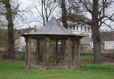
![Randonnée A pied Chotilsko - [Z] Záhoří-Nad Sejckou hájovnou - Photo](https://media.geolcdn.com/t/375/260/ext.jpg?maxdim=2&url=https%3A%2F%2Fstatic1.geolcdn.com%2Fsiteimages%2Fupload%2Ffiles%2F1545311037marcheuse_200dpi.jpg)
![A pied A pied](https://static1.geolcdn.com/sitytour/trail-icons/100.png)
[Z] Záhoří-Nad Sejckou hájovnou
A pied
Facile
Chotilsko,
Střední Čechy,
Inconnu,
République Tchèque
![](/images/other/stat-length.png)
10,8 km | 15,9 km-effort
3h 37min
![](https://static1.geolcdn.com/siteimages/upload/files/16400158638029165_repeat_loop_refresh_sync_direction_icon.png)
Non
![Randonnée A pied Chotilsko - [M] Dobříš - Pod Veselým vrchem - Photo](https://media.geolcdn.com/t/375/260/ext.jpg?maxdim=2&url=https%3A%2F%2Fstatic1.geolcdn.com%2Fsiteimages%2Fupload%2Ffiles%2F1545311037marcheuse_200dpi.jpg)
![A pied A pied](https://static1.geolcdn.com/sitytour/trail-icons/100.png)
[M] Dobříš - Pod Veselým vrchem
A pied
Facile
Chotilsko,
Střední Čechy,
Inconnu,
République Tchèque
![](/images/other/stat-length.png)
15,1 km | 18,3 km-effort
4h 9min
![](https://static1.geolcdn.com/siteimages/upload/files/16400158638029165_repeat_loop_refresh_sync_direction_icon.png)
Non
![Randonnée A pied Chotilsko - [Ž] Živohošť-Hříměždice - Photo](https://media.geolcdn.com/t/375/260/ext.jpg?maxdim=2&url=https%3A%2F%2Fstatic1.geolcdn.com%2Fsiteimages%2Fupload%2Ffiles%2F1545311037marcheuse_200dpi.jpg)
![A pied A pied](https://static1.geolcdn.com/sitytour/trail-icons/100.png)
[Ž] Živohošť-Hříměždice
A pied
Facile
Chotilsko,
Střední Čechy,
Inconnu,
République Tchèque
![](/images/other/stat-length.png)
11,8 km | 16,6 km-effort
3h 46min
![](https://static1.geolcdn.com/siteimages/upload/files/16400158638029165_repeat_loop_refresh_sync_direction_icon.png)
Non
![Randonnée A pied Radíč - Radíč - Křečovice - Photo](https://media.geolcdn.com/t/375/260/f0dafbfe-5aad-4577-be75-77d1f63b561c.jpeg&format=jpg&maxdim=2)
![A pied A pied](https://static1.geolcdn.com/sitytour/trail-icons/100.png)
Radíč - Křečovice
A pied
Facile
Radíč,
Střední Čechy,
Inconnu,
République Tchèque
![](/images/other/stat-length.png)
5,8 km | 7,3 km-effort
1h 40min
![](https://static1.geolcdn.com/siteimages/upload/files/16400158638029165_repeat_loop_refresh_sync_direction_icon.png)
Non