![](/images/other/stat-length.png)
![Randonnée A pied Žlutice - CZ-6716 - Photo](https://media.geolcdn.com/t/1900/400/c68eaa98-333f-47f8-8f76-5ea6902bcb6f.jpeg&format=pjpeg&maxdim=2)
CZ-6716
SityTrail - itinéraires balisés pédestres
Tous les sentiers balisés d’Europe GUIDE+
![Longueur](/images/other/stat-length.png)
Longueur
14,6 km
![Altitude max](https://static1.geolcdn.com/siteimages/upload/files/1508320355ic_sort_altitude_max_24dp.png)
Altitude max
602 m
![Dénivelé positif](https://static1.geolcdn.com/siteimages/upload/files/1508320355ic_sort_den_pos_24dp.png)
Dénivelé positif
330 m
![Km-Effort](/images/other/stat-length.png)
Km-Effort
18,7 km
![Altitude min](https://static1.geolcdn.com/siteimages/upload/files/1508320355ic_sort_altitude_min_24dp.png)
Altitude min
445 m
![Dénivelé négatif](https://static1.geolcdn.com/siteimages/upload/files/1508320355ic_sort_den_neg_24dp.png)
Dénivelé négatif
230 m
![Boucle](https://static1.geolcdn.com/siteimages/upload/files/16400158638029165_repeat_loop_refresh_sync_direction_icon.png)
Boucle
Non
Balise
Date de création :
2025-02-07 08:07:47.837
Dernière modification :
2025-02-07 08:07:47.837
![A pied](https://static1.geolcdn.com/sitytour/trail-icons/100.png)
4h14
Difficulté : Facile
![Scannez ce code QR pour ouvrir la randonnée dans l'application SityTrail](https://capi.geolives.com/qq0zvz2zws4bq2lad0pu/sitytour/trails/4344913/qr.png?size=200)
Application GPS de randonnée GRATUITE
À propos
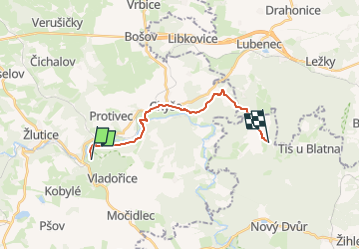
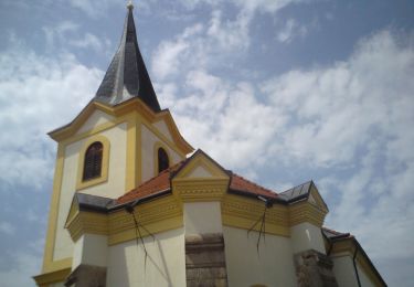
Randonnée A pied de 14,6 km à découvrir à Severozápad, Karlovarský kraj, Žlutice. Cette randonnée est proposée par SityTrail - itinéraires balisés pédestres.
Description
Randonnée créée par cz:KČT.
Localisation
Pays :
République Tchèque
Région :
Severozápad
Département/Province :
Karlovarský kraj
Commune :
Žlutice
Localité :
Unknown
Départ:(Dec)
Départ:(UTM)
371051 ; 5549194 (33U) N.
Commentaires
Randonnées à proximité
![Randonnée A pied Doupovské Hradiště - CZ-žlutá - Photo](https://media.geolcdn.com/t/375/260/70039ae6-2f4a-48f9-945d-435a193ef6f2.jpeg&format=jpg&maxdim=2)
![A pied A pied](https://static1.geolcdn.com/sitytour/trail-icons/100.png)
CZ-žlutá
A pied
Facile
Doupovské Hradiště,
Severozápad,
Karlovarský kraj,
République Tchèque
![](/images/other/stat-length.png)
5 km | 6,9 km-effort
1h 34min
![](https://static1.geolcdn.com/siteimages/upload/files/16400158638029165_repeat_loop_refresh_sync_direction_icon.png)
Non
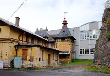
![Randonnée A pied Kryry - [M] Nepomyšl - Kryry - Photo](https://media.geolcdn.com/t/375/260/a2408f13-d402-4160-be99-95020e040a2f.jpeg&format=jpg&maxdim=2)
![A pied A pied](https://static1.geolcdn.com/sitytour/trail-icons/100.png)
[M] Nepomyšl - Kryry
A pied
Facile
Kryry,
Severozápad,
Ústecký kraj,
République Tchèque
![](/images/other/stat-length.png)
15,2 km | 19,4 km-effort
4h 24min
![](https://static1.geolcdn.com/siteimages/upload/files/16400158638029165_repeat_loop_refresh_sync_direction_icon.png)
Non
![Randonnée A pied Nečtiny - modrý místní okruh Manětín - Nečtiny - Manětín - Photo](https://media.geolcdn.com/t/375/260/667ed6a2-df7c-4fc6-b930-0a717d6e16da.jpeg&format=jpg&maxdim=2)
![A pied A pied](https://static1.geolcdn.com/sitytour/trail-icons/100.png)
modrý místní okruh Manětín - Nečtiny - Manětín
A pied
Moyen
Nečtiny,
Jihozápad,
Plzeňský kraj,
République Tchèque
![](/images/other/stat-length.png)
15,6 km | 20 km-effort
4h 37min
![](https://static1.geolcdn.com/siteimages/upload/files/16400158638029165_repeat_loop_refresh_sync_direction_icon.png)
Oui
![Randonnée A pied Manětín - červený místní okruh Manětín - Lipí - Libenov - Manětín - Photo](https://media.geolcdn.com/t/375/260/56c32eef-f931-4513-84e5-e734ba69430b.jpeg&format=jpg&maxdim=2)
![A pied A pied](https://static1.geolcdn.com/sitytour/trail-icons/100.png)
červený místní okruh Manětín - Lipí - Libenov - Manětín
A pied
Facile
Manětín,
Jihozápad,
Plzeňský kraj,
République Tchèque
![](/images/other/stat-length.png)
15,6 km | 19,7 km-effort
4h 28min
![](https://static1.geolcdn.com/siteimages/upload/files/16400158638029165_repeat_loop_refresh_sync_direction_icon.png)
Oui
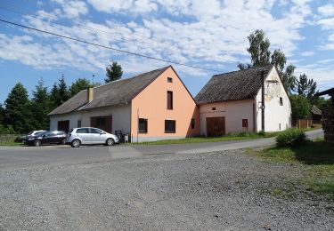
![Randonnée A pied Krásný Dvůr - [Č] 0378 Červený okruh - Photo](https://media.geolcdn.com/t/375/260/a2237453-12a7-4014-acf3-8544ee4986a4.jpeg&format=jpg&maxdim=2)
![A pied A pied](https://static1.geolcdn.com/sitytour/trail-icons/100.png)
[Č] 0378 Červený okruh
A pied
Facile
Krásný Dvůr,
Severozápad,
Ústecký kraj,
République Tchèque
![](/images/other/stat-length.png)
4,6 km | 5,8 km-effort
1h 18min
![](https://static1.geolcdn.com/siteimages/upload/files/16400158638029165_repeat_loop_refresh_sync_direction_icon.png)
Oui
![Randonnée A pied Vroutek - NS Stezka lesů ČR - Photo](https://media.geolcdn.com/t/375/260/4eae7e88-1dbb-4dab-bcf0-c5b4aff92986.jpeg&format=jpg&maxdim=2)
![A pied A pied](https://static1.geolcdn.com/sitytour/trail-icons/100.png)
NS Stezka lesů ČR
A pied
Facile
Vroutek,
Severozápad,
Ústecký kraj,
République Tchèque
![](/images/other/stat-length.png)
5,1 km | 6,2 km-effort
1h 25min
![](https://static1.geolcdn.com/siteimages/upload/files/16400158638029165_repeat_loop_refresh_sync_direction_icon.png)
Non
![Randonnée A pied Plasy - NS Ludvíka Očenáška - Photo](https://media.geolcdn.com/t/375/260/896bf5cf-f443-487e-be76-ba92d469daf4.jpeg&format=jpg&maxdim=2)
![A pied A pied](https://static1.geolcdn.com/sitytour/trail-icons/100.png)
NS Ludvíka Očenáška
A pied
Facile
Plasy,
Jihozápad,
Plzeňský kraj,
République Tchèque
![](/images/other/stat-length.png)
12,6 km | 16,6 km-effort
3h 46min
![](https://static1.geolcdn.com/siteimages/upload/files/16400158638029165_repeat_loop_refresh_sync_direction_icon.png)
Non
![Randonnée A pied Plasy - Okružní NS Plasy - Photo](https://media.geolcdn.com/t/375/260/ea17131c-7e62-4380-9b72-c66161169eb4.jpeg&format=jpg&maxdim=2)
![A pied A pied](https://static1.geolcdn.com/sitytour/trail-icons/100.png)
Okružní NS Plasy
A pied
Facile
Plasy,
Jihozápad,
Plzeňský kraj,
République Tchèque
![](/images/other/stat-length.png)
4,4 km | 4,9 km-effort
1h 6min
![](https://static1.geolcdn.com/siteimages/upload/files/16400158638029165_repeat_loop_refresh_sync_direction_icon.png)
Oui
![Randonnée A pied Bezdružice - CZ-3694 - Photo](https://media.geolcdn.com/t/375/260/204f6e9b-baf4-471a-af05-8ac601086f65.jpeg&format=jpg&maxdim=2)
![A pied A pied](https://static1.geolcdn.com/sitytour/trail-icons/100.png)
CZ-3694
A pied
Facile
Bezdružice,
Jihozápad,
Plzeňský kraj,
République Tchèque
![](/images/other/stat-length.png)
3,4 km | 3,9 km-effort
52min
![](https://static1.geolcdn.com/siteimages/upload/files/16400158638029165_repeat_loop_refresh_sync_direction_icon.png)
Non