


13,5 km | 16,3 km-effort
![Randonnée A pied Varvažov - [Ž] Varvažov - U mostu - Photo](https://media.geolcdn.com/t/1900/400/a4e04a71-baf8-4e14-ba58-e9217997d189.jpeg&format=pjpeg&maxdim=2)

Tous les sentiers balisés d’Europe GUIDE+


Application GPS de randonnée GRATUITE
 SityTrail
IGN / Instituts géographiques
SityTrail World
Le monde est à vous
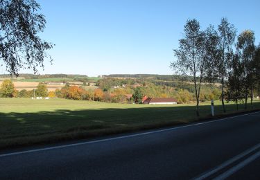
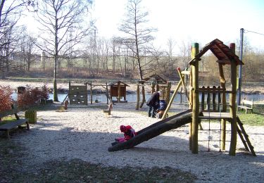
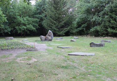
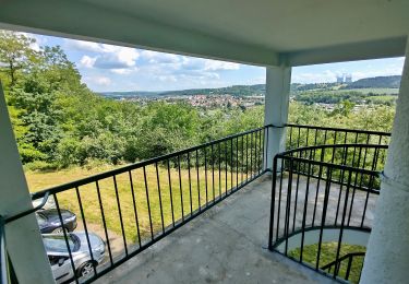
Randonnée A pied de 6,6 km à découvrir à Jihozápad, Jihočeský kraj, Varvažov. Cette randonnée est proposée par SityTrail - itinéraires balisés pédestres.
Randonnée créée par cz:KČT.
![Randonnée A pied Varvažov - [Ž] Varvažov - U mostu - Photo 1](https://media.geolcdn.com/t/2048/auto/f9689c9f-271d-439d-9a99-371926e00d86.jpeg&format=jpg&maxdim=0 "Randonnée A pied Varvažov - [Ž] Varvažov - U mostu - Photo 1")
![Randonnée A pied Varvažov - [Ž] Varvažov - U mostu - Photo 2](https://media.geolcdn.com/t/2048/auto/b67b6113-109a-43dd-861a-59e122f97f81.jpeg&format=jpg&maxdim=0 "Randonnée A pied Varvažov - [Ž] Varvažov - U mostu - Photo 2")
![Randonnée A pied Varvažov - [Ž] Varvažov - U mostu - Photo 3](https://media.geolcdn.com/t/2048/auto/754ad0be-c567-483b-890a-c8629e5dd0ec.jpeg&format=jpg&maxdim=0 "Randonnée A pied Varvažov - [Ž] Varvažov - U mostu - Photo 3")
![Randonnée A pied Varvažov - [Ž] Varvažov - U mostu - Photo 4](https://media.geolcdn.com/t/2048/auto/b1fb81c7-9271-460b-afcc-4af4b3f52620.jpeg&format=jpg&maxdim=0 "Randonnée A pied Varvažov - [Ž] Varvažov - U mostu - Photo 4")
![Randonnée A pied Varvažov - [Ž] Varvažov - U mostu - Photo 5](https://media.geolcdn.com/t/2048/auto/0cc89d59-7a6f-4e21-b3c8-4b84d713bb56.jpeg&format=jpg&maxdim=0 "Randonnée A pied Varvažov - [Ž] Varvažov - U mostu - Photo 5")
![Randonnée A pied Varvažov - [Ž] Varvažov - U mostu - Photo 6](https://media.geolcdn.com/t/2048/auto/00c72af1-9755-4376-af96-5b502c748233.jpeg&format=jpg&maxdim=0 "Randonnée A pied Varvažov - [Ž] Varvažov - U mostu - Photo 6")
![Randonnée A pied Varvažov - [Ž] Varvažov - U mostu - Photo 7](https://media.geolcdn.com/t/2048/auto/9816bd4f-719a-4854-b1be-a25402eb2d39.jpeg&format=jpg&maxdim=0 "Randonnée A pied Varvažov - [Ž] Varvažov - U mostu - Photo 7")
![Randonnée A pied Varvažov - [Ž] Varvažov - U mostu - Photo 8](https://media.geolcdn.com/t/2048/auto/74938d77-255f-4d58-a56a-6729691d3f95.jpeg&format=jpg&maxdim=0 "Randonnée A pied Varvažov - [Ž] Varvažov - U mostu - Photo 8")
![Randonnée A pied Varvažov - [Ž] Varvažov - U mostu - Photo 9](https://media.geolcdn.com/t/2048/auto/0ca5bc58-8c3d-47f3-b5df-0fa1250e06f4.jpeg&format=jpg&maxdim=0 "Randonnée A pied Varvažov - [Ž] Varvažov - U mostu - Photo 9")
![Randonnée A pied Varvažov - [Ž] Varvažov - U mostu - Photo 10](https://media.geolcdn.com/t/2048/auto/a4e04a71-baf8-4e14-ba58-e9217997d189.jpeg&format=jpg&maxdim=0 "Randonnée A pied Varvažov - [Ž] Varvažov - U mostu - Photo 10")
A pied
![Randonnée A pied Písek - [Č] Písek - Velká Brašna - Photo](https://media.geolcdn.com/t/375/260/bfca88cd-0504-44c2-9a66-8e406f087387.jpeg&format=jpg&maxdim=2)
A pied
![Randonnée A pied Milevsko - [Č] Milevsko - Jetětice - Photo](https://media.geolcdn.com/t/375/260/19b73443-10f3-4ee2-b906-2593e9794aea.jpeg&format=jpg&maxdim=2)
A pied
A pied
![Randonnée A pied Milevsko - [Ž] Budák rybník - Karlov - Photo](https://media.geolcdn.com/t/375/260/6a7dbc34-5b93-44a1-bcc9-52d789012a05.jpeg&format=jpg&maxdim=2)
A pied
A pied
![Randonnée A pied Sedlice - [Ž] Láz - Milavy - sedlická obora - Photo](https://media.geolcdn.com/t/375/260/6a91fed6-3737-44c3-9d07-3733ec90ba53.jpeg&format=jpg&maxdim=2)
A pied
A pied
A pied