


3,7 km | 5,6 km-effort
![Randonnée A pied Bílina - [Z] 3909 Okruh kolem Bořně - Photo](https://media.geolcdn.com/t/1900/400/bc873dc2-cb34-45f8-a12b-172dfcfe3b34.jpeg&format=pjpeg&maxdim=2)

Tous les sentiers balisés d’Europe GUIDE+


Application GPS de randonnée GRATUITE
 SityTrail
IGN / Instituts géographiques
SityTrail World
Le monde est à vous
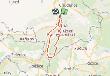
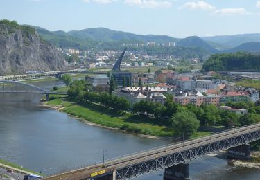
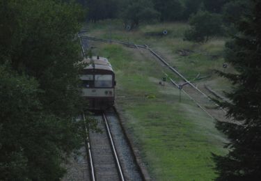
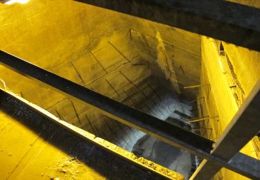
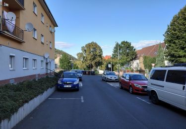
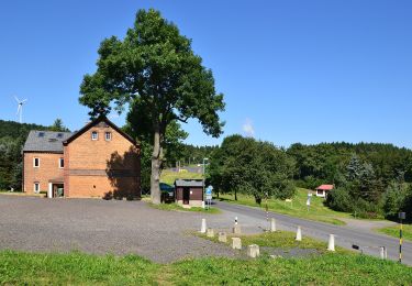
Randonnée A pied de 8,9 km à découvrir à Severozápad, Ústecký kraj, Bílina. Cette randonnée est proposée par SityTrail - itinéraires balisés pédestres.
Randonnée créée par cz:KČT.
![Randonnée A pied Bílina - [Z] 3909 Okruh kolem Bořně - Photo 1](https://media.geolcdn.com/t/2048/auto/61afe0b1-38f3-4b54-a615-6a6d15bd32dd.jpeg&format=jpg&maxdim=0 "Randonnée A pied Bílina - [Z] 3909 Okruh kolem Bořně - Photo 1")
![Randonnée A pied Bílina - [Z] 3909 Okruh kolem Bořně - Photo 2](https://media.geolcdn.com/t/2048/auto/66748aa2-eddf-420d-9484-8afa4f0a5726.jpeg&format=jpg&maxdim=0 "Randonnée A pied Bílina - [Z] 3909 Okruh kolem Bořně - Photo 2")
![Randonnée A pied Bílina - [Z] 3909 Okruh kolem Bořně - Photo 3](https://media.geolcdn.com/t/2048/auto/25da3488-a898-4129-81cd-df4df74ed077.jpeg&format=jpg&maxdim=0 "Randonnée A pied Bílina - [Z] 3909 Okruh kolem Bořně - Photo 3")
![Randonnée A pied Bílina - [Z] 3909 Okruh kolem Bořně - Photo 4](https://media.geolcdn.com/t/2048/auto/96d6e3b0-e661-4d98-b894-7bd8d9f33411.jpeg&format=jpg&maxdim=0 "Randonnée A pied Bílina - [Z] 3909 Okruh kolem Bořně - Photo 4")
![Randonnée A pied Bílina - [Z] 3909 Okruh kolem Bořně - Photo 5](https://media.geolcdn.com/t/2048/auto/a50f6b1e-c34c-4fed-a39e-a61787fd11ec.jpeg&format=jpg&maxdim=0 "Randonnée A pied Bílina - [Z] 3909 Okruh kolem Bořně - Photo 5")
![Randonnée A pied Bílina - [Z] 3909 Okruh kolem Bořně - Photo 6](https://media.geolcdn.com/t/2048/auto/92ddc48e-1eaa-46d2-b149-dad1ec068d92.jpeg&format=jpg&maxdim=0 "Randonnée A pied Bílina - [Z] 3909 Okruh kolem Bořně - Photo 6")
![Randonnée A pied Bílina - [Z] 3909 Okruh kolem Bořně - Photo 7](https://media.geolcdn.com/t/2048/auto/7d281da6-745c-44ef-a02b-2f35f235674b.jpeg&format=jpg&maxdim=0 "Randonnée A pied Bílina - [Z] 3909 Okruh kolem Bořně - Photo 7")
![Randonnée A pied Bílina - [Z] 3909 Okruh kolem Bořně - Photo 8](https://media.geolcdn.com/t/2048/auto/84157d1c-6c58-46ba-bf3f-cdd8e6af9ce6.jpeg&format=jpg&maxdim=0 "Randonnée A pied Bílina - [Z] 3909 Okruh kolem Bořně - Photo 8")
![Randonnée A pied Bílina - [Z] 3909 Okruh kolem Bořně - Photo 9](https://media.geolcdn.com/t/2048/auto/2d1a4396-7c8d-4570-af32-a22a6a2ab92d.jpeg&format=jpg&maxdim=0 "Randonnée A pied Bílina - [Z] 3909 Okruh kolem Bořně - Photo 9")
![Randonnée A pied Bílina - [Z] 3909 Okruh kolem Bořně - Photo 10](https://media.geolcdn.com/t/2048/auto/bc873dc2-cb34-45f8-a12b-172dfcfe3b34.jpeg&format=jpg&maxdim=0 "Randonnée A pied Bílina - [Z] 3909 Okruh kolem Bořně - Photo 10")
A pied
A pied
![Randonnée A pied Evaň - [Z] Poplze - Horka - Photo](https://media.geolcdn.com/t/375/260/58b6020a-01a4-4926-b083-ab4b33d6a3be.jpeg&format=jpg&maxdim=2)
A pied
A pied
![Randonnée A pied Most - [M] Po stopách magistra Edwarda Kelleyho - Photo](https://media.geolcdn.com/t/375/260/5df09c52-675f-49ac-827d-5202529fcf32.jpeg&format=jpg&maxdim=2)
A pied
A pied
![Randonnée A pied Litvínov - [Ž] 6949 Hamr - Nad hrází Mostecké přehrady - Photo](https://media.geolcdn.com/t/375/260/066fef76-c2e2-4e7c-95b7-4d56047c103c.jpeg&format=jpg&maxdim=2)
A pied
A pied
![Randonnée A pied Ústí nad Labem - [M] Modrý vycházkový okruh - Střížovický vrch - Photo](https://media.geolcdn.com/t/375/260/009e9caa-28f6-4b1e-9328-d158e5ef6640.jpeg&format=jpg&maxdim=2)
A pied