![](/images/other/stat-length.png)
![Randonnée A pied Studená - [Ž] Studená - za Vrškem - Photo](https://media.geolcdn.com/t/1900/400/dbf7c158-72a2-4a80-bde9-4b16abef1677.jpeg&format=pjpeg&maxdim=2)
[Ž] Studená - za Vrškem
SityTrail - itinéraires balisés pédestres
Tous les sentiers balisés d’Europe GUIDE+
![Longueur](/images/other/stat-length.png)
Longueur
4 km
![Altitude max](https://static1.geolcdn.com/siteimages/upload/files/1508320355ic_sort_altitude_max_24dp.png)
Altitude max
744 m
![Dénivelé positif](https://static1.geolcdn.com/siteimages/upload/files/1508320355ic_sort_den_pos_24dp.png)
Dénivelé positif
133 m
![Km-Effort](/images/other/stat-length.png)
Km-Effort
5,5 km
![Altitude min](https://static1.geolcdn.com/siteimages/upload/files/1508320355ic_sort_altitude_min_24dp.png)
Altitude min
619 m
![Dénivelé négatif](https://static1.geolcdn.com/siteimages/upload/files/1508320355ic_sort_den_neg_24dp.png)
Dénivelé négatif
34 m
![Boucle](https://static1.geolcdn.com/siteimages/upload/files/16400158638029165_repeat_loop_refresh_sync_direction_icon.png)
Boucle
Non
Balise
Date de création :
2025-02-07 02:32:17.126
Dernière modification :
2025-02-07 02:32:17.126
![A pied](https://static1.geolcdn.com/sitytour/trail-icons/100.png)
1h14
Difficulté : Facile
![Scannez ce code QR pour ouvrir la randonnée dans l'application SityTrail](https://capi.geolives.com/qq0zvz2zws4bq2lad0pu/sitytour/trails/4344467/qr.png?size=200)
Application GPS de randonnée GRATUITE
À propos
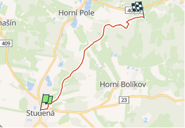
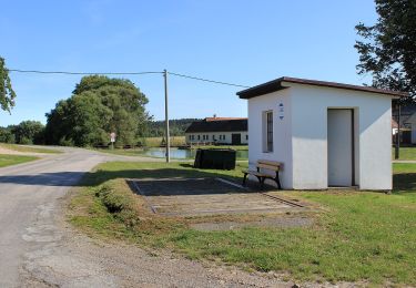
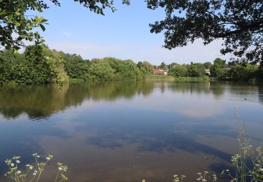
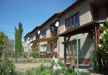
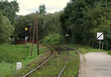
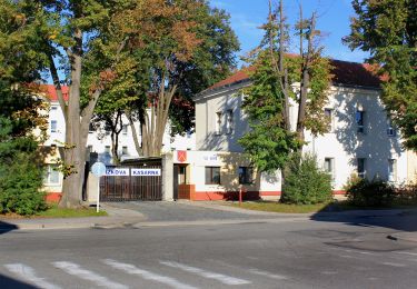
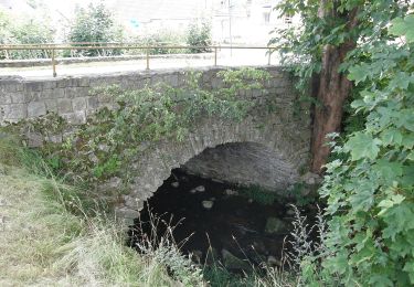
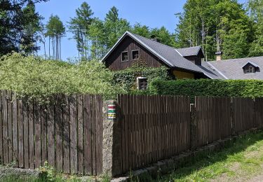
Randonnée A pied de 4 km à découvrir à Jihozápad, Jihočeský kraj, Studená. Cette randonnée est proposée par SityTrail - itinéraires balisés pédestres.
Description
Randonnée créée par cz:KČT.
Localisation
Pays :
République Tchèque
Région :
Jihozápad
Département/Province :
Jihočeský kraj
Commune :
Studená
Localité :
Unknown
Départ:(Dec)
Départ:(UTM)
520901 ; 5448086 (33U) N.
Commentaires
Randonnées à proximité
![Randonnée A pied Kostelní Myslová - Naučná stezka F. M. Nágla - Photo](https://media.geolcdn.com/t/375/260/d952882b-c3b0-45c4-96b7-77250ac36d82.jpeg&format=jpg&maxdim=2)
![A pied A pied](https://static1.geolcdn.com/sitytour/trail-icons/100.png)
Naučná stezka F. M. Nágla
A pied
Facile
Kostelní Myslová,
Jihovýchod,
Kraj Vysočina,
République Tchèque
![](/images/other/stat-length.png)
3,5 km | 4,4 km-effort
1h 0min
![](https://static1.geolcdn.com/siteimages/upload/files/16400158638029165_repeat_loop_refresh_sync_direction_icon.png)
Oui
![Randonnée A pied Telč - NS Otokara Březiny - Photo](https://media.geolcdn.com/t/375/260/703d2f25-c711-47da-b690-62cdf36f0fa8.jpeg&format=jpg&maxdim=2)
![A pied A pied](https://static1.geolcdn.com/sitytour/trail-icons/100.png)
NS Otokara Březiny
A pied
Moyen
Telč,
Jihovýchod,
Kraj Vysočina,
République Tchèque
![](/images/other/stat-length.png)
19,3 km | 25 km-effort
5h 37min
![](https://static1.geolcdn.com/siteimages/upload/files/16400158638029165_repeat_loop_refresh_sync_direction_icon.png)
Non
![Randonnée A pied Heřmaneč - NS valdenské a české reformace - Photo](https://media.geolcdn.com/t/375/260/d5a47e21-ef93-4ba2-bf5b-460931567f89.jpeg&format=jpg&maxdim=2)
![A pied A pied](https://static1.geolcdn.com/sitytour/trail-icons/100.png)
NS valdenské a české reformace
A pied
Facile
Heřmaneč,
Jihozápad,
Jihočeský kraj,
République Tchèque
![](/images/other/stat-length.png)
12,2 km | 16 km-effort
3h 37min
![](https://static1.geolcdn.com/siteimages/upload/files/16400158638029165_repeat_loop_refresh_sync_direction_icon.png)
Non
![Randonnée A pied Dačice - NS Okolím Dačic - Photo](https://media.geolcdn.com/t/375/260/fb6dc71b-485f-4ce9-b157-33d6c208fd05.jpeg&format=jpg&maxdim=2)
![A pied A pied](https://static1.geolcdn.com/sitytour/trail-icons/100.png)
NS Okolím Dačic
A pied
Facile
Dačice,
Jihozápad,
Jihočeský kraj,
République Tchèque
![](/images/other/stat-length.png)
10,4 km | 12,5 km-effort
2h 50min
![](https://static1.geolcdn.com/siteimages/upload/files/16400158638029165_repeat_loop_refresh_sync_direction_icon.png)
Oui
![Randonnée A pied Blažejov - Jindrova NS - Photo](https://media.geolcdn.com/t/375/260/69cc2369-2488-42b0-ab37-2bdeeb7298f5.jpeg&format=jpg&maxdim=2)
![A pied A pied](https://static1.geolcdn.com/sitytour/trail-icons/100.png)
Jindrova NS
A pied
Facile
Blažejov,
Jihozápad,
Jihočeský kraj,
République Tchèque
![](/images/other/stat-length.png)
12,4 km | 15 km-effort
3h 24min
![](https://static1.geolcdn.com/siteimages/upload/files/16400158638029165_repeat_loop_refresh_sync_direction_icon.png)
Non
![Randonnée A pied Český Rudolec - Graselova stezka (G) - Český Rudolec - Photo](https://media.geolcdn.com/t/375/260/3f39a127-cc74-4865-934d-74f13b55844d.jpeg&format=jpg&maxdim=2)
![A pied A pied](https://static1.geolcdn.com/sitytour/trail-icons/100.png)
Graselova stezka (G) - Český Rudolec
A pied
Facile
Český Rudolec,
Jihozápad,
Jihočeský kraj,
République Tchèque
![](/images/other/stat-length.png)
10,1 km | 13 km-effort
2h 56min
![](https://static1.geolcdn.com/siteimages/upload/files/16400158638029165_repeat_loop_refresh_sync_direction_icon.png)
Oui
![Randonnée A pied Dačice - [Ž] Velký Pěčín - Nad Strouhou - Photo](https://media.geolcdn.com/t/375/260/6f24d6cf-46a7-4080-beb9-e9ebcbdd2919.jpeg&format=jpg&maxdim=2)
![A pied A pied](https://static1.geolcdn.com/sitytour/trail-icons/100.png)
[Ž] Velký Pěčín - Nad Strouhou
A pied
Facile
Dačice,
Jihozápad,
Jihočeský kraj,
République Tchèque
![](/images/other/stat-length.png)
8,3 km | 10,9 km-effort
2h 28min
![](https://static1.geolcdn.com/siteimages/upload/files/16400158638029165_repeat_loop_refresh_sync_direction_icon.png)
Non
![Randonnée A pied Dolní Cerekev - Naučná stezka Čeřínek - Photo](https://media.geolcdn.com/t/375/260/2e65a863-f40a-4380-8034-537cfc0ccd11.jpeg&format=jpg&maxdim=2)
![A pied A pied](https://static1.geolcdn.com/sitytour/trail-icons/100.png)
Naučná stezka Čeřínek
A pied
Facile
Dolní Cerekev,
Jihovýchod,
Kraj Vysočina,
République Tchèque
![](/images/other/stat-length.png)
6,1 km | 8,7 km-effort
1h 58min
![](https://static1.geolcdn.com/siteimages/upload/files/16400158638029165_repeat_loop_refresh_sync_direction_icon.png)
Oui
![Randonnée A pied Třešť - Naučná stezka Špičák - Photo](https://media.geolcdn.com/t/375/260/1776db07-bb82-416b-924a-edd1e2a86df9.jpeg&format=jpg&maxdim=2)
![A pied A pied](https://static1.geolcdn.com/sitytour/trail-icons/100.png)
Naučná stezka Špičák
A pied
Facile
Třešť,
Jihovýchod,
Kraj Vysočina,
République Tchèque
![](/images/other/stat-length.png)
10,8 km | 14,9 km-effort
3h 22min
![](https://static1.geolcdn.com/siteimages/upload/files/16400158638029165_repeat_loop_refresh_sync_direction_icon.png)
Non