


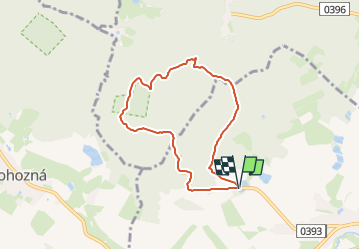

4,7 km | 6 km-effort

Tous les sentiers balisés d’Europe GUIDE+


Application GPS de randonnée GRATUITE
 SityTrail
IGN / Instituts géographiques
SityTrail World
Le monde est à vous
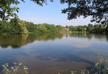
Randonnée A pied de 6,1 km à découvrir à Jihovýchod, Kraj Vysočina, Dolní Cerekev. Cette randonnée est proposée par SityTrail - itinéraires balisés pédestres.
Randonnée créée par cz:KČT.


A pied
A pied
A pied
![Randonnée A pied Pelhřimov - [Č] Pelhřimov - Nový Rychnov - Photo](https://media.geolcdn.com/t/375/260/3b527b44-da93-45e2-822d-496afe7c79e4.jpeg&format=jpg&maxdim=2)
A pied
![Randonnée A pied Humpolec - [Ž] Humpolec - Kletečná - Photo](https://media.geolcdn.com/t/375/260/61c79774-ac44-4316-bc7b-59e2527b1d21.jpeg&format=jpg&maxdim=2)
A pied
![Randonnée A pied Studená - [Ž] Studená - za Vrškem - Photo](https://media.geolcdn.com/t/375/260/dbf7c158-72a2-4a80-bde9-4b16abef1677.jpeg&format=jpg&maxdim=2)
A pied
A pied
![Randonnée A pied Nový Rychnov - [Z] Křemešnický okruh - Photo](https://media.geolcdn.com/t/375/260/f11d492b-ddb0-4c5d-b682-83aa126fd453.jpeg&format=jpg&maxdim=2)
A pied
![Randonnée A pied Červená Řečice - [Ž] Červená Řečice - Na vyhlídce - Photo](https://media.geolcdn.com/t/375/260/d705b93f-8824-4978-8f66-916e162f23b1.jpeg&format=jpg&maxdim=2)
A pied