![](/images/other/stat-length.png)
![Randonnée A pied Kunžak - žlutá Kunžak Lomy - Pod Vysokým kamenem - Photo](https://media.geolcdn.com/t/1900/400/8d6deced-a5ac-4da4-b4ec-a4d55816f973.jpeg&format=pjpeg&maxdim=2)
žlutá Kunžak Lomy - Pod Vysokým kamenem
SityTrail - itinéraires balisés pédestres
Tous les sentiers balisés d’Europe GUIDE+
![Longueur](/images/other/stat-length.png)
Longueur
3,9 km
![Altitude max](https://static1.geolcdn.com/siteimages/upload/files/1508320355ic_sort_altitude_max_24dp.png)
Altitude max
732 m
![Dénivelé positif](https://static1.geolcdn.com/siteimages/upload/files/1508320355ic_sort_den_pos_24dp.png)
Dénivelé positif
33 m
![Km-Effort](/images/other/stat-length.png)
Km-Effort
4,7 km
![Altitude min](https://static1.geolcdn.com/siteimages/upload/files/1508320355ic_sort_altitude_min_24dp.png)
Altitude min
591 m
![Dénivelé négatif](https://static1.geolcdn.com/siteimages/upload/files/1508320355ic_sort_den_neg_24dp.png)
Dénivelé négatif
147 m
![Boucle](https://static1.geolcdn.com/siteimages/upload/files/16400158638029165_repeat_loop_refresh_sync_direction_icon.png)
Boucle
Non
Balise
Date de création :
2025-02-07 00:57:31.252
Dernière modification :
2025-02-07 00:57:31.252
![A pied](https://static1.geolcdn.com/sitytour/trail-icons/100.png)
1h04
Difficulté : Facile
![Scannez ce code QR pour ouvrir la randonnée dans l'application SityTrail](https://capi.geolives.com/qq0zvz2zws4bq2lad0pu/sitytour/trails/4344357/qr.png?size=200)
Application GPS de randonnée GRATUITE
À propos
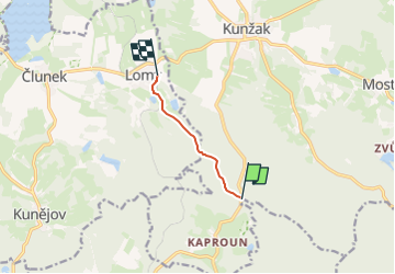
Randonnée A pied de 3,9 km à découvrir à Jihozápad, Jihočeský kraj, Kunžak. Cette randonnée est proposée par SityTrail - itinéraires balisés pédestres.
Description
Randonnée créée par cz:KČT.
Localisation
Pays :
République Tchèque
Région :
Jihozápad
Département/Province :
Jihočeský kraj
Commune :
Kunžak
Localité :
Unknown
Départ:(Dec)
Départ:(UTM)
513817 ; 5437094 (33U) N.
Commentaires
Randonnées à proximité
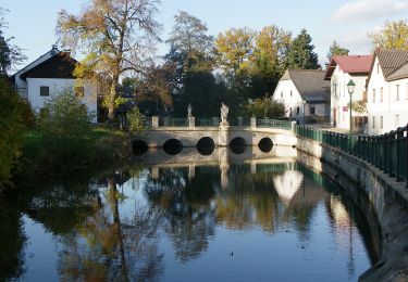
![Randonnée A pied Chlum u Třeboně - [M] Chlum u Třeboně - Majdalena - Photo](https://media.geolcdn.com/t/375/260/c5b3127b-51b9-444c-873e-2820e6bdc5ba.jpeg&format=jpg&maxdim=2)
![A pied A pied](https://static1.geolcdn.com/sitytour/trail-icons/100.png)
[M] Chlum u Třeboně - Majdalena
A pied
Facile
Chlum u Třeboně,
Jihozápad,
Jihočeský kraj,
République Tchèque
![](/images/other/stat-length.png)
7 km | 7,8 km-effort
1h 46min
![](https://static1.geolcdn.com/siteimages/upload/files/16400158638029165_repeat_loop_refresh_sync_direction_icon.png)
Non
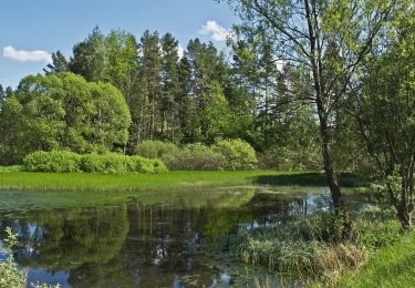
![Randonnée A pied Studená - [Ž] Studená - za Vrškem - Photo](https://media.geolcdn.com/t/375/260/dbf7c158-72a2-4a80-bde9-4b16abef1677.jpeg&format=jpg&maxdim=2)
![A pied A pied](https://static1.geolcdn.com/sitytour/trail-icons/100.png)
[Ž] Studená - za Vrškem
A pied
Facile
Studená,
Jihozápad,
Jihočeský kraj,
République Tchèque
![](/images/other/stat-length.png)
4 km | 5,5 km-effort
1h 14min
![](https://static1.geolcdn.com/siteimages/upload/files/16400158638029165_repeat_loop_refresh_sync_direction_icon.png)
Non
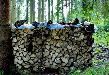
![Randonnée A pied Slavonice - [Z] U Pfaffenshlagu - U Velkého rákosního rybníku - Photo](https://media.geolcdn.com/t/375/260/211566f5-2838-442e-b8a8-1eb4141d961e.jpeg&format=jpg&maxdim=2)
![A pied A pied](https://static1.geolcdn.com/sitytour/trail-icons/100.png)
[Z] U Pfaffenshlagu - U Velkého rákosního rybníku
A pied
Facile
Slavonice,
Jihozápad,
Jihočeský kraj,
République Tchèque
![](/images/other/stat-length.png)
3,1 km | 3,9 km-effort
52min
![](https://static1.geolcdn.com/siteimages/upload/files/16400158638029165_repeat_loop_refresh_sync_direction_icon.png)
Non
![Randonnée A pied Staré Město pod Landštejnem - [Z] Landštejnský okruh - Photo](https://media.geolcdn.com/t/375/260/4832e62c-1f0a-401b-b2b7-a5b710e2b929.jpeg&format=jpg&maxdim=2)
![A pied A pied](https://static1.geolcdn.com/sitytour/trail-icons/100.png)
[Z] Landštejnský okruh
A pied
Facile
Staré Město pod Landštejnem,
Jihozápad,
Jihočeský kraj,
République Tchèque
![](/images/other/stat-length.png)
8,2 km | 10,6 km-effort
2h 24min
![](https://static1.geolcdn.com/siteimages/upload/files/16400158638029165_repeat_loop_refresh_sync_direction_icon.png)
Oui
![Randonnée A pied Telč - NS Lipky - Photo](https://media.geolcdn.com/t/375/260/7646877c-c2ff-4596-a127-af05a71670a7.jpeg&format=jpg&maxdim=2)
![A pied A pied](https://static1.geolcdn.com/sitytour/trail-icons/100.png)
NS Lipky
A pied
Facile
Telč,
Jihovýchod,
Kraj Vysočina,
République Tchèque
![](/images/other/stat-length.png)
6 km | 7,5 km-effort
1h 42min
![](https://static1.geolcdn.com/siteimages/upload/files/16400158638029165_repeat_loop_refresh_sync_direction_icon.png)
Oui
![Randonnée A pied Gemeinde Litschau - AT-14 - Photo](https://media.geolcdn.com/t/375/260/453bebf0-ff82-458d-9783-be054adef187.jpeg&format=jpg&maxdim=2)
![A pied A pied](https://static1.geolcdn.com/sitytour/trail-icons/100.png)
AT-14
A pied
Facile
Gemeinde Litschau,
Basse-Autriche,
Bezirk Gmünd,
Autriche
![](/images/other/stat-length.png)
6,8 km | 8,5 km-effort
1h 55min
![](https://static1.geolcdn.com/siteimages/upload/files/16400158638029165_repeat_loop_refresh_sync_direction_icon.png)
Non
![Randonnée A pied Gemeinde Litschau - AT-16 - Photo](https://media.geolcdn.com/t/375/260/39427cb6-7b15-4078-aed0-33e2664528b2.jpeg&format=jpg&maxdim=2)
![A pied A pied](https://static1.geolcdn.com/sitytour/trail-icons/100.png)
AT-16
A pied
Facile
Gemeinde Litschau,
Basse-Autriche,
Bezirk Gmünd,
Autriche
![](/images/other/stat-length.png)
7,1 km | 8,8 km-effort
2h 0min
![](https://static1.geolcdn.com/siteimages/upload/files/16400158638029165_repeat_loop_refresh_sync_direction_icon.png)
Non
![Randonnée A pied Gemeinde Litschau - AT-11 - Photo](https://media.geolcdn.com/t/375/260/651d1960-f68f-464e-b4cb-54f4cdf83309.jpeg&format=jpg&maxdim=2)
![A pied A pied](https://static1.geolcdn.com/sitytour/trail-icons/100.png)
AT-11
A pied
Facile
Gemeinde Litschau,
Basse-Autriche,
Bezirk Gmünd,
Autriche
![](/images/other/stat-length.png)
7,4 km | 9,2 km-effort
2h 5min
![](https://static1.geolcdn.com/siteimages/upload/files/16400158638029165_repeat_loop_refresh_sync_direction_icon.png)
Non
![Randonnée A pied Gemeinde Litschau - AT-12 - Photo](https://media.geolcdn.com/t/375/260/8bc6575b-5606-4f30-b51b-d2a4d8b3a33e.jpeg&format=jpg&maxdim=2)
![A pied A pied](https://static1.geolcdn.com/sitytour/trail-icons/100.png)
AT-12
A pied
Facile
Gemeinde Litschau,
Basse-Autriche,
Bezirk Gmünd,
Autriche
![](/images/other/stat-length.png)
8,7 km | 10,8 km-effort
2h 27min
![](https://static1.geolcdn.com/siteimages/upload/files/16400158638029165_repeat_loop_refresh_sync_direction_icon.png)
Non