![](/images/other/stat-length.png)
![Randonnée A pied Hamry - CZ-6690 - Photo](https://media.geolcdn.com/t/1900/400/14dc120c-8466-4b65-b4ef-e497130f3a76.jpeg&format=pjpeg&maxdim=2)
CZ-6690
SityTrail - itinéraires balisés pédestres
Tous les sentiers balisés d’Europe GUIDE+
![Longueur](/images/other/stat-length.png)
Longueur
5,2 km
![Altitude max](https://static1.geolcdn.com/siteimages/upload/files/1508320355ic_sort_altitude_max_24dp.png)
Altitude max
983 m
![Dénivelé positif](https://static1.geolcdn.com/siteimages/upload/files/1508320355ic_sort_den_pos_24dp.png)
Dénivelé positif
179 m
![Km-Effort](/images/other/stat-length.png)
Km-Effort
8,3 km
![Altitude min](https://static1.geolcdn.com/siteimages/upload/files/1508320355ic_sort_altitude_min_24dp.png)
Altitude min
619 m
![Dénivelé négatif](https://static1.geolcdn.com/siteimages/upload/files/1508320355ic_sort_den_neg_24dp.png)
Dénivelé négatif
394 m
![Boucle](https://static1.geolcdn.com/siteimages/upload/files/16400158638029165_repeat_loop_refresh_sync_direction_icon.png)
Boucle
Non
Balise
Date de création :
2025-02-07 00:55:39.587
Dernière modification :
2025-02-07 00:55:39.587
![A pied](https://static1.geolcdn.com/sitytour/trail-icons/100.png)
1h53
Difficulté : Facile
![Scannez ce code QR pour ouvrir la randonnée dans l'application SityTrail](https://capi.geolives.com/qq0zvz2zws4bq2lad0pu/sitytour/trails/4344353/qr.png?size=200)
Application GPS de randonnée GRATUITE
À propos
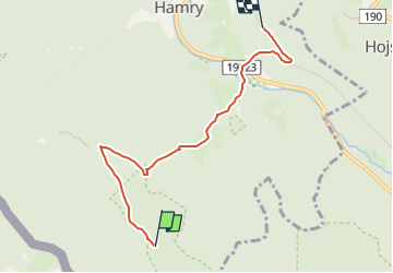
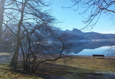
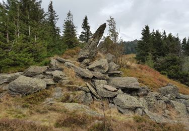
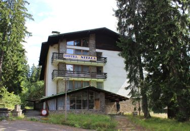
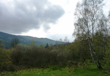
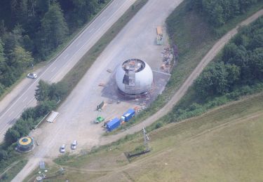
Randonnée A pied de 5,2 km à découvrir à Jihozápad, Plzeňský kraj, Hamry. Cette randonnée est proposée par SityTrail - itinéraires balisés pédestres.
Description
Randonnée créée par cz:KČT.
Localisation
Pays :
République Tchèque
Région :
Jihozápad
Département/Province :
Plzeňský kraj
Commune :
Hamry
Localité :
Unknown
Départ:(Dec)
Départ:(UTM)
365696 ; 5450270 (33U) N.
Commentaires
Randonnées à proximité
![Randonnée A pied Železná Ruda - [Ž] Špičák - Čertovo jezero - Photo](https://media.geolcdn.com/t/375/260/ee7368cb-a4b6-4b61-a473-0c41d55d848b.jpeg&format=jpg&maxdim=2)
![A pied A pied](https://static1.geolcdn.com/sitytour/trail-icons/100.png)
[Ž] Špičák - Čertovo jezero
A pied
Facile
Železná Ruda,
Jihozápad,
Plzeňský kraj,
République Tchèque
![](/images/other/stat-length.png)
4,3 km | 7 km-effort
1h 35min
![](https://static1.geolcdn.com/siteimages/upload/files/16400158638029165_repeat_loop_refresh_sync_direction_icon.png)
Non
![Randonnée A pied Hamry - naučná stezka Z Hamrů na Ostrý - Photo](https://media.geolcdn.com/t/375/260/61e7dac2-c96d-492c-9cd6-be2dee904295.jpeg&format=jpg&maxdim=2)
![A pied A pied](https://static1.geolcdn.com/sitytour/trail-icons/100.png)
naučná stezka Z Hamrů na Ostrý
A pied
Facile
Hamry,
Jihozápad,
Plzeňský kraj,
République Tchèque
![](/images/other/stat-length.png)
5,6 km | 11,4 km-effort
2h 35min
![](https://static1.geolcdn.com/siteimages/upload/files/16400158638029165_repeat_loop_refresh_sync_direction_icon.png)
Non
![Randonnée A pied Železná Ruda - NS Sklářská - Photo](https://media.geolcdn.com/t/375/260/4723e5db-c93a-44b6-b0d7-a25dff6deab0.jpeg&format=jpg&maxdim=2)
![A pied A pied](https://static1.geolcdn.com/sitytour/trail-icons/100.png)
NS Sklářská
A pied
Facile
Železná Ruda,
Jihozápad,
Plzeňský kraj,
République Tchèque
![](/images/other/stat-length.png)
3,3 km | 5,4 km-effort
1h 14min
![](https://static1.geolcdn.com/siteimages/upload/files/16400158638029165_repeat_loop_refresh_sync_direction_icon.png)
Non
![Randonnée A pied - Lo 5 Zwerchecker-Steig (Lohberg) - Photo](https://media.geolcdn.com/t/375/260/afdf211f-3378-4ccf-a493-44a5d1b4a1ef.jpeg&format=jpg&maxdim=2)
![A pied A pied](https://static1.geolcdn.com/sitytour/trail-icons/100.png)
Lo 5 Zwerchecker-Steig (Lohberg)
A pied
Moyen
,
Bavière,
Landkreis Cham,
Allemagne
![](/images/other/stat-length.png)
13,4 km | 23 km-effort
5h 11min
![](https://static1.geolcdn.com/siteimages/upload/files/16400158638029165_repeat_loop_refresh_sync_direction_icon.png)
Non
![Randonnée A pied Železná Ruda - Jezerní okruh - Photo](https://media.geolcdn.com/t/375/260/ee7368cb-a4b6-4b61-a473-0c41d55d848b.jpeg&format=jpg&maxdim=2)
![A pied A pied](https://static1.geolcdn.com/sitytour/trail-icons/100.png)
Jezerní okruh
A pied
Facile
Železná Ruda,
Jihozápad,
Plzeňský kraj,
République Tchèque
![](/images/other/stat-length.png)
8,3 km | 12 km-effort
2h 43min
![](https://static1.geolcdn.com/siteimages/upload/files/16400158638029165_repeat_loop_refresh_sync_direction_icon.png)
Oui
![Randonnée A pied - Lo 1 Osserpfad (Lohberg) - Photo](https://media.geolcdn.com/t/375/260/cd6368dc-f40d-41f9-a41b-727bb4be759d.jpeg&format=jpg&maxdim=2)
![A pied A pied](https://static1.geolcdn.com/sitytour/trail-icons/100.png)
Lo 1 Osserpfad (Lohberg)
A pied
Facile
,
Bavière,
Landkreis Cham,
Allemagne
![](/images/other/stat-length.png)
4,6 km | 10,7 km-effort
2h 25min
![](https://static1.geolcdn.com/siteimages/upload/files/16400158638029165_repeat_loop_refresh_sync_direction_icon.png)
Non
![Randonnée A pied Železná Ruda - NS Historie obce Špičák - Photo](https://media.geolcdn.com/t/375/260/ca2c0cf0-5f0b-41c5-bf32-eb2acd8edbad.jpeg&format=jpg&maxdim=2)
![A pied A pied](https://static1.geolcdn.com/sitytour/trail-icons/100.png)
NS Historie obce Špičák
A pied
Facile
Železná Ruda,
Jihozápad,
Plzeňský kraj,
République Tchèque
![](/images/other/stat-length.png)
6,7 km | 9,5 km-effort
2h 9min
![](https://static1.geolcdn.com/siteimages/upload/files/16400158638029165_repeat_loop_refresh_sync_direction_icon.png)
Oui
![Randonnée A pied Železná Ruda - NS Brčálník - Photo](https://media.geolcdn.com/t/375/260/40ac645c-c39d-4cea-8c68-4b85319ac7e2.jpeg&format=jpg&maxdim=2)
![A pied A pied](https://static1.geolcdn.com/sitytour/trail-icons/100.png)
NS Brčálník
A pied
Facile
Železná Ruda,
Jihozápad,
Plzeňský kraj,
République Tchèque
![](/images/other/stat-length.png)
4,3 km | 6,4 km-effort
1h 27min
![](https://static1.geolcdn.com/siteimages/upload/files/16400158638029165_repeat_loop_refresh_sync_direction_icon.png)
Oui
![Randonnée A pied Lohberg - Lo 3 Lohberg - Erlebnispfad Brennes - kleiner Arbersee - Photo](https://media.geolcdn.com/t/375/260/a54d4e06-8ee9-4275-af98-bed7c74f424e.jpeg&format=jpg&maxdim=2)
![A pied A pied](https://static1.geolcdn.com/sitytour/trail-icons/100.png)
Lo 3 Lohberg - Erlebnispfad Brennes - kleiner Arbersee
A pied
Facile
Lohberg,
Bavière,
Landkreis Cham,
Allemagne
![](/images/other/stat-length.png)
6,4 km | 11,5 km-effort
2h 37min
![](https://static1.geolcdn.com/siteimages/upload/files/16400158638029165_repeat_loop_refresh_sync_direction_icon.png)
Non