![](/images/other/stat-length.png)
![Randonnée A pied Velký Bor - Újezd u Chanovic - Jetenovice (žst) - Photo](https://media.geolcdn.com/t/1900/400/c97f9532-96e4-47f6-b96c-d91770aaa81f.jpeg&format=pjpeg&maxdim=2)
Újezd u Chanovic - Jetenovice (žst)
SityTrail - itinéraires balisés pédestres
Tous les sentiers balisés d’Europe GUIDE+
![Longueur](/images/other/stat-length.png)
Longueur
5,5 km
![Altitude max](https://static1.geolcdn.com/siteimages/upload/files/1508320355ic_sort_altitude_max_24dp.png)
Altitude max
537 m
![Dénivelé positif](https://static1.geolcdn.com/siteimages/upload/files/1508320355ic_sort_den_pos_24dp.png)
Dénivelé positif
109 m
![Km-Effort](/images/other/stat-length.png)
Km-Effort
6,8 km
![Altitude min](https://static1.geolcdn.com/siteimages/upload/files/1508320355ic_sort_altitude_min_24dp.png)
Altitude min
471 m
![Dénivelé négatif](https://static1.geolcdn.com/siteimages/upload/files/1508320355ic_sort_den_neg_24dp.png)
Dénivelé négatif
62 m
![Boucle](https://static1.geolcdn.com/siteimages/upload/files/16400158638029165_repeat_loop_refresh_sync_direction_icon.png)
Boucle
Non
Balise
Date de création :
2025-02-06 23:20:12.659
Dernière modification :
2025-02-06 23:20:12.659
![A pied](https://static1.geolcdn.com/sitytour/trail-icons/100.png)
1h33
Difficulté : Facile
![Scannez ce code QR pour ouvrir la randonnée dans l'application SityTrail](https://capi.geolives.com/qq0zvz2zws4bq2lad0pu/sitytour/trails/4344252/qr.png?size=200)
Application GPS de randonnée GRATUITE
À propos
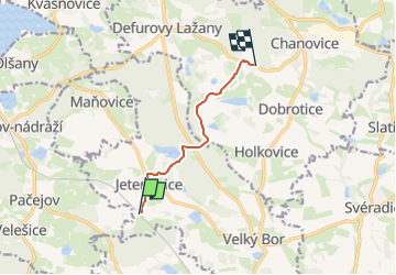
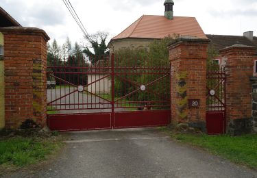
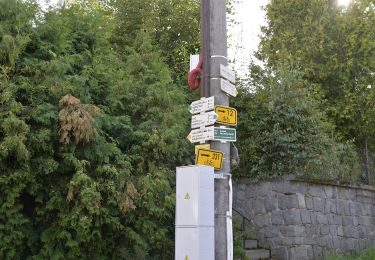
Randonnée A pied de 5,5 km à découvrir à Jihozápad, Plzeňský kraj, Velký Bor. Cette randonnée est proposée par SityTrail - itinéraires balisés pédestres.
Description
Randonnée créée par cz:KČT.
Localisation
Pays :
République Tchèque
Région :
Jihozápad
Département/Province :
Plzeňský kraj
Commune :
Velký Bor
Localité :
Unknown
Départ:(Dec)
Départ:(UTM)
403131 ; 5469455 (33U) N.
Commentaires
Randonnées à proximité
![Randonnée A pied Hvožďany - [Z] Vacíkov - Třemšín - Photo](https://media.geolcdn.com/t/375/260/f1b092e8-e85a-4488-b770-d743603f9f8f.jpeg&format=jpg&maxdim=2)
![A pied A pied](https://static1.geolcdn.com/sitytour/trail-icons/100.png)
[Z] Vacíkov - Třemšín
A pied
Facile
Hvožďany,
Střední Čechy,
Inconnu,
République Tchèque
![](/images/other/stat-length.png)
6,6 km | 9,8 km-effort
2h 13min
![](https://static1.geolcdn.com/siteimages/upload/files/16400158638029165_repeat_loop_refresh_sync_direction_icon.png)
Non
![Randonnée A pied Strakonice - Naučná stezka Švandy dudáka - Photo](https://media.geolcdn.com/t/375/260/db91a694-ca6d-41cc-8c86-9f51d0159de5.jpeg&format=jpg&maxdim=2)
![A pied A pied](https://static1.geolcdn.com/sitytour/trail-icons/100.png)
Naučná stezka Švandy dudáka
A pied
Facile
Strakonice,
Jihozápad,
Jihočeský kraj,
République Tchèque
![](/images/other/stat-length.png)
11,1 km | 14,1 km-effort
3h 12min
![](https://static1.geolcdn.com/siteimages/upload/files/16400158638029165_repeat_loop_refresh_sync_direction_icon.png)
Oui
![Randonnée A pied Malý Bor - NS Velké Hydčice-Hejná-Nezamyslice - Photo](https://media.geolcdn.com/t/375/260/e0f6ef5d-9e80-47ac-a9f8-76b2e139893d.jpeg&format=jpg&maxdim=2)
![A pied A pied](https://static1.geolcdn.com/sitytour/trail-icons/100.png)
NS Velké Hydčice-Hejná-Nezamyslice
A pied
Facile
Malý Bor,
Jihozápad,
Plzeňský kraj,
République Tchèque
![](/images/other/stat-length.png)
7,7 km | 9,9 km-effort
2h 15min
![](https://static1.geolcdn.com/siteimages/upload/files/16400158638029165_repeat_loop_refresh_sync_direction_icon.png)
Non
![Randonnée A pied Letiny - NS Čertovo břemeno - Photo](https://media.geolcdn.com/t/375/260/80a70307-c5ea-41ef-9c70-40438b625d75.jpeg&format=jpg&maxdim=2)
![A pied A pied](https://static1.geolcdn.com/sitytour/trail-icons/100.png)
NS Čertovo břemeno
A pied
Moyen
Letiny,
Jihozápad,
Plzeňský kraj,
République Tchèque
![](/images/other/stat-length.png)
16,9 km | 22 km-effort
4h 59min
![](https://static1.geolcdn.com/siteimages/upload/files/16400158638029165_repeat_loop_refresh_sync_direction_icon.png)
Non
![Randonnée A pied Sušice - CZ-6709 - Photo](https://media.geolcdn.com/t/375/260/b631ab19-e2a0-4d40-94e8-b135fa8c7e8b.jpeg&format=jpg&maxdim=2)
![A pied A pied](https://static1.geolcdn.com/sitytour/trail-icons/100.png)
CZ-6709
A pied
Facile
Sušice,
Jihozápad,
Plzeňský kraj,
République Tchèque
![](/images/other/stat-length.png)
5,5 km | 6,5 km-effort
1h 28min
![](https://static1.geolcdn.com/siteimages/upload/files/16400158638029165_repeat_loop_refresh_sync_direction_icon.png)
Non
![Randonnée Marche Velhartice - Tsjechie - Velhartice - Raysky Mlyn - Photo](https://media.geolcdn.com/t/375/260/ext.jpg?maxdim=2&url=https%3A%2F%2Fstatic1.geolcdn.com%2Fsiteimages%2Fupload%2Ffiles%2F1553511878bg_sport_marche.png)
![Marche Marche](https://static1.geolcdn.com/sitytour/trail-icons/101.png)
Tsjechie - Velhartice - Raysky Mlyn
Marche
Très facile
Velhartice,
Jihozápad,
Plzeňský kraj,
République Tchèque
![](/images/other/stat-length.png)
15 km | 21 km-effort
Inconnu
![](https://static1.geolcdn.com/siteimages/upload/files/16400158638029165_repeat_loop_refresh_sync_direction_icon.png)
Oui
![Randonnée Marche Velhartice - Tsjechie - Velhartice - Kolinec - Photo](https://media.geolcdn.com/t/375/260/ext.jpg?maxdim=2&url=https%3A%2F%2Fstatic1.geolcdn.com%2Fsiteimages%2Fupload%2Ffiles%2F1553511878bg_sport_marche.png)
![Marche Marche](https://static1.geolcdn.com/sitytour/trail-icons/101.png)
Tsjechie - Velhartice - Kolinec
Marche
Très facile
Velhartice,
Jihozápad,
Plzeňský kraj,
République Tchèque
![](/images/other/stat-length.png)
16 km | 22 km-effort
Inconnu
![](https://static1.geolcdn.com/siteimages/upload/files/16400158638029165_repeat_loop_refresh_sync_direction_icon.png)
Oui
![Randonnée Marche Petrovice u Sušice - Tsjechie - Petrovice - Svatobor - Photo](https://media.geolcdn.com/t/375/260/ext.jpg?maxdim=2&url=https%3A%2F%2Fstatic1.geolcdn.com%2Fsiteimages%2Fupload%2Ffiles%2F1553511878bg_sport_marche.png)
![Marche Marche](https://static1.geolcdn.com/sitytour/trail-icons/101.png)
Tsjechie - Petrovice - Svatobor
Marche
Très facile
Petrovice u Sušice,
Jihozápad,
Plzeňský kraj,
République Tchèque
![](/images/other/stat-length.png)
17,7 km | 25 km-effort
Inconnu
![](https://static1.geolcdn.com/siteimages/upload/files/16400158638029165_repeat_loop_refresh_sync_direction_icon.png)
Oui
![Randonnée A pied Čížkov - [Ž] Pod Korálkou - Čížkov - Photo](https://media.geolcdn.com/t/375/260/93fa220f-10db-4424-b7ef-af29593f564b.jpeg&format=jpg&maxdim=2)
![A pied A pied](https://static1.geolcdn.com/sitytour/trail-icons/100.png)
[Ž] Pod Korálkou - Čížkov
A pied
Facile
Čížkov,
Jihozápad,
Plzeňský kraj,
République Tchèque
![](/images/other/stat-length.png)
4,4 km | 5,7 km-effort
1h 17min
![](https://static1.geolcdn.com/siteimages/upload/files/16400158638029165_repeat_loop_refresh_sync_direction_icon.png)
Non