


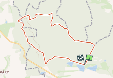

18,5 km | 25 km-effort

Tous les sentiers balisés d’Europe GUIDE+


Application GPS de randonnée GRATUITE
 SityTrail
IGN / Instituts géographiques
SityTrail World
Le monde est à vous
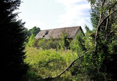
Randonnée A pied de 9,2 km à découvrir à Jihozápad, Plzeňský kraj, Mířkov. Cette randonnée est proposée par SityTrail - itinéraires balisés pédestres.
Randonnée créée par cz:KČT.


A pied
![Randonnée A pied Horní Kamenice - [Ž] Holubí hlava - Hráz - Photo](https://media.geolcdn.com/t/375/260/9dc1522f-4ee1-48b9-9358-e28f17cc2b31.jpeg&format=jpg&maxdim=2)
A pied
A pied
A pied
![Randonnée A pied Hradec - [Z] Hradec - Vytůň - Photo](https://media.geolcdn.com/t/375/260/36372a90-b81a-4a71-9876-a3bf9f884ffe.jpeg&format=jpg&maxdim=2)
A pied
![Randonnée A pied Stod - [Ž] Stod - Vytůň - Photo](https://media.geolcdn.com/t/375/260/5f465939-ef20-4d07-aeae-d7b7b507e19b.jpeg&format=jpg&maxdim=2)
A pied
![Randonnée A pied Holýšov - [Č] Stod - Holýšov - Photo](https://media.geolcdn.com/t/375/260/90aeb2c9-5fc5-41c2-ad60-4fffca584599.jpeg&format=jpg&maxdim=2)
A pied
![Randonnée A pied Domažlice - [Ž]Baldovské návrší - Hrádek - Photo](https://media.geolcdn.com/t/375/260/4477f887-f79e-4587-bad2-e6810befb070.jpeg&format=jpg&maxdim=2)
A pied
![Randonnée A pied Domažlice - [Z] Domažlice - Spálenec - Photo](https://media.geolcdn.com/t/375/260/b2328041-b82d-4ca4-8f9f-5980374d1e88.jpeg&format=jpg&maxdim=2)
A pied