


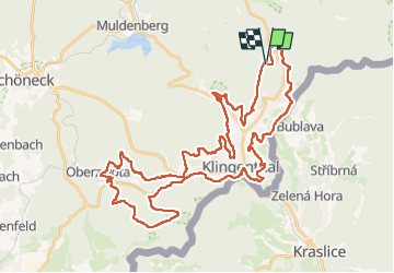

19,3 km | 26 km-effort

Tous les sentiers balisés d’Europe GUIDE+


Application GPS de randonnée GRATUITE
 SityTrail
IGN / Instituts géographiques
SityTrail World
Le monde est à vous
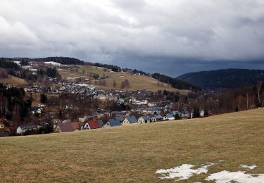
Randonnée A pied de 47 km à découvrir à Saxe, Vogtlandkreis, Klingenthal. Cette randonnée est proposée par SityTrail - itinéraires balisés pédestres.
Juni 2013: im Abschnitt Klingenthal, ca. Kammweg 9, ist grüner Strich auf weißem Grund entlang des Grenzpfades ausgeschildert. Im gegensatz dazu befindet such an der Schutzhütte N50 22 29.7 E12 29 18.8 aber auch ein solches Wanderzeichen.
Symbole: grüner Strich, weißem Grund


A pied
A pied
A pied

A pied
A pied
![Randonnée A pied Kraslice - [Z] Hraničná (CZ/D) - Kraslice - Photo](https://media.geolcdn.com/t/375/260/9a2c3207-a793-4795-9d2f-4ccb6b0dd654.jpeg&format=jpg&maxdim=2)
A pied
![Randonnée A pied Bublava - [NS] Stopami horníků - Photo](https://media.geolcdn.com/t/375/260/257fa595-2ef7-4f16-a7bf-1d9572e0230e.jpeg&format=jpg&maxdim=2)
A pied