


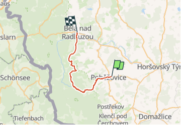

18,5 km | 25 km-effort
![Randonnée A pied Poběžovice - [Ž] Bělá nad Radbuzou - Poběžovice - Photo](https://media.geolcdn.com/t/1900/400/bb0c1710-ff2f-4100-a1f6-7d76c59a9e07.jpeg&format=pjpeg&maxdim=2)

Tous les sentiers balisés d’Europe GUIDE+


Application GPS de randonnée GRATUITE
 SityTrail
IGN / Instituts géographiques
SityTrail World
Le monde est à vous
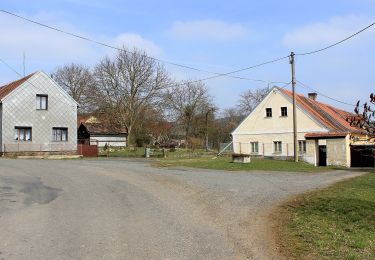
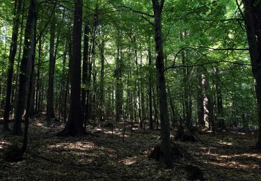
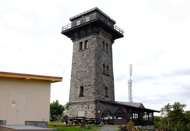
Randonnée A pied de 25 km à découvrir à Jihozápad, Plzeňský kraj, Poběžovice. Cette randonnée est proposée par SityTrail - itinéraires balisés pédestres.
Randonnée créée par cz:KČT.
![Randonnée A pied Poběžovice - [Ž] Bělá nad Radbuzou - Poběžovice - Photo 1](https://media.geolcdn.com/t/2048/auto/1e91ebce-cbd3-4fb8-a119-97785b003831.jpeg&format=jpg&maxdim=0 "Randonnée A pied Poběžovice - [Ž] Bělá nad Radbuzou - Poběžovice - Photo 1")
![Randonnée A pied Poběžovice - [Ž] Bělá nad Radbuzou - Poběžovice - Photo 2](https://media.geolcdn.com/t/2048/auto/9243cef2-f394-4084-887b-0fd1fbc06ede.jpeg&format=jpg&maxdim=0 "Randonnée A pied Poběžovice - [Ž] Bělá nad Radbuzou - Poběžovice - Photo 2")
![Randonnée A pied Poběžovice - [Ž] Bělá nad Radbuzou - Poběžovice - Photo 3](https://media.geolcdn.com/t/2048/auto/73a3739c-11ca-4fe3-9978-65c051542db3.jpeg&format=jpg&maxdim=0 "Randonnée A pied Poběžovice - [Ž] Bělá nad Radbuzou - Poběžovice - Photo 3")
![Randonnée A pied Poběžovice - [Ž] Bělá nad Radbuzou - Poběžovice - Photo 4](https://media.geolcdn.com/t/2048/auto/ec9738d6-3f9c-4f3c-9ef2-4077474b0b6c.jpeg&format=jpg&maxdim=0 "Randonnée A pied Poběžovice - [Ž] Bělá nad Radbuzou - Poběžovice - Photo 4")
![Randonnée A pied Poběžovice - [Ž] Bělá nad Radbuzou - Poběžovice - Photo 5](https://media.geolcdn.com/t/2048/auto/91384075-7188-437c-adf2-89581f4bcd51.jpeg&format=jpg&maxdim=0 "Randonnée A pied Poběžovice - [Ž] Bělá nad Radbuzou - Poběžovice - Photo 5")
![Randonnée A pied Poběžovice - [Ž] Bělá nad Radbuzou - Poběžovice - Photo 6](https://media.geolcdn.com/t/2048/auto/a2f20cbe-453c-421d-8737-409f3c0cb0dc.jpeg&format=jpg&maxdim=0 "Randonnée A pied Poběžovice - [Ž] Bělá nad Radbuzou - Poběžovice - Photo 6")
![Randonnée A pied Poběžovice - [Ž] Bělá nad Radbuzou - Poběžovice - Photo 7](https://media.geolcdn.com/t/2048/auto/982494d7-9e09-4609-aa52-f684c16706c1.jpeg&format=jpg&maxdim=0 "Randonnée A pied Poběžovice - [Ž] Bělá nad Radbuzou - Poběžovice - Photo 7")
![Randonnée A pied Poběžovice - [Ž] Bělá nad Radbuzou - Poběžovice - Photo 8](https://media.geolcdn.com/t/2048/auto/ec235fee-f8ac-41bc-b6ff-7a043276583c.jpeg&format=jpg&maxdim=0 "Randonnée A pied Poběžovice - [Ž] Bělá nad Radbuzou - Poběžovice - Photo 8")
![Randonnée A pied Poběžovice - [Ž] Bělá nad Radbuzou - Poběžovice - Photo 9](https://media.geolcdn.com/t/2048/auto/e8d07f75-0e64-45c7-9284-489f49d4437b.jpeg&format=jpg&maxdim=0 "Randonnée A pied Poběžovice - [Ž] Bělá nad Radbuzou - Poběžovice - Photo 9")
![Randonnée A pied Poběžovice - [Ž] Bělá nad Radbuzou - Poběžovice - Photo 10](https://media.geolcdn.com/t/2048/auto/bb0c1710-ff2f-4100-a1f6-7d76c59a9e07.jpeg&format=jpg&maxdim=0 "Randonnée A pied Poběžovice - [Ž] Bělá nad Radbuzou - Poběžovice - Photo 10")
A pied
A pied
A pied
A pied
A pied
A pied
![Randonnée A pied Kdyně - [Ž] Kdyně - Dobříkov na Šumavě - Photo](https://media.geolcdn.com/t/375/260/b8b7d031-dfc4-45ae-abc8-c92a941a3ed6.jpeg&format=jpg&maxdim=2)
A pied
![Randonnée A pied Kdyně - [Ž] Němčice - Koráb - Photo](https://media.geolcdn.com/t/375/260/802fd0a6-5871-499d-ae46-767ba9647a6f.jpeg&format=jpg&maxdim=2)
A pied
![Randonnée A pied Kdyně - [Č] Podzámčí - Photo](https://media.geolcdn.com/t/375/260/38e8da5a-3736-45c3-9d00-35897a120b19.jpeg&format=jpg&maxdim=2)
A pied