![](/images/other/stat-length.png)
![Randonnée A pied Omlenice - [Ž] Zahrádka - Omlenička - Photo](https://media.geolcdn.com/t/1900/400/62c2cb13-d80e-4bec-bfc5-ba9504bd4c3d.jpeg&format=pjpeg&maxdim=2)
[Ž] Zahrádka - Omlenička
SityTrail - itinéraires balisés pédestres
Tous les sentiers balisés d’Europe GUIDE+
![Longueur](/images/other/stat-length.png)
Longueur
4,5 km
![Altitude max](https://static1.geolcdn.com/siteimages/upload/files/1508320355ic_sort_altitude_max_24dp.png)
Altitude max
873 m
![Dénivelé positif](https://static1.geolcdn.com/siteimages/upload/files/1508320355ic_sort_den_pos_24dp.png)
Dénivelé positif
230 m
![Km-Effort](/images/other/stat-length.png)
Km-Effort
7 km
![Altitude min](https://static1.geolcdn.com/siteimages/upload/files/1508320355ic_sort_altitude_min_24dp.png)
Altitude min
677 m
![Dénivelé négatif](https://static1.geolcdn.com/siteimages/upload/files/1508320355ic_sort_den_neg_24dp.png)
Dénivelé négatif
38 m
![Boucle](https://static1.geolcdn.com/siteimages/upload/files/16400158638029165_repeat_loop_refresh_sync_direction_icon.png)
Boucle
Non
Balise
Date de création :
2025-02-06 16:47:01.768
Dernière modification :
2025-02-06 16:47:01.768
![A pied](https://static1.geolcdn.com/sitytour/trail-icons/100.png)
1h35
Difficulté : Facile
![Scannez ce code QR pour ouvrir la randonnée dans l'application SityTrail](https://capi.geolives.com/qq0zvz2zws4bq2lad0pu/sitytour/trails/4343658/qr.png?size=200)
Application GPS de randonnée GRATUITE
À propos
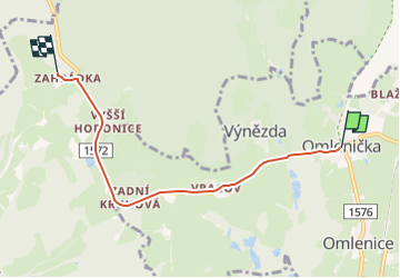
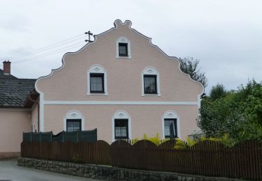
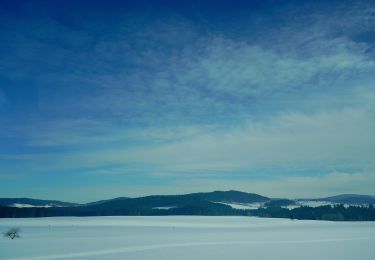
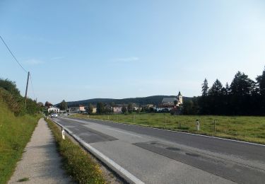
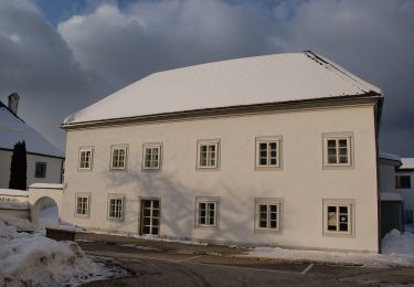
Randonnée A pied de 4,5 km à découvrir à Jihozápad, Jihočeský kraj, Omlenice. Cette randonnée est proposée par SityTrail - itinéraires balisés pédestres.
Description
Randonnée créée par cz:KČT.
Symbole: white yellow white
Localisation
Pays :
République Tchèque
Région :
Jihozápad
Département/Province :
Jihočeský kraj
Commune :
Omlenice
Localité :
Unknown
Départ:(Dec)
Départ:(UTM)
458892 ; 5398205 (33U) N.
Commentaires
Randonnées à proximité
![Randonnée A pied Vorderweißenbach - Steinerne Mühl Weg - Photo](https://media.geolcdn.com/t/375/260/1248ec60-2e25-4827-a4c2-29736c88c1c6.jpeg&format=jpg&maxdim=2)
![A pied A pied](https://static1.geolcdn.com/sitytour/trail-icons/100.png)
Steinerne Mühl Weg
A pied
Facile
Vorderweißenbach,
Haute-Autriche,
Bezirk Urfahr-Umgebung,
Autriche
![](/images/other/stat-length.png)
5,6 km | 7,5 km-effort
1h 42min
![](https://static1.geolcdn.com/siteimages/upload/files/16400158638029165_repeat_loop_refresh_sync_direction_icon.png)
Oui
![Randonnée A pied Leopoldschlag - Töpferweg - Photo](https://media.geolcdn.com/t/375/260/49a726b7-87f3-4c44-a0c8-d13123f1a830.jpeg&format=jpg&maxdim=2)
![A pied A pied](https://static1.geolcdn.com/sitytour/trail-icons/100.png)
Töpferweg
A pied
Facile
Leopoldschlag,
Haute-Autriche,
Bezirk Freistadt,
Autriche
![](/images/other/stat-length.png)
4,8 km | 5,3 km-effort
1h 11min
![](https://static1.geolcdn.com/siteimages/upload/files/16400158638029165_repeat_loop_refresh_sync_direction_icon.png)
Oui
![Randonnée A pied Leopoldschlag - Nordwaldkammweg Verbindungsweg V10 - Photo](https://media.geolcdn.com/t/375/260/57be3e2b-05a1-4076-9da6-345459688a8c.jpeg&format=jpg&maxdim=2)
![A pied A pied](https://static1.geolcdn.com/sitytour/trail-icons/100.png)
Nordwaldkammweg Verbindungsweg V10
A pied
Facile
Leopoldschlag,
Haute-Autriche,
Bezirk Freistadt,
Autriche
![](/images/other/stat-length.png)
5,8 km | 7,1 km-effort
1h 36min
![](https://static1.geolcdn.com/siteimages/upload/files/16400158638029165_repeat_loop_refresh_sync_direction_icon.png)
Non
![Randonnée A pied Windhaag bei Freistadt - Plochwaldrundweg - Photo](https://media.geolcdn.com/t/375/260/c6d6ddce-049b-4013-b79d-b40167fc215c.jpeg&format=jpg&maxdim=2)
![A pied A pied](https://static1.geolcdn.com/sitytour/trail-icons/100.png)
Plochwaldrundweg
A pied
Facile
Windhaag bei Freistadt,
Haute-Autriche,
Bezirk Freistadt,
Autriche
![](/images/other/stat-length.png)
11,7 km | 17,1 km-effort
3h 53min
![](https://static1.geolcdn.com/siteimages/upload/files/16400158638029165_repeat_loop_refresh_sync_direction_icon.png)
Oui
![Randonnée A pied Windhaag bei Freistadt - Steinerlebnisweg - Photo](https://media.geolcdn.com/t/375/260/c6d6ddce-049b-4013-b79d-b40167fc215c.jpeg&format=jpg&maxdim=2)
![A pied A pied](https://static1.geolcdn.com/sitytour/trail-icons/100.png)
Steinerlebnisweg
A pied
Facile
Windhaag bei Freistadt,
Haute-Autriche,
Bezirk Freistadt,
Autriche
![](/images/other/stat-length.png)
9,7 km | 12,5 km-effort
2h 50min
![](https://static1.geolcdn.com/siteimages/upload/files/16400158638029165_repeat_loop_refresh_sync_direction_icon.png)
Oui
![Randonnée A pied Windhaag bei Freistadt - Grenzlandweg - Photo](https://media.geolcdn.com/t/375/260/c6d6ddce-049b-4013-b79d-b40167fc215c.jpeg&format=jpg&maxdim=2)
![A pied A pied](https://static1.geolcdn.com/sitytour/trail-icons/100.png)
Grenzlandweg
A pied
Facile
Windhaag bei Freistadt,
Haute-Autriche,
Bezirk Freistadt,
Autriche
![](/images/other/stat-length.png)
11,4 km | 15,3 km-effort
3h 28min
![](https://static1.geolcdn.com/siteimages/upload/files/16400158638029165_repeat_loop_refresh_sync_direction_icon.png)
Oui
![Randonnée A pied Rainbach im Mühlkreis - Weg der Farben - Photo](https://media.geolcdn.com/t/375/260/668734bc-f752-42ca-b920-7926c11738e2.jpeg&format=jpg&maxdim=2)
![A pied A pied](https://static1.geolcdn.com/sitytour/trail-icons/100.png)
Weg der Farben
A pied
Facile
Rainbach im Mühlkreis,
Haute-Autriche,
Bezirk Freistadt,
Autriche
![](/images/other/stat-length.png)
4,7 km | 5,5 km-effort
1h 14min
![](https://static1.geolcdn.com/siteimages/upload/files/16400158638029165_repeat_loop_refresh_sync_direction_icon.png)
Oui
![Randonnée A pied Sandl - Feuerwehr Erlebnisweg - Photo](https://media.geolcdn.com/t/375/260/73c2063c-163b-4768-a96b-0910ea9d3381.jpeg&format=jpg&maxdim=2)
![A pied A pied](https://static1.geolcdn.com/sitytour/trail-icons/100.png)
Feuerwehr Erlebnisweg
A pied
Facile
Sandl,
Haute-Autriche,
Bezirk Freistadt,
Autriche
![](/images/other/stat-length.png)
3,3 km | 4,5 km-effort
1h 1min
![](https://static1.geolcdn.com/siteimages/upload/files/16400158638029165_repeat_loop_refresh_sync_direction_icon.png)
Non
![Randonnée A pied Sandl - AT-S7 - Photo](https://media.geolcdn.com/t/375/260/fadfdd0e-5cd4-46bf-bff3-f5e0e0aab457.jpeg&format=jpg&maxdim=2)
![A pied A pied](https://static1.geolcdn.com/sitytour/trail-icons/100.png)
AT-S7
A pied
Facile
Sandl,
Haute-Autriche,
Bezirk Freistadt,
Autriche
![](/images/other/stat-length.png)
3,2 km | 4,4 km-effort
59min
![](https://static1.geolcdn.com/siteimages/upload/files/16400158638029165_repeat_loop_refresh_sync_direction_icon.png)
Non