Randonnée V.T.C. La Chapelle-Bouëxic - lcb guipry guer - Photo
 patricefischer
patricefischer

Utilisateur

© OpenStreetMap contributors
Longueur
Longueur
56 km
Altitude max
Altitude max
112 m
Dénivelé positif
Dénivelé positif
563 m
Km-Effort
Km-Effort  
63 km
Altitude min
Altitude min
13 m
Dénivelé négatif
Dénivelé négatif
563 m
Boucle
Boucle
Oui
Date de création :
2025-02-06 12:37:55.965
Dernière modification :
2025-02-06 15:51:46.903

(0 Avis)

V.T.C.
V.T.C.
3h13
Difficulté : Moyen

Scannez ce code QR pour ouvrir la randonnée dans l'application SityTrail

Application GPS de randonnée GRATUITE

Logo SityTrail SityTrail

IGN / Instituts géographiques

Télécharger SityTrail sur l'App Store Télécharger SityTrail sur Google Play

Logo SityTrail SityTrail World

Le monde est à vous

Télécharger SityTrail sur l'App Store Télécharger SityTrail sur Google Play Télécharger SityTrail sur Huawei AppGallery

À propos

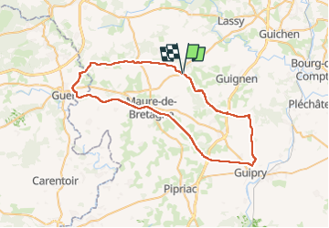
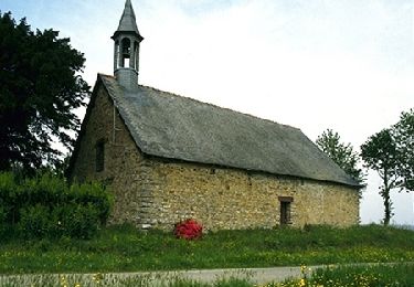
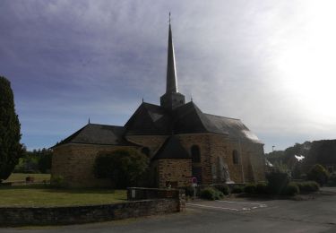
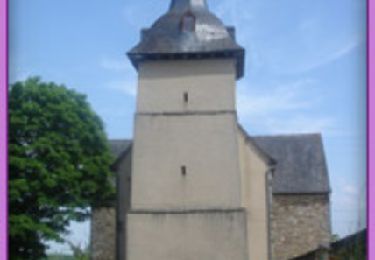
Randonnée V.T.C. de 56 km à découvrir à Bretagne, Ille-et-Vilaine, La Chapelle-Bouëxic. Cette randonnée est proposée par patricefischer.

Description

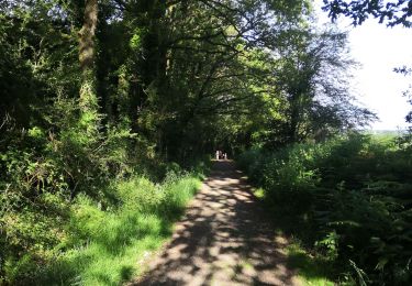
moitié petite route moitié voie verte

Profil altimétrique

Localisation

Pays :
France
Région :
Bretagne
Département/Province :
Ille-et-Vilaine
Commune :
La Chapelle-Bouëxic
Localité :
Unknown
Départ:(UTM)
579022 ; 5308535 (30T) N.

Randonnées à proximité

Randonnée Marche Lassy - canut - Photo
Marche
Path VGK

Marche

Très facile
(1)
Lassy, Bretagne, Ille-et-Vilaine, France
3,6 km | 4,5 km-effort
57min
Oui
Randonnée A pied La Chapelle-Bouëxic - Le Chêne au Loup - Photo
A pied
GUIDE+

A pied

Facile
La Chapelle-Bouëxic, Bretagne, Ille-et-Vilaine, France
15,2 km | 17,9 km-effort
4h 4min
Oui
Randonnée Marche Val d'Anast - circuit des landes et des étangs. Campel - Photo
Marche
slm3005

Marche

Très facile
(1)
Val d'Anast, Bretagne, Ille-et-Vilaine, France
14,9 km | 17,8 km-effort
3h 34min
Oui
Randonnée Vélo Val d'Anast - Circuit vélo de Maure de Bretagne - Photo
Vélo
tracegps

Vélo

Moyen
Val d'Anast, Bretagne, Ille-et-Vilaine, France
36 km | 42 km-effort
2h 0min
Oui
Randonnée Marche Val d'Anast - Circuit des étangs et des Landes - Campel - Photo
Marche
tracegps

Marche

Difficile
(3)
Val d'Anast, Bretagne, Ille-et-Vilaine, France
13,7 km | 16,3 km-effort
3h 25min
Oui
Randonnée Marche La Chapelle-Bouëxic - 07052021 la Chapelle bouexic - Photo
Marche
chasle

Marche

Facile
La Chapelle-Bouëxic, Bretagne, Ille-et-Vilaine, France
23 km | 27 km-effort
5h 26min
Oui
Randonnée Marche Mernel - MERNEL / BOIS DE COURROUET  13 01 2019 - Photo
Marche
limase

Marche

Très facile
Mernel, Bretagne, Ille-et-Vilaine, France
11,2 km | 13 km-effort
2h 56min
Oui
Randonnée Marche Bovel - Circuit du Bois de Cent Jours - Bovel - Photo
Marche
tracegps

Marche

Facile
Bovel, Bretagne, Ille-et-Vilaine, France
5,6 km | 7 km-effort
1h 19min
Oui
Randonnée Marche Guignen - La Chapelle Bouexic 03/10/2024 - Photo
Marche
nolsim

Marche

Très facile
Guignen, Bretagne, Ille-et-Vilaine, France
12,2 km | 14,3 km-effort
2h 50min
Oui


Fermer
Mes abonnements