![](/images/other/stat-length.png)
![Randonnée A pied okres Trenčín - SK-0799M - Photo](https://media.geolcdn.com/t/1900/400/c3e3ce03-8652-4fe8-b468-1fcad5146bb1.jpeg&format=pjpeg&maxdim=2)
SK-0799M
SityTrail - itinéraires balisés pédestres
Tous les sentiers balisés d’Europe GUIDE+
![Longueur](/images/other/stat-length.png)
Longueur
4 km
![Altitude max](https://static1.geolcdn.com/siteimages/upload/files/1508320355ic_sort_altitude_max_24dp.png)
Altitude max
575 m
![Dénivelé positif](https://static1.geolcdn.com/siteimages/upload/files/1508320355ic_sort_den_pos_24dp.png)
Dénivelé positif
296 m
![Km-Effort](/images/other/stat-length.png)
Km-Effort
7,2 km
![Altitude min](https://static1.geolcdn.com/siteimages/upload/files/1508320355ic_sort_altitude_min_24dp.png)
Altitude min
277 m
![Dénivelé négatif](https://static1.geolcdn.com/siteimages/upload/files/1508320355ic_sort_den_neg_24dp.png)
Dénivelé négatif
81 m
![Boucle](https://static1.geolcdn.com/siteimages/upload/files/16400158638029165_repeat_loop_refresh_sync_direction_icon.png)
Boucle
Non
Balise
Date de création :
2025-02-06 14:02:24.163
Dernière modification :
2025-02-06 14:02:24.163
![A pied](https://static1.geolcdn.com/sitytour/trail-icons/100.png)
1h38
Difficulté : Facile
![Scannez ce code QR pour ouvrir la randonnée dans l'application SityTrail](https://capi.geolives.com/qq0zvz2zws4bq2lad0pu/sitytour/trails/4343061/qr.png?size=200)
Application GPS de randonnée GRATUITE
À propos
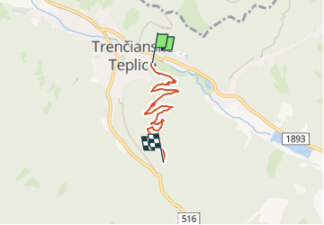
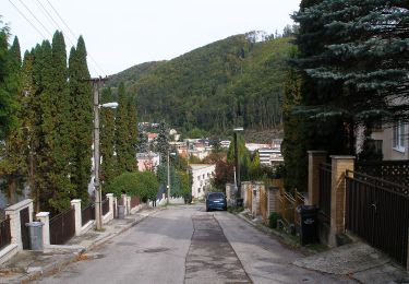
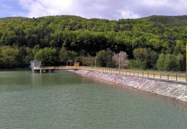
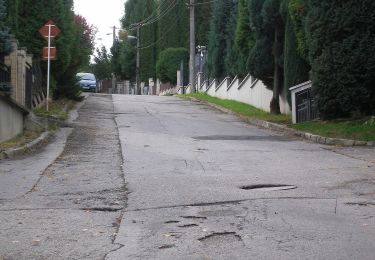
Randonnée A pied de 4 km à découvrir à Région de Trenčín, Inconnu, okres Trenčín. Cette randonnée est proposée par SityTrail - itinéraires balisés pédestres.
Description
Randonnée créée par KST.
Symbole: local
Localisation
Pays :
Slovaquie
Région :
Région de Trenčín
Département/Province :
Inconnu
Commune :
okres Trenčín
Localité :
Trenčianske Teplice
Départ:(Dec)
Départ:(UTM)
292938 ; 5421136 (34U) N.
Commentaires
Randonnées à proximité
![Randonnée A pied okres Trenčín - IVV6 - VLADOV CHODNÍK (maratónska trasa) - Photo](https://media.geolcdn.com/t/375/260/6431251b-aa09-4a8f-af79-8add328de865.jpeg&format=jpg&maxdim=2)
![A pied A pied](https://static1.geolcdn.com/sitytour/trail-icons/100.png)
IVV6 - VLADOV CHODNÍK (maratónska trasa)
A pied
Très difficile
okres Trenčín,
Région de Trenčín,
Inconnu,
Slovaquie
![](/images/other/stat-length.png)
32 km | 48 km-effort
10h 50min
![](https://static1.geolcdn.com/siteimages/upload/files/16400158638029165_repeat_loop_refresh_sync_direction_icon.png)
Oui
![Randonnée A pied okres Trenčín - Po skale na Baske - Photo](https://media.geolcdn.com/t/375/260/3bcd2c2a-781f-4d7e-b787-30bd1a2e6e03.jpeg&format=jpg&maxdim=2)
![A pied A pied](https://static1.geolcdn.com/sitytour/trail-icons/100.png)
Po skale na Baske
A pied
Facile
okres Trenčín,
Région de Trenčín,
Inconnu,
Slovaquie
![](/images/other/stat-length.png)
3,3 km | 4,7 km-effort
1h 4min
![](https://static1.geolcdn.com/siteimages/upload/files/16400158638029165_repeat_loop_refresh_sync_direction_icon.png)
Non
![Randonnée A pied okres Trenčín - Náučný chodník Čvirigovec - Photo](https://media.geolcdn.com/t/375/260/adfed5d2-1eaf-4afd-b69b-d016f1dbb781.jpeg&format=jpg&maxdim=2)
![A pied A pied](https://static1.geolcdn.com/sitytour/trail-icons/100.png)
Náučný chodník Čvirigovec
A pied
Facile
okres Trenčín,
Région de Trenčín,
Inconnu,
Slovaquie
![](/images/other/stat-length.png)
8,4 km | 13 km-effort
2h 57min
![](https://static1.geolcdn.com/siteimages/upload/files/16400158638029165_repeat_loop_refresh_sync_direction_icon.png)
Non
![Randonnée A pied okres Trenčín - SK-5400M - Photo](https://media.geolcdn.com/t/375/260/b2f29d45-eb4c-4cec-8fb4-e1e831fb8dfd.jpeg&format=jpg&maxdim=2)
![A pied A pied](https://static1.geolcdn.com/sitytour/trail-icons/100.png)
SK-5400M
A pied
Facile
okres Trenčín,
Région de Trenčín,
Inconnu,
Slovaquie
![](/images/other/stat-length.png)
3,6 km | 6,9 km-effort
1h 33min
![](https://static1.geolcdn.com/siteimages/upload/files/16400158638029165_repeat_loop_refresh_sync_direction_icon.png)
Non
![Randonnée A pied okres Trenčín - Náučný chodník Klepáč - Photo](https://media.geolcdn.com/t/375/260/628cce15-b12c-4092-9590-c0389bc34eea.jpeg&format=jpg&maxdim=2)
![A pied A pied](https://static1.geolcdn.com/sitytour/trail-icons/100.png)
Náučný chodník Klepáč
A pied
Facile
okres Trenčín,
Région de Trenčín,
Inconnu,
Slovaquie
![](/images/other/stat-length.png)
4,9 km | 8,4 km-effort
1h 53min
![](https://static1.geolcdn.com/siteimages/upload/files/16400158638029165_repeat_loop_refresh_sync_direction_icon.png)
Non
![Randonnée A pied okres Trenčín - SK-2599M - Photo](https://media.geolcdn.com/t/375/260/628cce15-b12c-4092-9590-c0389bc34eea.jpeg&format=jpg&maxdim=2)
![A pied A pied](https://static1.geolcdn.com/sitytour/trail-icons/100.png)
SK-2599M
A pied
Facile
okres Trenčín,
Région de Trenčín,
Inconnu,
Slovaquie
![](/images/other/stat-length.png)
3,4 km | 5,1 km-effort
1h 9min
![](https://static1.geolcdn.com/siteimages/upload/files/16400158638029165_repeat_loop_refresh_sync_direction_icon.png)
Non