Randonnée Marche Saint-Vincent-sur-Jabron - Rando des Crêtes de Mare (Jabron 02 2025 - Photo
 LEGUE
LEGUE

Utilisateur

© OpenStreetMap contributors
Longueur
Longueur
17,2 km
Altitude max
Altitude max
1603 m
Dénivelé positif
Dénivelé positif
575 m
Km-Effort
Km-Effort  
26 km
Altitude min
Altitude min
857 m
Dénivelé négatif
Dénivelé négatif
911 m
Boucle
Boucle
Non
Date de création :
2025-02-03 08:12:31.0
Dernière modification :
2025-02-03 16:11:30.232

(0 Avis)

Marche
Marche
5h50
Difficulté : Moyen

Scannez ce code QR pour ouvrir la randonnée dans l'application SityTrail

Application GPS de randonnée GRATUITE

Logo SityTrail SityTrail

IGN / Instituts géographiques

Télécharger SityTrail sur l'App Store Télécharger SityTrail sur Google Play

Logo SityTrail SityTrail World

Le monde est à vous

Télécharger SityTrail sur l'App Store Télécharger SityTrail sur Google Play Télécharger SityTrail sur Huawei AppGallery

À propos

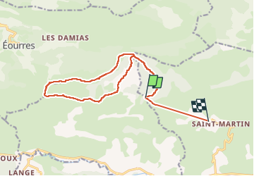
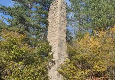
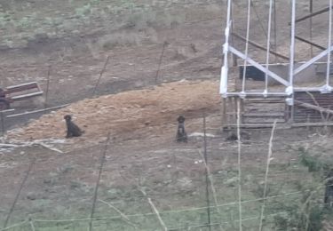
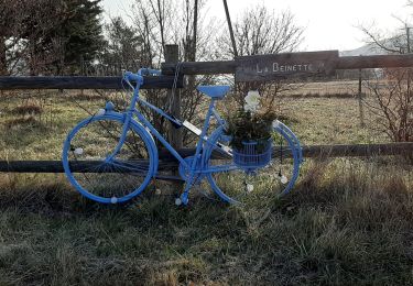
Randonnée Marche de 17,2 km à découvrir à Provence-Alpes-Côte d'Azur, Alpes-de-Haute-Provence, Saint-Vincent-sur-Jabron. Cette randonnée est proposée par LEGUE.

Description

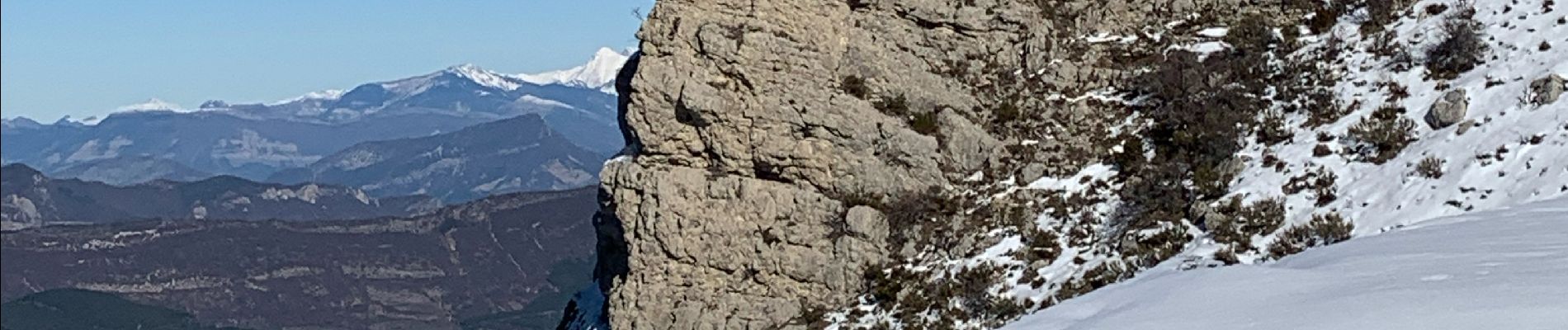
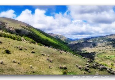
Très belle randonnée, dénivelés constant mais progressifs, temps magnifique

Profil altimétrique

Photos

Localisation

Pays :
France
Région :
Provence-Alpes-Côte d'Azur
Département/Province :
Alpes-de-Haute-Provence
Commune :
Saint-Vincent-sur-Jabron
Localité :
Unknown
Départ:(Dec)
Départ:(UTM)
720632 ; 4897204 (31T) N.

Randonnées à proximité

Randonnée Marche Saint-Vincent-sur-Jabron - SAINT VINCENT DU JABRON . Aubard ,  vieux Curel  , chateau des Graves o l s  - Photo
Marche
GUIDE
RobinMicheline

Marche

Difficile
(1)
Saint-Vincent-sur-Jabron, Provence-Alpes-Côte d'Azur, Alpes-de-Haute-Provence, France
16,1 km | 24 km-effort
4h 53min
Oui
Randonnée Marche Saint-Vincent-sur-Jabron - Traversée de la Montagne de Mare depuis Aubard - Photo
Marche
tracegps

Marche

Facile
(1)
Saint-Vincent-sur-Jabron, Provence-Alpes-Côte d'Azur, Alpes-de-Haute-Provence, France
13,3 km | 23 km-effort
5h 45min
Oui
Randonnée Marche Saint-Vincent-sur-Jabron - 2024-10-13 Saint Vincent sur Jabron- Pas de Parandier - Photo
Marche
GUIDE
Kargil

Marche

Très difficile
Saint-Vincent-sur-Jabron, Provence-Alpes-Côte d'Azur, Alpes-de-Haute-Provence, France
14,1 km | 22 km-effort
5h 1min
Oui
Randonnée Marche Noyers-sur-Jabron - Noyers sur Jabron - Crête de l'Ane - Photo
Marche
GUIDE
Marco05

Marche

Difficile
Noyers-sur-Jabron, Provence-Alpes-Côte d'Azur, Alpes-de-Haute-Provence, France
13,3 km | 24 km-effort
5h 28min
Oui
Randonnée Marche Saint-Vincent-sur-Jabron - SAINT VINCENT DU JABRON.  Aubard,  col de Verdun , le pied du mulet o l m s  - Photo
Marche
GUIDE
RobinMicheline

Marche

Moyen
Saint-Vincent-sur-Jabron, Provence-Alpes-Côte d'Azur, Alpes-de-Haute-Provence, France
13,3 km | 23 km-effort
3h 48min
Oui
Randonnée Marche Éourres - EOURRES.  Les Damias , col S Pierre , col de Branche , crête de Chanteduc , o l m s - Photo
Marche
GUIDE
RobinMicheline

Marche

Facile
Éourres, Provence-Alpes-Côte d'Azur, Hautes-Alpes, France
10 km | 17,9 km-effort
3h 3min
Oui
Randonnée Marche Saint-Vincent-sur-Jabron - SAINT VINCENT SUR JABRON. Pas de Parandier  ,montagne S Michel o n - Photo
Marche
GUIDE
RobinMicheline

Marche

Moyen
Saint-Vincent-sur-Jabron, Provence-Alpes-Côte d'Azur, Alpes-de-Haute-Provence, France
14,4 km | 23 km-effort
4h 13min
Oui
Randonnée Marche Éourres - mare et pied du mulet - Photo
Marche
y39c43l

Marche

Facile
(1)
Éourres, Provence-Alpes-Côte d'Azur, Hautes-Alpes, France
12,2 km | 23 km-effort
5h 47min
Non
Randonnée Marche Val-Buëch-Méouge - Crête de l'âne, des Planes et Roc de Gloritte Via Plaugiers - Photo
Marche
PapouBertrand

Marche

Très difficile
Val-Buëch-Méouge, Provence-Alpes-Côte d'Azur, Hautes-Alpes, France
11,1 km | 23 km-effort
5h 19min
Oui


Fermer
Mes abonnements