Randonnée Randonnée équestre Flavin - Parcours santé - Photo
© OpenStreetMap contributors
Longueur
Longueur
9,1 km
Altitude max
Altitude max
674 m
Dénivelé positif
Dénivelé positif
119 m
Km-Effort
Km-Effort  
10,7 km
Altitude min
Altitude min
611 m
Dénivelé négatif
Dénivelé négatif
108 m
Boucle
Boucle
Non
Date de création :
2025-02-01 15:05:01.0
Dernière modification :
2025-02-01 17:02:21.05

(0 Avis)

Randonnée équestre
Randonnée équestre
1h56
Difficulté : Facile

Scannez ce code QR pour ouvrir la randonnée dans l'application SityTrail

Application GPS de randonnée GRATUITE

Logo SityTrail SityTrail

IGN / Instituts géographiques

Télécharger SityTrail sur l'App Store Télécharger SityTrail sur Google Play

Logo SityTrail SityTrail World

Le monde est à vous

Télécharger SityTrail sur l'App Store Télécharger SityTrail sur Google Play Télécharger SityTrail sur Huawei AppGallery

À propos

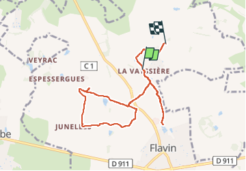
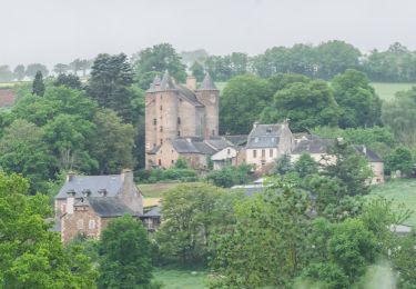
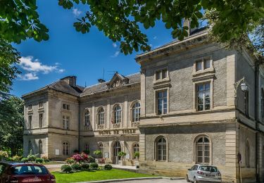
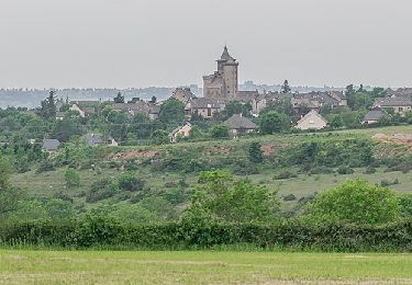
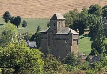
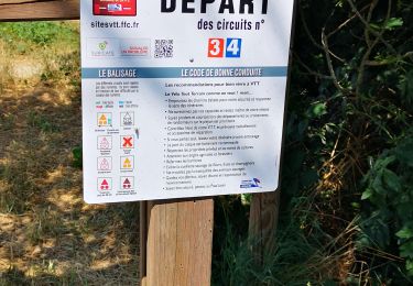
Randonnée Randonnée équestre de 9,1 km à découvrir à Occitanie, Aveyron, Flavin. Cette randonnée est proposée par 001182.014838d2acb247d89157d2c5ed3d3680.1752.

Profil altimétrique

Localisation

Pays :
France
Région :
Occitanie
Département/Province :
Aveyron
Commune :
Flavin
Localité :
Unknown
Départ:(Dec)
Départ:(UTM)
468020 ; 4905757 (31T) N.

Randonnées à proximité

Randonnée A pied Sainte-Radegonde - Circuit 15 Inières - Photo
A pied
GUIDE+

A pied

Facile
Sainte-Radegonde, Occitanie, Aveyron, France
5,6 km | 8,2 km-effort
1h 51min
Oui
Randonnée A pied Sainte-Radegonde - Circuit 14 Sainte-Radegonde - Photo
A pied
GUIDE+

A pied

Facile
Sainte-Radegonde, Occitanie, Aveyron, France
12,2 km | 16,2 km-effort
3h 40min
Oui
Randonnée A pied Le Monastère - Circuit 11 Le Monsastère - Photo
A pied
GUIDE+

A pied

Facile
Le Monastère, Occitanie, Aveyron, France
6,4 km | 7,9 km-effort
1h 47min
Non
Randonnée A pied Luc-la-Primaube - Circuit 10 La Capelle Saint-Martin - Photo
A pied
GUIDE+

A pied

Facile
Luc-la-Primaube, Occitanie, Aveyron, France
9,6 km | 11,8 km-effort
2h 40min
Non
Randonnée A pied Olemps - Circuit 8 Le Viel Olemps - Photo
A pied
GUIDE+

A pied

Facile
Olemps, Occitanie, Aveyron, France
5,1 km | 6,5 km-effort
1h 29min
Oui
Randonnée A pied Rodez - Via Piodensis - Rodez - Photo
A pied
GUIDE+

A pied

Très difficile
Rodez, Occitanie, Aveyron, France
113 km | 150 km-effort
34h 12min
Non
Randonnée A pied Sainte-Radegonde - Sainte-Radegonde - Photo
A pied
GUIDE+

A pied

Facile
Sainte-Radegonde, Occitanie, Aveyron, France
9,9 km | 13,2 km-effort
2h 59min
Oui
Randonnée Marche Sainte-Radegonde - Ignieres - Photo
Marche
gege22

Marche

Très facile
Sainte-Radegonde, Occitanie, Aveyron, France
6,5 km | 9 km-effort
2h 9min
Oui
Randonnée V.T.T. Luc-la-Primaube - Rodez Agglomeration - Circuit 4 - Les trois châteaux  - Photo
V.T.T.
randoruthene

V.T.T.

Difficile
Luc-la-Primaube, Occitanie, Aveyron, France
33 km | 40 km-effort
2h 40min
Oui


Fermer
Mes abonnements