![](/images/other/stat-length.png)
![Randonnée Marche Arbonne-la-Forêt - PSO-150527 - BicheMillyMuletsReine - Photo](https://media.geolcdn.com/t/1900/400/ext.pjpeg?maxdim=2&url=https%3A%2F%2Fservices.sitytrail.com%2FGeolivesWS%2FDownloadMedia.ashx%3FTrailID%3D431576%26Media%3Dd436dedf-ebbe-4aa1-b6ee-4daa90256cb2.jpg)
PSO-150527 - BicheMillyMuletsReine
randodan
Utilisateur
![Longueur](/images/other/stat-length.png)
![Altitude max](https://static1.geolcdn.com/siteimages/upload/files/1508320355ic_sort_altitude_max_24dp.png)
![Dénivelé positif](https://static1.geolcdn.com/siteimages/upload/files/1508320355ic_sort_den_pos_24dp.png)
![Km-Effort](/images/other/stat-length.png)
![Altitude min](https://static1.geolcdn.com/siteimages/upload/files/1508320355ic_sort_altitude_min_24dp.png)
![Dénivelé négatif](https://static1.geolcdn.com/siteimages/upload/files/1508320355ic_sort_den_neg_24dp.png)
![Boucle](https://static1.geolcdn.com/siteimages/upload/files/16400158638029165_repeat_loop_refresh_sync_direction_icon.png)
![Marche](https://static1.geolcdn.com/sitytour/trail-icons/101.png)
5h50
Difficulté : Facile
![Scannez ce code QR pour ouvrir la randonnée dans l'application SityTrail](https://capi.geolives.com/qq0zvz2zws4bq2lad0pu/sitytour/trails/431576/qr.png?size=200)
Application GPS de randonnée GRATUITE
À propos
Randonnée Marche de 12,8 km à découvrir à Île-de-France, Seine-et-Marne, Arbonne-la-Forêt. Cette randonnée est proposée par randodan.
Description
La Biche, le Milly, le Mulet et la Reine.<br>
Tout ça en hors piste ou petit sentier.<br>
- Mercredi 27 mai 2015 -<br>
9h20, départ du parking de Chanfroy.<br>
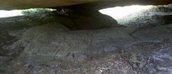
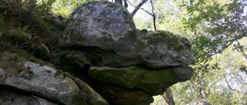
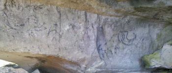
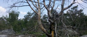
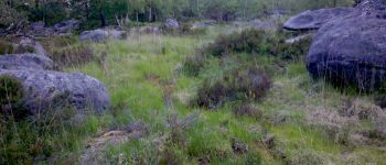
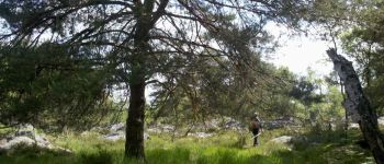
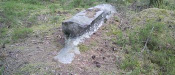
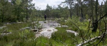
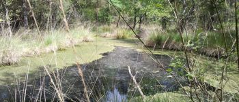
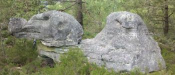
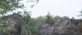
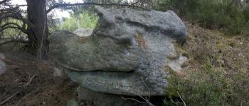
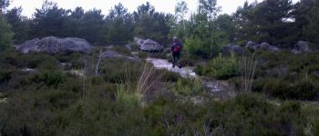
La crête de Corne-Biche en sens inverse de celui habituel me donne l'impression d'un tout nouveau sentier . Une cavité gravée, jamais vue avant . Après coupé le Chemin des Pieds Pourris, on attaque le Rocher de Milly, tout nouveau <u>hors piste</u> . Très jolie lande piquetée de rochers plats . Nombreux rochers remarquables et surtout beaucoup de zones humides . A éviter les lendemains de grosses pluies . En fait, sur une édition IGN de 1985 (!), il existait bien un sentier.<br>
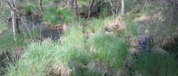
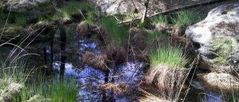
12h30, débouchons sur la Route de la Poche (?), et juste en face, une sympathique mare nous tend ses bras moussus et quelques troncs pour le pique-nique.<br>
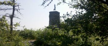
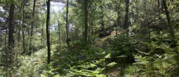
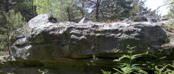
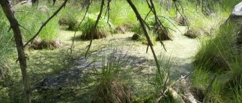
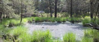
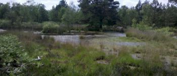
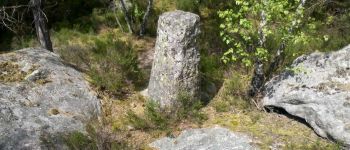
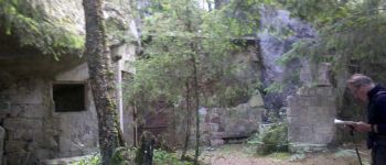
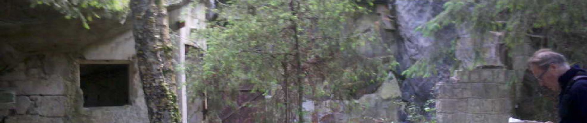
14h, nous repartons avec l'intention de continuer la journée hors piste . Démarrons la Platière de la Touche aux Mulets par une belle grande mare repérée sur la carte . Ici aussi, de beaux rochers remarquables . La Platière se prolonge par le Rocher de la Reine, puis dans la descente de son extrémité Ouest, ça devient vraiment hors piste touffu . C'est presque par hasard qu'on tombe sur l'ancien accès à l'aqueduc souterrain.<br>
16h40 de retour aux voitures.<br>
Journée magnifique.
Points d'intérêt
Localisation
Commentaires
Randonnées à proximité
![Randonnée Marche Le Vaudoué - Ultra 25 bosses - Photo](https://media.geolcdn.com/t/375/260/ext.jpg?maxdim=2&url=https%3A%2F%2Fservices.sitytrail.com%2FGeolivesWS%2FDownloadMedia.ashx%3FTrailID%3D243413%26Media%3Dfix__20140112104549.jpg)
![Marche Marche](https://static1.geolcdn.com/sitytour/trail-icons/101.png)
Marche
![](/images/other/stat-length.png)
![](https://static1.geolcdn.com/siteimages/upload/files/16400158638029165_repeat_loop_refresh_sync_direction_icon.png)
![Randonnée Marche Noisy-sur-École - M&R-121118 - 250Marches - Photo](https://media.geolcdn.com/t/375/260/ext.jpg?maxdim=2&url=https%3A%2F%2Fservices.sitytrail.com%2FGeolivesWS%2FDownloadMedia.ashx%3FTrailID%3D163348%26Media%3D20121118101634.jpeg)
![Marche Marche](https://static1.geolcdn.com/sitytour/trail-icons/101.png)
Marche
![](/images/other/stat-length.png)
![](https://static1.geolcdn.com/siteimages/upload/files/16400158638029165_repeat_loop_refresh_sync_direction_icon.png)
![Randonnée Marche Milly-la-Forêt - Du parking de la Boulignère aux 100 marches via la ferme des Coquibus - Photo](https://media.geolcdn.com/t/375/260/2d4021ff-70a8-48ff-ad65-d6df60ccba59.jpg&format=jpg&maxdim=2)
![Marche Marche](https://static1.geolcdn.com/sitytour/trail-icons/101.png)
Marche
![](/images/other/stat-length.png)
![](https://static1.geolcdn.com/siteimages/upload/files/16400158638029165_repeat_loop_refresh_sync_direction_icon.png)
![Randonnée Marche Noisy-sur-École - Bois Rond#4 - Photo](https://media.geolcdn.com/t/375/260/7321184d-880d-445f-98b4-47f0ff0d82dd.jpg&format=jpg&maxdim=2)
![Marche Marche](https://static1.geolcdn.com/sitytour/trail-icons/101.png)
Marche
![](/images/other/stat-length.png)
![](https://static1.geolcdn.com/siteimages/upload/files/16400158638029165_repeat_loop_refresh_sync_direction_icon.png)
![Randonnée Marche Noisy-sur-École - Les 25 Bosses - Gps en Forêt de Fontainebleau - Photo](https://media.geolcdn.com/t/375/260/ext.jpg?maxdim=2&url=https%3A%2F%2Fservices.sitytrail.com%2FGeolivesWS%2FDownloadMedia.ashx%3FTrailID%3D101528%26Media%3D1630_1.jpg)
![Marche Marche](https://static1.geolcdn.com/sitytour/trail-icons/101.png)
Marche
![](/images/other/stat-length.png)
![](https://static1.geolcdn.com/siteimages/upload/files/16400158638029165_repeat_loop_refresh_sync_direction_icon.png)
![Randonnée Marche Fontainebleau - Boucle Barbizon - Arbonne 26 km - Photo](https://media.geolcdn.com/t/375/260/d3a133ff-ea77-47a6-826a-54bbe45391c4.jpg&format=jpg&maxdim=2)
![Marche Marche](https://static1.geolcdn.com/sitytour/trail-icons/101.png)
Marche
![](/images/other/stat-length.png)
![](https://static1.geolcdn.com/siteimages/upload/files/16400158638029165_repeat_loop_refresh_sync_direction_icon.png)
![Randonnée A pied Le Vaudoué - Boucle Le Vaudoué - Photo](https://media.geolcdn.com/t/375/260/d05a3ec5-b137-48e5-a689-019375766e60.jpg&format=jpg&maxdim=2)
![A pied A pied](https://static1.geolcdn.com/sitytour/trail-icons/100.png)
A pied
![](/images/other/stat-length.png)
![](https://static1.geolcdn.com/siteimages/upload/files/16400158638029165_repeat_loop_refresh_sync_direction_icon.png)
![Randonnée Marche Noisy-sur-École - Boucle 24 km Fontainebleau Arbonne - Photo](https://media.geolcdn.com/t/375/260/5aaa62f0-dc57-4770-a77a-231413885a94.jpg&format=jpg&maxdim=2)
![Marche Marche](https://static1.geolcdn.com/sitytour/trail-icons/101.png)
Marche
![](/images/other/stat-length.png)
![](https://static1.geolcdn.com/siteimages/upload/files/16400158638029165_repeat_loop_refresh_sync_direction_icon.png)
![Randonnée Marche Noisy-sur-École - Noisy sur Ecole / Coquibus - Photo](https://media.geolcdn.com/t/375/260/9f6ffc55-2cbc-4988-8e49-be93fd15ba38.jpg&format=jpg&maxdim=2)
![Marche Marche](https://static1.geolcdn.com/sitytour/trail-icons/101.png)
Marche
![](/images/other/stat-length.png)
![](https://static1.geolcdn.com/siteimages/upload/files/16400158638029165_repeat_loop_refresh_sync_direction_icon.png)