![](/images/other/stat-length.png)
![Randonnée Marche nordique Ver-sur-Launette - Chapelle sainte Marguerite - Photo](https://media.geolcdn.com/t/1900/400/ext.pjpeg?maxdim=2&url=https%3A%2F%2Fstatic1.geolcdn.com%2Fsiteimages%2Fupload%2Ffiles%2F1545311037marcheuse_200dpi.jpg)
Chapelle sainte Marguerite
damerenvielle@gmail.com
Utilisateur
![Longueur](/images/other/stat-length.png)
![Altitude max](https://static1.geolcdn.com/siteimages/upload/files/1508320355ic_sort_altitude_max_24dp.png)
![Dénivelé positif](https://static1.geolcdn.com/siteimages/upload/files/1508320355ic_sort_den_pos_24dp.png)
![Km-Effort](/images/other/stat-length.png)
![Altitude min](https://static1.geolcdn.com/siteimages/upload/files/1508320355ic_sort_altitude_min_24dp.png)
![Dénivelé négatif](https://static1.geolcdn.com/siteimages/upload/files/1508320355ic_sort_den_neg_24dp.png)
![Boucle](https://static1.geolcdn.com/siteimages/upload/files/16400158638029165_repeat_loop_refresh_sync_direction_icon.png)
![Marche nordique](https://static1.geolcdn.com/sitytour/trail-icons/102.png)
2h18
Difficulté : Facile
![Scannez ce code QR pour ouvrir la randonnée dans l'application SityTrail](https://capi.geolives.com/qq0zvz2zws4bq2lad0pu/sitytour/trails/4310439/qr.png?size=200)
Application GPS de randonnée GRATUITE
À propos
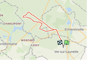
Randonnée Marche nordique de 13,4 km à découvrir à Hauts-de-France, Oise, Ver-sur-Launette. Cette randonnée est proposée par damerenvielle@gmail.com.
Description
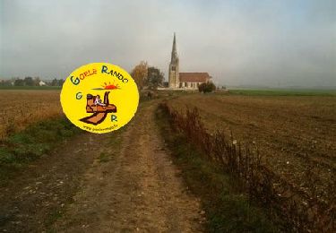
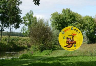
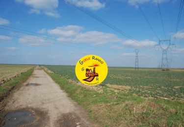
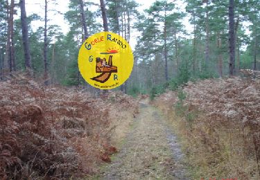
Au départ de Ver Sur Launette, en passant par l'aire de pique nique de Boisdhyver, le pavillon du prince, carrefour du carreau, carrefour du peuple, puis proche de la chapelle retour par le carrefour du bosquet rond et sur la route du même nom, la route anglaise et le pavillon du prince.
Localisation
Commentaires
Randonnées à proximité
![Randonnée Marche Ermenonville - SM_ERMENONVILLE CHATEAU_NORD_8.1Km - Photo](https://media.geolcdn.com/t/375/260/7d446e19-5e6a-43bb-b3e7-8604a42003f5.jpg&format=jpg&maxdim=2)
![Marche Marche](https://static1.geolcdn.com/sitytour/trail-icons/101.png)
Marche
![](/images/other/stat-length.png)
![](https://static1.geolcdn.com/siteimages/upload/files/16400158638029165_repeat_loop_refresh_sync_direction_icon.png)
![Randonnée Marche Fontaine-Chaalis - SM_Abbaye de Chaalis OUEST_7,9Km - Photo](https://media.geolcdn.com/t/375/260/657f82f2-464a-46f3-a6d5-6815f63cb655.jpg&format=jpg&maxdim=2)
![Marche Marche](https://static1.geolcdn.com/sitytour/trail-icons/101.png)
Marche
![](/images/other/stat-length.png)
![](https://static1.geolcdn.com/siteimages/upload/files/16400158638029165_repeat_loop_refresh_sync_direction_icon.png)
![Randonnée Marche Ver-sur-Launette - SM_VER-sur-LAUNETTE_8.5Km - Photo](https://media.geolcdn.com/t/375/260/e4a0fe41-690f-4014-9611-5ec255c04f3d.jpg&format=jpg&maxdim=2)
![Marche Marche](https://static1.geolcdn.com/sitytour/trail-icons/101.png)
Marche
![](/images/other/stat-length.png)
![](https://static1.geolcdn.com/siteimages/upload/files/16400158638029165_repeat_loop_refresh_sync_direction_icon.png)
![Randonnée Marche Fontaine-Chaalis - SM_Abbaye de Chaalis-NORD_8.4Km - Photo](https://media.geolcdn.com/t/375/260/15af4e3c-b372-40df-abf5-027cf19e5dd0.jpg&format=jpg&maxdim=2)
![Marche Marche](https://static1.geolcdn.com/sitytour/trail-icons/101.png)
Marche
![](/images/other/stat-length.png)
![](https://static1.geolcdn.com/siteimages/upload/files/16400158638029165_repeat_loop_refresh_sync_direction_icon.png)
![Randonnée Marche Ermenonville - MR_ERMENONVILLE-Chateau 5.8Km - Photo](https://media.geolcdn.com/t/375/260/4ced2ae2-3324-4103-b3b1-afffd891ea1f.jpg&format=jpg&maxdim=2)
![Marche Marche](https://static1.geolcdn.com/sitytour/trail-icons/101.png)
Marche
![](/images/other/stat-length.png)
![](https://static1.geolcdn.com/siteimages/upload/files/16400158638029165_repeat_loop_refresh_sync_direction_icon.png)
![Randonnée Marche Montagny-Sainte-Félicité - SM_MONTAGNY_Ste-FELECITE_8.5Km - Photo](https://media.geolcdn.com/t/375/260/7f77d429-995c-4fbd-8931-c05c864ab4aa.jpg&format=jpg&maxdim=2)
![Marche Marche](https://static1.geolcdn.com/sitytour/trail-icons/101.png)
Marche
![](/images/other/stat-length.png)
![](https://static1.geolcdn.com/siteimages/upload/files/16400158638029165_repeat_loop_refresh_sync_direction_icon.png)
![Randonnée Marche Ver-sur-Launette - SM_LOISY_8.5Km - Photo](https://media.geolcdn.com/t/375/260/11537f1c-9100-4fb5-a43a-20a54cad8fb4.jpg&format=jpg&maxdim=2)
![Marche Marche](https://static1.geolcdn.com/sitytour/trail-icons/101.png)
Marche
![](/images/other/stat-length.png)
![](https://static1.geolcdn.com/siteimages/upload/files/16400158638029165_repeat_loop_refresh_sync_direction_icon.png)
![Randonnée Marche Othis - SM_BEAUMARCHAIS_8.2Km - Photo](https://media.geolcdn.com/t/375/260/77e12fa5-e8b4-47fd-984a-c11823705817.jpg&format=jpg&maxdim=2)
![Marche Marche](https://static1.geolcdn.com/sitytour/trail-icons/101.png)
Marche
![](/images/other/stat-length.png)
![](https://static1.geolcdn.com/siteimages/upload/files/16400158638029165_repeat_loop_refresh_sync_direction_icon.png)
![Randonnée Marche Fontaine-Chaalis - MR_ERMENONVILLE-Maison-Blanche_EST_5.8Km - Photo](https://media.geolcdn.com/t/375/260/9923fd81-5d90-403c-9e41-4a668aba5ad7.jpg&format=jpg&maxdim=2)
![Marche Marche](https://static1.geolcdn.com/sitytour/trail-icons/101.png)
Marche
![](/images/other/stat-length.png)
![](https://static1.geolcdn.com/siteimages/upload/files/16400158638029165_repeat_loop_refresh_sync_direction_icon.png)