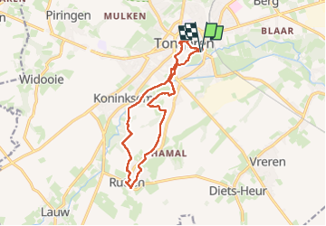
![](/images/other/stat-length.png)
![Randonnée Marche Tongres - Evermaruspad & Grand-Place - Photo](https://media.geolcdn.com/t/1900/400/c867cc14-2361-4b2a-97b8-f49d914b0177.jpg&format=pjpeg&maxdim=2)
Evermaruspad & Grand-Place
Je vous emmène sur mes chemins
Par Mumu.larandonneuse
![Longueur](/images/other/stat-length.png)
![Altitude max](https://static1.geolcdn.com/siteimages/upload/files/1508320355ic_sort_altitude_max_24dp.png)
![Dénivelé positif](https://static1.geolcdn.com/siteimages/upload/files/1508320355ic_sort_den_pos_24dp.png)
![Km-Effort](/images/other/stat-length.png)
![Altitude min](https://static1.geolcdn.com/siteimages/upload/files/1508320355ic_sort_altitude_min_24dp.png)
![Dénivelé négatif](https://static1.geolcdn.com/siteimages/upload/files/1508320355ic_sort_den_neg_24dp.png)
![Boucle](https://static1.geolcdn.com/siteimages/upload/files/16400158638029165_repeat_loop_refresh_sync_direction_icon.png)
![Marche](https://static1.geolcdn.com/sitytour/trail-icons/101.png)
2h53
Difficulté : Facile
![Scannez ce code QR pour ouvrir la randonnée dans l'application SityTrail](https://capi.geolives.com/qq0zvz2zws4bq2lad0pu/sitytour/trails/4307599/qr.png?size=200)
Application GPS de randonnée GRATUITE
À propos
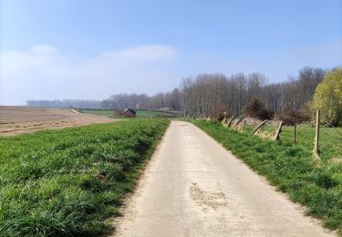
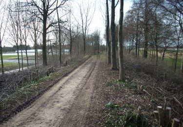
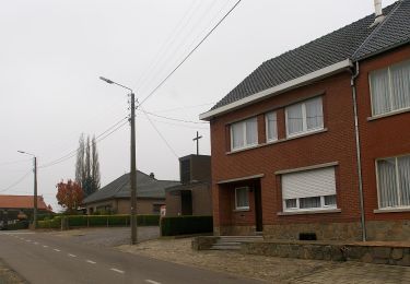
Randonnée Marche de 12,9 km à découvrir à Flandre, Limbourg, Tongres. Cette randonnée est proposée par Je vous emmène sur mes chemins .
Description
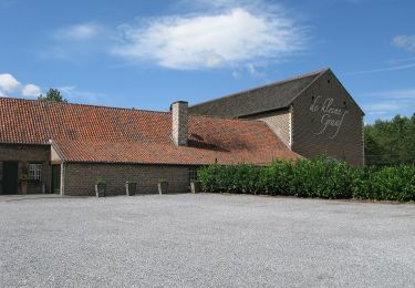
🇧🇪 [La der] Ça devient une tradition de terminer l'année par une dernière randonnée à Tongres avant un pré-réveillon sur la Grand-Place, près d'Ambiorix, au pied de la Basilique Notre-Dame.
📍& 🅿️ De Motten (gratuit)
ℹ️ www.visittongeren.be
➡️ Balade balisée 10 km >> Evermaruspad
Localisation
Commentaires
Randonnées à proximité
![Randonnée Marche Tongres - Piringen - Tongeren _1502 - Photo](https://media.geolcdn.com/t/375/260/d71d4a1e-f4de-4acf-94ea-656bc11edf66.jpg&format=jpg&maxdim=2)
![Marche Marche](https://static1.geolcdn.com/sitytour/trail-icons/101.png)
Marche
![](/images/other/stat-length.png)
![](https://static1.geolcdn.com/siteimages/upload/files/16400158638029165_repeat_loop_refresh_sync_direction_icon.png)
![Randonnée A pied Kortessem - La vallée du ruisseau Sint-Anna à Zammelen - Photo](https://media.geolcdn.com/t/375/260/fc718cb3-95ec-485f-a77f-edadc1be0696.jpeg&format=jpg&maxdim=2)
![A pied A pied](https://static1.geolcdn.com/sitytour/trail-icons/100.png)
A pied
![](/images/other/stat-length.png)
![](https://static1.geolcdn.com/siteimages/upload/files/16400158638029165_repeat_loop_refresh_sync_direction_icon.png)
![Randonnée Marche Tongres - Tongres - Photo](https://media.geolcdn.com/t/375/260/e6784500-8094-4a7e-b3d4-8606bc9495c2.jpg&format=jpg&maxdim=2)
![Marche Marche](https://static1.geolcdn.com/sitytour/trail-icons/101.png)
![Randonnée Marche Tongres - Promenade de la beauté cachée à Lauw - Photo](https://media.geolcdn.com/t/375/260/e09aa99f-84cb-4b46-8a0c-50d633d5a7ef.jpg&format=jpg&maxdim=2)
![Marche Marche](https://static1.geolcdn.com/sitytour/trail-icons/101.png)
Marche
![](/images/other/stat-length.png)
![](https://static1.geolcdn.com/siteimages/upload/files/16400158638029165_repeat_loop_refresh_sync_direction_icon.png)
![Randonnée A pied Tongres - Rond de bronnen van de Mombeek - Photo](https://media.geolcdn.com/t/375/260/13e3acb7-2467-4a11-bfa7-f876dab6b0eb.jpeg&format=jpg&maxdim=2)
![A pied A pied](https://static1.geolcdn.com/sitytour/trail-icons/100.png)
A pied
![](/images/other/stat-length.png)
![](https://static1.geolcdn.com/siteimages/upload/files/16400158638029165_repeat_loop_refresh_sync_direction_icon.png)
![Randonnée A pied Tongres - Widooie - Photo](https://media.geolcdn.com/t/375/260/1460d0c9-37d5-4e75-86eb-ce79ff244b22.jpeg&format=jpg&maxdim=2)
![A pied A pied](https://static1.geolcdn.com/sitytour/trail-icons/100.png)
![Randonnée A pied Tongres - Molsterbos - Photo](https://media.geolcdn.com/t/375/260/3c500f4e-d8ab-4470-8eed-45fbfc940cd4.jpeg&format=jpg&maxdim=2)
![A pied A pied](https://static1.geolcdn.com/sitytour/trail-icons/100.png)
![Randonnée A pied Tongres - 's Herenelderen - Photo](https://media.geolcdn.com/t/375/260/5ab8c445-6053-4792-93e2-8364cf86f17e.jpeg&format=jpg&maxdim=2)
![A pied A pied](https://static1.geolcdn.com/sitytour/trail-icons/100.png)
A pied
![](/images/other/stat-length.png)
![](https://static1.geolcdn.com/siteimages/upload/files/16400158638029165_repeat_loop_refresh_sync_direction_icon.png)
![Randonnée A pied Tongres - Rutten - Photo](https://media.geolcdn.com/t/375/260/128745d3-c995-43bd-9aeb-f310fcbdef14.jpeg&format=jpg&maxdim=2)
![A pied A pied](https://static1.geolcdn.com/sitytour/trail-icons/100.png)