![](/images/other/stat-length.png)
![Randonnée V.T.T. Saint-Bresson - Grand tour de Saint-Bresson 4 juin 2015 - Photo](https://media.geolcdn.com/t/1900/400/ext.pjpeg?maxdim=2&url=https%3A%2F%2Fstatic1.geolcdn.com%2Fsiteimages%2Fupload%2Ffiles%2F1524743154velo.jpg)
Grand tour de Saint-Bresson 4 juin 2015
jean70
Utilisateur
![Longueur](/images/other/stat-length.png)
Longueur
41 km
![Altitude max](https://static1.geolcdn.com/siteimages/upload/files/1508320355ic_sort_altitude_max_24dp.png)
Altitude max
730 m
![Dénivelé positif](https://static1.geolcdn.com/siteimages/upload/files/1508320355ic_sort_den_pos_24dp.png)
Dénivelé positif
920 m
![Km-Effort](/images/other/stat-length.png)
Km-Effort
53 km
![Altitude min](https://static1.geolcdn.com/siteimages/upload/files/1508320355ic_sort_altitude_min_24dp.png)
Altitude min
412 m
![Dénivelé négatif](https://static1.geolcdn.com/siteimages/upload/files/1508320355ic_sort_den_neg_24dp.png)
Dénivelé négatif
924 m
![Boucle](https://static1.geolcdn.com/siteimages/upload/files/16400158638029165_repeat_loop_refresh_sync_direction_icon.png)
Boucle
Oui
Date de création :
2015-09-09 00:00:00.0
Dernière modification :
2015-09-09 00:00:00.0
![V.T.T.](https://static1.geolcdn.com/sitytour/trail-icons/202.png)
3h23
Difficulté : Moyen
![Scannez ce code QR pour ouvrir la randonnée dans l'application SityTrail](https://capi.geolives.com/qq0zvz2zws4bq2lad0pu/sitytour/trails/429536/qr.png?size=200)
Application GPS de randonnée GRATUITE
À propos
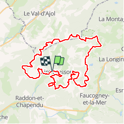
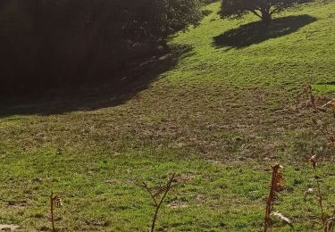
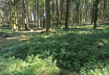
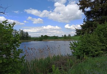
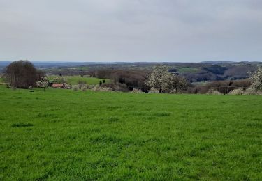
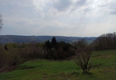
Randonnée V.T.T. de 41 km à découvrir à Bourgogne-Franche-Comté, Haute-Saône, Saint-Bresson. Cette randonnée est proposée par jean70.
Description
Mix des circuits 4.3 et 4.4
Départ à l'aire de camping-cars.
Début sur le 4.4 puis au km 24, on prend le 4.3
Au compteur du VTT, 42 km et 850m de dénivelé
Localisation
Pays :
France
Région :
Bourgogne-Franche-Comté
Département/Province :
Haute-Saône
Commune :
Saint-Bresson
Localité :
Unknown
Départ:(Dec)
Départ:(UTM)
313232 ; 5304891 (32T) N.
Commentaires
Randonnées à proximité
![Randonnée sport Amont-et-Effreney - 2023-05-27_12h07m26_randonnee-33932321-effreney-la-noz-du-pin-effreney (3) - Photo](https://media.geolcdn.com/t/375/260/ext.jpg?maxdim=2&url=https%3A%2F%2Fsecurestorage.geolives.com%2Fsitytour%2Ftrail-bg%2Fdefault.jpg)
2023-05-27_12h07m26_randonnee-33932321-effreney-la-noz-du-pin-effreney (3)
sport
Très facile
(1)
Amont-et-Effreney,
Bourgogne-Franche-Comté,
Haute-Saône,
France
![](/images/other/stat-length.png)
18,5 km | 24 km-effort
Inconnu
![](https://static1.geolcdn.com/siteimages/upload/files/16400158638029165_repeat_loop_refresh_sync_direction_icon.png)
Oui
![Randonnée Marche nordique Amage - amage-mille etang20230430 - Photo](https://media.geolcdn.com/t/375/260/00b07d96-901c-479a-8a03-a71f6be7d5b7.jpg&format=jpg&maxdim=2)
![Marche nordique Marche nordique](https://static1.geolcdn.com/sitytour/trail-icons/102.png)
amage-mille etang20230430
Marche nordique
Très facile
Amage,
Bourgogne-Franche-Comté,
Haute-Saône,
France
![](/images/other/stat-length.png)
14 km | 16,8 km-effort
2h 43min
![](https://static1.geolcdn.com/siteimages/upload/files/16400158638029165_repeat_loop_refresh_sync_direction_icon.png)
Oui
![Randonnée Marche Raddon-et-Chapendu - Raddon et Chapendu - Photo](https://media.geolcdn.com/t/375/260/9eab562e-9fe2-4647-8762-18a781bf654a.jpg&format=jpg&maxdim=2)
![Marche Marche](https://static1.geolcdn.com/sitytour/trail-icons/101.png)
Raddon et Chapendu
Marche
Moyen
Raddon-et-Chapendu,
Bourgogne-Franche-Comté,
Haute-Saône,
France
![](/images/other/stat-length.png)
18,2 km | 23 km-effort
4h 36min
![](https://static1.geolcdn.com/siteimages/upload/files/16400158638029165_repeat_loop_refresh_sync_direction_icon.png)
Oui
![Randonnée Marche Raddon-et-Chapendu - 30-04-23 Chapendu - Photo](https://media.geolcdn.com/t/375/260/b611f2f4-5172-4645-a6ec-ecaba909cfae.jpg&format=jpg&maxdim=2)
![Marche Marche](https://static1.geolcdn.com/sitytour/trail-icons/101.png)
30-04-23 Chapendu
Marche
Facile
Raddon-et-Chapendu,
Bourgogne-Franche-Comté,
Haute-Saône,
France
![](/images/other/stat-length.png)
8,7 km | 10,6 km-effort
2h 28min
![](https://static1.geolcdn.com/siteimages/upload/files/16400158638029165_repeat_loop_refresh_sync_direction_icon.png)
Oui
![Randonnée V.T.T. Faucogney-et-la-Mer - Faucogney - Photo](https://media.geolcdn.com/t/375/260/4937a779-27ba-469d-a9f0-2d3c73857167.jpg&format=jpg&maxdim=2)
![V.T.T. V.T.T.](https://static1.geolcdn.com/sitytour/trail-icons/202.png)
Faucogney
V.T.T.
Moyen
Faucogney-et-la-Mer,
Bourgogne-Franche-Comté,
Haute-Saône,
France
![](/images/other/stat-length.png)
23 km | 29 km-effort
2h 28min
![](https://static1.geolcdn.com/siteimages/upload/files/16400158638029165_repeat_loop_refresh_sync_direction_icon.png)
Non
![Randonnée Marche Saint-Bresson - 08-07-22 chemins forestiers autour des prés benons- Outremont - Photo](https://media.geolcdn.com/t/375/260/e752aa17-c1ea-4948-8d05-0d1dfdc164eb.jpg&format=jpg&maxdim=2)
![Marche Marche](https://static1.geolcdn.com/sitytour/trail-icons/101.png)
08-07-22 chemins forestiers autour des prés benons- Outremont
Marche
Moyen
Saint-Bresson,
Bourgogne-Franche-Comté,
Haute-Saône,
France
![](/images/other/stat-length.png)
10,8 km | 15,5 km-effort
2h 57min
![](https://static1.geolcdn.com/siteimages/upload/files/16400158638029165_repeat_loop_refresh_sync_direction_icon.png)
Oui
![Randonnée Marche Amage - 07-05-22 circuit des bans Amage - Photo](https://media.geolcdn.com/t/375/260/568fe603-d42f-48dc-87ac-7bc4d69b7a09.jpg&format=jpg&maxdim=2)
![Marche Marche](https://static1.geolcdn.com/sitytour/trail-icons/101.png)
07-05-22 circuit des bans Amage
Marche
Moyen
Amage,
Bourgogne-Franche-Comté,
Haute-Saône,
France
![](/images/other/stat-length.png)
11,3 km | 15,9 km-effort
2h 49min
![](https://static1.geolcdn.com/siteimages/upload/files/16400158638029165_repeat_loop_refresh_sync_direction_icon.png)
Oui
![Randonnée Marche Fougerolles-Saint-Valbert - Fougeroles - Photo](https://media.geolcdn.com/t/375/260/a1ddd368-4e3b-4443-8195-2d83a72051e8.jpg&format=jpg&maxdim=2)
![Marche Marche](https://static1.geolcdn.com/sitytour/trail-icons/101.png)
Fougeroles
Marche
Difficile
Fougerolles-Saint-Valbert,
Bourgogne-Franche-Comté,
Haute-Saône,
France
![](/images/other/stat-length.png)
9,5 km | 13,1 km-effort
3h 21min
![](https://static1.geolcdn.com/siteimages/upload/files/16400158638029165_repeat_loop_refresh_sync_direction_icon.png)
Non
![Randonnée Marche Sainte-Marie-en-Chanois - 22-04-21 rando des 2 chapelles Amage - Photo](https://media.geolcdn.com/t/375/260/a84edaf4-9c9e-4267-b2ad-fb18ccd72033.jpg&format=jpg&maxdim=2)
![Marche Marche](https://static1.geolcdn.com/sitytour/trail-icons/101.png)
22-04-21 rando des 2 chapelles Amage
Marche
Moyen
Sainte-Marie-en-Chanois,
Bourgogne-Franche-Comté,
Haute-Saône,
France
![](/images/other/stat-length.png)
9,8 km | 13,1 km-effort
2h 22min
![](https://static1.geolcdn.com/siteimages/upload/files/16400158638029165_repeat_loop_refresh_sync_direction_icon.png)
Oui