![](/images/other/stat-length.png)
![Randonnée Marche Rions - Rions - Photo](https://media.geolcdn.com/t/1900/400/ext.pjpeg?maxdim=2&url=https%3A%2F%2Fstatic1.geolcdn.com%2Fsiteimages%2Fupload%2Ffiles%2F1553511878bg_sport_marche.png)
Rions
frandominic
Utilisateur
![Longueur](/images/other/stat-length.png)
Longueur
16,6 km
![Altitude max](https://static1.geolcdn.com/siteimages/upload/files/1508320355ic_sort_altitude_max_24dp.png)
Altitude max
85 m
![Dénivelé positif](https://static1.geolcdn.com/siteimages/upload/files/1508320355ic_sort_den_pos_24dp.png)
Dénivelé positif
192 m
![Km-Effort](/images/other/stat-length.png)
Km-Effort
19,2 km
![Altitude min](https://static1.geolcdn.com/siteimages/upload/files/1508320355ic_sort_altitude_min_24dp.png)
Altitude min
2 m
![Dénivelé négatif](https://static1.geolcdn.com/siteimages/upload/files/1508320355ic_sort_den_neg_24dp.png)
Dénivelé négatif
192 m
![Boucle](https://static1.geolcdn.com/siteimages/upload/files/16400158638029165_repeat_loop_refresh_sync_direction_icon.png)
Boucle
Oui
Date de création :
2024-12-13 08:51:08.65
Dernière modification :
2025-01-13 13:54:22.808
![Marche](https://static1.geolcdn.com/sitytour/trail-icons/101.png)
4h21
Difficulté : Très difficile
![Scannez ce code QR pour ouvrir la randonnée dans l'application SityTrail](https://capi.geolives.com/qq0zvz2zws4bq2lad0pu/sitytour/trails/4295035/qr.png?size=200)
Application GPS de randonnée GRATUITE
À propos
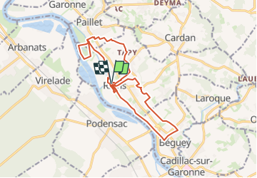
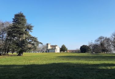
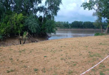
Randonnée Marche de 16,6 km à découvrir à Nouvelle-Aquitaine, Gironde, Rions. Cette randonnée est proposée par frandominic.
Description
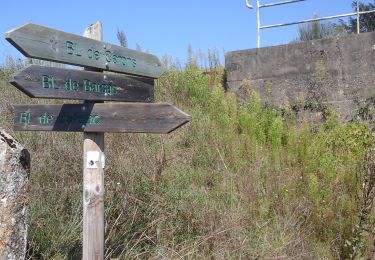
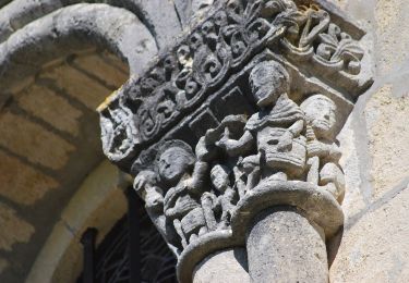
Randonnée très variée : des petites routes goudronnées, des chemins, des zones beaucoup plus souples.
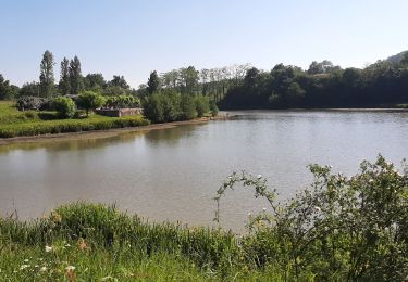
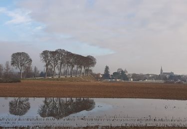
De belles vues sur la Garonne
Localisation
Pays :
France
Région :
Nouvelle-Aquitaine
Département/Province :
Gironde
Commune :
Rions
Localité :
Unknown
Départ:(Dec)
Départ:(UTM)
709825 ; 4949089 (30T) N.
Commentaires
Randonnées à proximité
![Randonnée Marche Podensac - Environs de Podensac - Photo](https://media.geolcdn.com/t/375/260/204dae07-dea2-44b4-a55c-a3f158503ca2.jpg&format=jpg&maxdim=2)
![Marche Marche](https://static1.geolcdn.com/sitytour/trail-icons/101.png)
Environs de Podensac
Marche
Difficile
Podensac,
Nouvelle-Aquitaine,
Gironde,
France
![](/images/other/stat-length.png)
12,9 km | 14 km-effort
3h 10min
![](https://static1.geolcdn.com/siteimages/upload/files/16400158638029165_repeat_loop_refresh_sync_direction_icon.png)
Oui
![Randonnée Marche Omet - Laroque - Photo](https://media.geolcdn.com/t/375/260/2918ad7b-0710-4b41-9b98-11e25d750081.jpg&format=jpg&maxdim=2)
![Marche Marche](https://static1.geolcdn.com/sitytour/trail-icons/101.png)
![Randonnée Marche Loupiac - Loupiac. Les coteaux. - Photo](https://media.geolcdn.com/t/375/260/f2129390-37e4-44db-941f-7256aa8ef486.jpg&format=jpg&maxdim=2)
![Marche Marche](https://static1.geolcdn.com/sitytour/trail-icons/101.png)
Loupiac. Les coteaux.
Marche
Difficile
Loupiac,
Nouvelle-Aquitaine,
Gironde,
France
![](/images/other/stat-length.png)
14 km | 17,7 km-effort
4h 1min
![](https://static1.geolcdn.com/siteimages/upload/files/16400158638029165_repeat_loop_refresh_sync_direction_icon.png)
Oui
![Randonnée A pied Cérons - Boucle locale de Cérons - Photo](https://media.geolcdn.com/t/375/260/0cb637ee-2c72-4b29-98b2-63dc8718bd3c.jpeg&format=jpg&maxdim=2)
![A pied A pied](https://static1.geolcdn.com/sitytour/trail-icons/100.png)
Boucle locale de Cérons
A pied
Facile
Cérons,
Nouvelle-Aquitaine,
Gironde,
France
![](/images/other/stat-length.png)
9 km | 9,8 km-effort
2h 14min
![](https://static1.geolcdn.com/siteimages/upload/files/16400158638029165_repeat_loop_refresh_sync_direction_icon.png)
Oui
![Randonnée A pied Loupiac - Monprimblanc et Loupiac : boucle locale - Photo](https://media.geolcdn.com/t/375/260/252b1336-069e-4cad-9573-2b7af99298fc.jpeg&format=jpg&maxdim=2)
![A pied A pied](https://static1.geolcdn.com/sitytour/trail-icons/100.png)
Monprimblanc et Loupiac : boucle locale
A pied
Facile
Loupiac,
Nouvelle-Aquitaine,
Gironde,
France
![](/images/other/stat-length.png)
10,5 km | 13,1 km-effort
2h 59min
![](https://static1.geolcdn.com/siteimages/upload/files/16400158638029165_repeat_loop_refresh_sync_direction_icon.png)
Non
![Randonnée Marche Podensac - podensac - Photo](https://media.geolcdn.com/t/375/260/8ea79d30-499b-4ff7-abfc-76b5556fea3e.jpg&format=jpg&maxdim=2)
![Marche Marche](https://static1.geolcdn.com/sitytour/trail-icons/101.png)
podensac
Marche
Très facile
Podensac,
Nouvelle-Aquitaine,
Gironde,
France
![](/images/other/stat-length.png)
17,9 km | 19,4 km-effort
4h 59min
![](https://static1.geolcdn.com/siteimages/upload/files/16400158638029165_repeat_loop_refresh_sync_direction_icon.png)
Oui
![Randonnée Marche Rions - Rions est - Photo](https://media.geolcdn.com/t/375/260/8b2b6b49-bae6-43ea-ae51-6c5c9b5752d5.jpg&format=jpg&maxdim=2)
![Marche Marche](https://static1.geolcdn.com/sitytour/trail-icons/101.png)
Rions est
Marche
Moyen
Rions,
Nouvelle-Aquitaine,
Gironde,
France
![](/images/other/stat-length.png)
13,2 km | 16,2 km-effort
4h 1min
![](https://static1.geolcdn.com/siteimages/upload/files/16400158638029165_repeat_loop_refresh_sync_direction_icon.png)
Oui
![Randonnée Marche Lestiac-sur-Garonne - aze - Photo](https://media.geolcdn.com/t/375/260/1dec3eb4-535b-45e9-9bdd-39a238c14c9b.jpg&format=jpg&maxdim=2)
![Marche Marche](https://static1.geolcdn.com/sitytour/trail-icons/101.png)
aze
Marche
Facile
Lestiac-sur-Garonne,
Nouvelle-Aquitaine,
Gironde,
France
![](/images/other/stat-length.png)
4,5 km | 4,8 km-effort
2h 34min
![](https://static1.geolcdn.com/siteimages/upload/files/16400158638029165_repeat_loop_refresh_sync_direction_icon.png)
Non
![Randonnée Marche Podensac - 40 km de Pondensac - Photo](https://media.geolcdn.com/t/375/260/ext.jpg?maxdim=2&url=https%3A%2F%2Fservices.sitytrail.com%2FGeolivesWS%2FDownloadMedia.ashx%3FTrailID%3D1131987%26Media%3Dfix__20190407125248.jpg)
![Marche Marche](https://static1.geolcdn.com/sitytour/trail-icons/101.png)
40 km de Pondensac
Marche
Difficile
Podensac,
Nouvelle-Aquitaine,
Gironde,
France
![](/images/other/stat-length.png)
41 km | 52 km-effort
7h 36min
![](https://static1.geolcdn.com/siteimages/upload/files/16400158638029165_repeat_loop_refresh_sync_direction_icon.png)
Oui