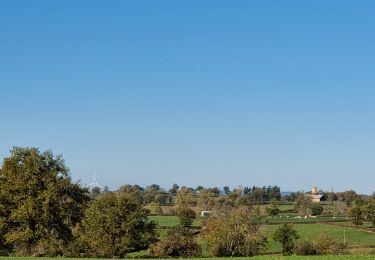

L'Économique

fanthou
Utilisateur

Longueur
12 km

Altitude max
506 m

Dénivelé positif
174 m

Km-Effort
14,3 km

Altitude min
445 m

Dénivelé négatif
174 m
Boucle
Oui
Date de création :
2024-11-29 18:39:29.966
Dernière modification :
2024-11-29 18:40:20.841
3h15
Difficulté : Difficile

Application GPS de randonnée GRATUITE
À propos
Randonnée Marche de 12 km à découvrir à Auvergne-Rhône-Alpes, Allier, Marcillat-en-Combraille. Cette randonnée est proposée par fanthou.
Description
Remontez le temps en empruntant l'ancienne voie de chemin de fer économique.Cheminez sur la ligne où le tacot passait jadis, entre prairies et élevages de vaches charolaises et limousines.
Localisation
Pays :
France
Région :
Auvergne-Rhône-Alpes
Département/Province :
Allier
Commune :
Marcillat-en-Combraille
Localité :
Unknown
Départ:(Dec)
Départ:(UTM)
471518 ; 5112685 (31T) N.
Commentaires
Randonnées à proximité

Le moulin rouge


V.T.T.
Difficile
Saint-Fargeol,
Auvergne-Rhône-Alpes,
Allier,
France

30 km | 38 km-effort
2h 39min
Oui

St fargeol


V.T.T.
Difficile
Saint-Fargeol,
Auvergne-Rhône-Alpes,
Allier,
France

27 km | 35 km-effort
3h 17min
Oui

Marcillat - Eveau les Bain - Rochebut - Marcillat


Moto-cross
Moyen
Marcillat-en-Combraille,
Auvergne-Rhône-Alpes,
Allier,
France

54 km | 72 km-effort
Inconnu
Oui

Les mares et les murets


sport
Très facile
Saint-Marcel-en-Marcillat,
Auvergne-Rhône-Alpes,
Allier,
France

14,2 km | 0 m-effort
Inconnu
Oui

Les Tartasses


Marche
Très difficile
Marcillat-en-Combraille,
Auvergne-Rhône-Alpes,
Allier,
France

22 km | 31 km-effort
6h 56min
Oui

Les Tartasses Bis


Marche
Difficile
Marcillat-en-Combraille,
Auvergne-Rhône-Alpes,
Allier,
France

9,4 km | 12,8 km-effort
2h 54min
Oui

La randonnée de la Marche


Marche
Moyen
La Petite-Marche,
Auvergne-Rhône-Alpes,
Allier,
France

9,4 km | 10,9 km-effort
2h 28min
Oui

Le dolmen de Mazérat Bis


Marche
Moyen
Saint-Fargeol,
Auvergne-Rhône-Alpes,
Allier,
France

9,1 km | 11,3 km-effort
2h 34min
Oui

Terjat


Marche
Difficile
Marcillat-en-Combraille,
Auvergne-Rhône-Alpes,
Allier,
France

15 km | 18,2 km-effort
3h 9min
Oui


 SityTrail


