![](/images/other/stat-length.png)
![Randonnée Marche Camps-la-Source - Rocher du Gueit- Camps la Source-06-11-2024 - Photo](https://media.geolcdn.com/t/1900/400/e92a19e7-d25b-4cc7-a41e-f3e4999745e6.jpg&format=pjpeg&maxdim=2)
Rocher du Gueit- Camps la Source-06-11-2024
Christiancordin
Utilisateur
![Longueur](/images/other/stat-length.png)
Longueur
10,3 km
![Altitude max](https://static1.geolcdn.com/siteimages/upload/files/1508320355ic_sort_altitude_max_24dp.png)
Altitude max
435 m
![Dénivelé positif](https://static1.geolcdn.com/siteimages/upload/files/1508320355ic_sort_den_pos_24dp.png)
Dénivelé positif
257 m
![Km-Effort](/images/other/stat-length.png)
Km-Effort
13,8 km
![Altitude min](https://static1.geolcdn.com/siteimages/upload/files/1508320355ic_sort_altitude_min_24dp.png)
Altitude min
262 m
![Dénivelé négatif](https://static1.geolcdn.com/siteimages/upload/files/1508320355ic_sort_den_neg_24dp.png)
Dénivelé négatif
256 m
![Boucle](https://static1.geolcdn.com/siteimages/upload/files/16400158638029165_repeat_loop_refresh_sync_direction_icon.png)
Boucle
Oui
Date de création :
2024-11-06 08:44:13.973
Dernière modification :
2024-11-09 17:49:08.923
![Marche](https://static1.geolcdn.com/sitytour/trail-icons/101.png)
2h54
Difficulté : Moyen
![Scannez ce code QR pour ouvrir la randonnée dans l'application SityTrail](https://capi.geolives.com/qq0zvz2zws4bq2lad0pu/sitytour/trails/4251068/qr.png?size=200)
Application GPS de randonnée GRATUITE
À propos
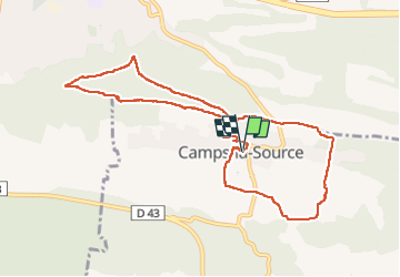
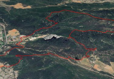
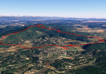
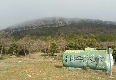
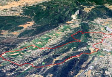
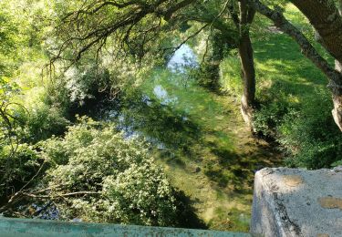
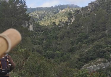
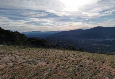
Randonnée Marche de 10,3 km à découvrir à Provence-Alpes-Côte d'Azur, Var, Camps-la-Source. Cette randonnée est proposée par Christiancordin.
Description
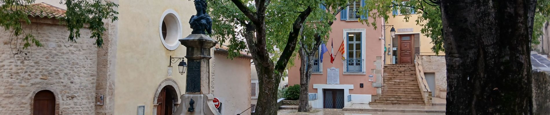
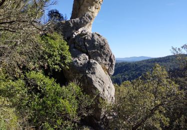
PK centre village, rocher du Gueit, théâtre de verdure, chapelle St Sébastien, Haras St Martin, Camps la Source.
Localisation
Pays :
France
Région :
Provence-Alpes-Côte d'Azur
Département/Province :
Var
Commune :
Camps-la-Source
Localité :
Unknown
Départ:(Dec)
Départ:(UTM)
264781 ; 4807676 (32T) N.
Commentaires
Randonnées à proximité
![Randonnée Marche La Celle - Les hautes Bastides - Lac - Candelon - Dolmen - Amarron - Photo](https://media.geolcdn.com/t/375/260/367c307f-f133-49ff-990b-24c0026569ab.jpg&format=jpg&maxdim=2)
![Marche Marche](https://static1.geolcdn.com/sitytour/trail-icons/101.png)
Les hautes Bastides - Lac - Candelon - Dolmen - Amarron
Marche
Difficile
(1)
La Celle,
Provence-Alpes-Côte d'Azur,
Var,
France
![](/images/other/stat-length.png)
13,9 km | 23 km-effort
8h 0min
![](https://static1.geolcdn.com/siteimages/upload/files/16400158638029165_repeat_loop_refresh_sync_direction_icon.png)
Oui
![Randonnée Marche Sainte-Anastasie-sur-Issole - Départ Ste Anastasie - Grotte de gaspard de Besse - Chapelle de St Quinis - Barres de St Quinis - Photo](https://media.geolcdn.com/t/375/260/855ac779-a3c7-4759-9622-72ff9450b7e1.jpg&format=jpg&maxdim=2)
![Marche Marche](https://static1.geolcdn.com/sitytour/trail-icons/101.png)
Départ Ste Anastasie - Grotte de gaspard de Besse - Chapelle de St Quinis - B...
Marche
Moyen
(2)
Sainte-Anastasie-sur-Issole,
Provence-Alpes-Côte d'Azur,
Var,
France
![](/images/other/stat-length.png)
11,8 km | 17,6 km-effort
6h 0min
![](https://static1.geolcdn.com/siteimages/upload/files/16400158638029165_repeat_loop_refresh_sync_direction_icon.png)
Oui
![Randonnée Marche Sainte-Anastasie-sur-Issole - St Anastasie St Quinis 2 - Photo](https://media.geolcdn.com/t/375/260/ext.jpg?maxdim=2&url=https%3A%2F%2Fservices.sitytrail.com%2FGeolivesWS%2FDownloadMedia.ashx%3FTrailID%3D901213%26Media%3Dfix__20180207101706.jpg)
![Marche Marche](https://static1.geolcdn.com/sitytour/trail-icons/101.png)
St Anastasie St Quinis 2
Marche
Moyen
(1)
Sainte-Anastasie-sur-Issole,
Provence-Alpes-Côte d'Azur,
Var,
France
![](/images/other/stat-length.png)
13,5 km | 19,4 km-effort
4h 7min
![](https://static1.geolcdn.com/siteimages/upload/files/16400158638029165_repeat_loop_refresh_sync_direction_icon.png)
Oui
![Randonnée Marche Brignoles - Vallon de Pouraque - Circuit de l'eau - Rocher de Gueit - St Sébastien - Camps - Photo](https://media.geolcdn.com/t/375/260/31d7ffa9-7745-46d9-9b40-e3c546757624.jpg&format=jpg&maxdim=2)
![Marche Marche](https://static1.geolcdn.com/sitytour/trail-icons/101.png)
Vallon de Pouraque - Circuit de l'eau - Rocher de Gueit - St Sébastien - Camps
Marche
Moyen
(1)
Brignoles,
Provence-Alpes-Côte d'Azur,
Var,
France
![](/images/other/stat-length.png)
16,3 km | 21 km-effort
7h 0min
![](https://static1.geolcdn.com/siteimages/upload/files/16400158638029165_repeat_loop_refresh_sync_direction_icon.png)
Oui
![Randonnée Marche La Celle - Roc de Candelon - Photo](https://media.geolcdn.com/t/375/260/a9cfb2ad-a53d-4040-a9b9-a70f08f9f434.jpg&format=jpg&maxdim=2)
![Marche Marche](https://static1.geolcdn.com/sitytour/trail-icons/101.png)
Roc de Candelon
Marche
Difficile
La Celle,
Provence-Alpes-Côte d'Azur,
Var,
France
![](/images/other/stat-length.png)
9,2 km | 16,3 km-effort
5h 11min
![](https://static1.geolcdn.com/siteimages/upload/files/16400158638029165_repeat_loop_refresh_sync_direction_icon.png)
Oui
![Randonnée sport Camps-la-Source - Barres de St QUINIS - Photo](https://media.geolcdn.com/t/375/260/391272de-8951-4955-b204-f5a6128f76c6.jpg&format=jpg&maxdim=2)
Barres de St QUINIS
sport
Très facile
Camps-la-Source,
Provence-Alpes-Côte d'Azur,
Var,
France
![](/images/other/stat-length.png)
12,8 km | 18,4 km-effort
Inconnu
![](https://static1.geolcdn.com/siteimages/upload/files/16400158638029165_repeat_loop_refresh_sync_direction_icon.png)
Oui
![Randonnée Marche Sainte-Anastasie-sur-Issole - Les Ribas-la Clape - Photo](https://media.geolcdn.com/t/375/260/7e0b258a-94e3-48f6-911c-8fa6347d6a29.jpg&format=jpg&maxdim=2)
![Marche Marche](https://static1.geolcdn.com/sitytour/trail-icons/101.png)
Les Ribas-la Clape
Marche
Moyen
Sainte-Anastasie-sur-Issole,
Provence-Alpes-Côte d'Azur,
Var,
France
![](/images/other/stat-length.png)
6,3 km | 8,1 km-effort
1h 54min
![](https://static1.geolcdn.com/siteimages/upload/files/16400158638029165_repeat_loop_refresh_sync_direction_icon.png)
Oui
![Randonnée Marche Brignoles - l'Amarron - Photo](https://media.geolcdn.com/t/375/260/9224daff-cf2d-4732-bd80-bafe4a1696c0.jpg&format=jpg&maxdim=2)
![Marche Marche](https://static1.geolcdn.com/sitytour/trail-icons/101.png)
l'Amarron
Marche
Difficile
Brignoles,
Provence-Alpes-Côte d'Azur,
Var,
France
![](/images/other/stat-length.png)
8,7 km | 15,9 km-effort
6h 38min
![](https://static1.geolcdn.com/siteimages/upload/files/16400158638029165_repeat_loop_refresh_sync_direction_icon.png)
Oui
![Randonnée Marche Sainte-Anastasie-sur-Issole - Chapelle Saint Quinis depuis Ste Anastasie - Photo](https://media.geolcdn.com/t/375/260/bda9e265-4c31-45c3-bb1e-1209e60a57a1.jpg&format=jpg&maxdim=2)
![Marche Marche](https://static1.geolcdn.com/sitytour/trail-icons/101.png)
Chapelle Saint Quinis depuis Ste Anastasie
Marche
Moyen
Sainte-Anastasie-sur-Issole,
Provence-Alpes-Côte d'Azur,
Var,
France
![](/images/other/stat-length.png)
12,3 km | 18,6 km-effort
5h 30min
![](https://static1.geolcdn.com/siteimages/upload/files/16400158638029165_repeat_loop_refresh_sync_direction_icon.png)
Oui