![](/images/other/stat-length.png)
![Randonnée Marche Pelt - Tweelandenpad Hageveen De Plateaux - Photo](https://media.geolcdn.com/t/1900/400/a557efa3-2347-4b2c-acd0-c84f565a9680.jpg&format=pjpeg&maxdim=2)
Tweelandenpad Hageveen De Plateaux
Charles Lemaire
Utilisateur GUIDE
![Longueur](/images/other/stat-length.png)
![Altitude max](https://static1.geolcdn.com/siteimages/upload/files/1508320355ic_sort_altitude_max_24dp.png)
![Dénivelé positif](https://static1.geolcdn.com/siteimages/upload/files/1508320355ic_sort_den_pos_24dp.png)
![Km-Effort](/images/other/stat-length.png)
![Altitude min](https://static1.geolcdn.com/siteimages/upload/files/1508320355ic_sort_altitude_min_24dp.png)
![Dénivelé négatif](https://static1.geolcdn.com/siteimages/upload/files/1508320355ic_sort_den_neg_24dp.png)
![Boucle](https://static1.geolcdn.com/siteimages/upload/files/16400158638029165_repeat_loop_refresh_sync_direction_icon.png)
![Marche](https://static1.geolcdn.com/sitytour/trail-icons/101.png)
3h11
Difficulté : Moyen
![Scannez ce code QR pour ouvrir la randonnée dans l'application SityTrail](https://capi.geolives.com/qq0zvz2zws4bq2lad0pu/sitytour/trails/4249173/qr.png?size=200)
Application GPS de randonnée GRATUITE
À propos
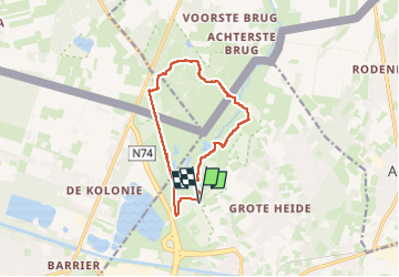
Randonnée Marche de 10,3 km à découvrir à Flandre, Limbourg, Pelt. Cette randonnée est proposée par Charles Lemaire.
Description
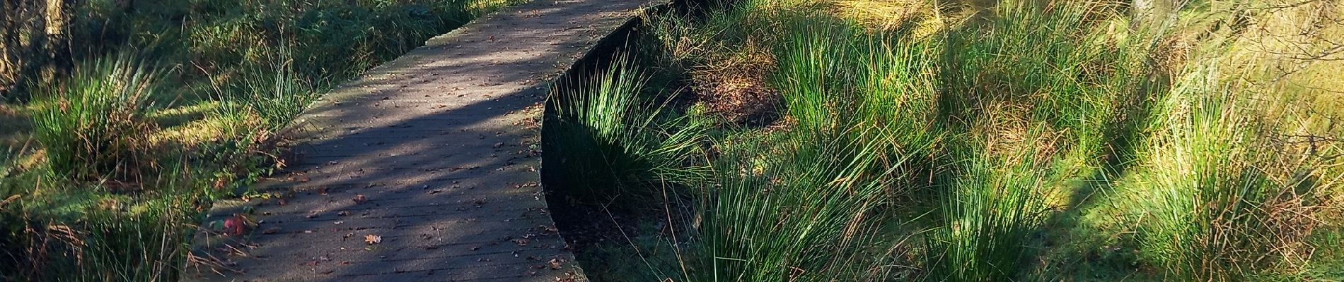
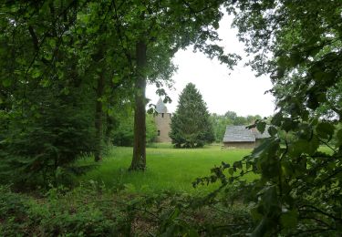
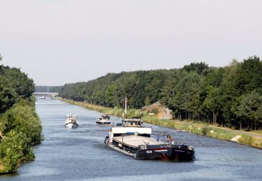
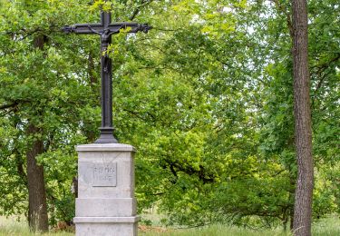
Une promenade dans la nature entre Belgique et Pays-Bas.
Des paysages magnifiques et le calme presque parfait.
Aucune difficulté.
... et pas besoin de GPX... le fléchage (flèche bleue) est parfait !
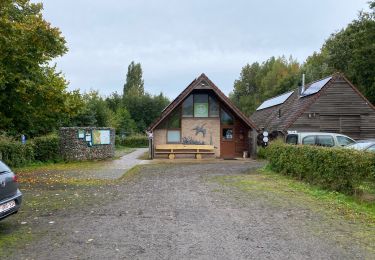
Alternative: au lieu de partir du centre d'accueil de la réserve naturelle on peut aussi poursuive brièvement la N74 vers Eindhoven et après l'entrée aux Pays-Bas (en face de la pompe à essence) tourner à droite vers le parking "De Plateaux" (tables de pic-nic disponibles).
Localisation
Commentaires
Randonnées à proximité
![Randonnée Marche Pelt - De Wulp Hageven Grote Heide 24 km - Photo](https://media.geolcdn.com/t/375/260/26645ea5-b088-4646-839a-d772229bc14b.jpg&format=jpg&maxdim=2)
![Marche Marche](https://static1.geolcdn.com/sitytour/trail-icons/101.png)
Marche
![](/images/other/stat-length.png)
![](https://static1.geolcdn.com/siteimages/upload/files/16400158638029165_repeat_loop_refresh_sync_direction_icon.png)
![Randonnée A pied Hamont-Achel - Engelszell - Photo](https://media.geolcdn.com/t/375/260/c1423da6-d606-42bd-8359-93be5173112d.jpeg&format=jpg&maxdim=2)
![A pied A pied](https://static1.geolcdn.com/sitytour/trail-icons/100.png)
A pied
![](/images/other/stat-length.png)
![](https://static1.geolcdn.com/siteimages/upload/files/16400158638029165_repeat_loop_refresh_sync_direction_icon.png)
![Randonnée A pied Hamont-Achel - Orval - Photo](https://media.geolcdn.com/t/375/260/f2785453-ece4-4bfc-8c43-14e870fda637.jpeg&format=jpg&maxdim=2)
![A pied A pied](https://static1.geolcdn.com/sitytour/trail-icons/100.png)
![Randonnée A pied Lommel - Heuvelse Heide Groene rechthoek - Photo](https://media.geolcdn.com/t/375/260/b69f1859-9567-4db0-9bc6-29a1f9baf513.jpeg&format=jpg&maxdim=2)
![A pied A pied](https://static1.geolcdn.com/sitytour/trail-icons/100.png)
A pied
![](/images/other/stat-length.png)
![](https://static1.geolcdn.com/siteimages/upload/files/16400158638029165_repeat_loop_refresh_sync_direction_icon.png)
![Randonnée A pied Lommel - Heuvelse Heide Oranje bol - Photo](https://media.geolcdn.com/t/375/260/d619256e-abf9-4225-a41a-a8b43d797f6a.jpeg&format=jpg&maxdim=2)
![A pied A pied](https://static1.geolcdn.com/sitytour/trail-icons/100.png)
A pied
![](/images/other/stat-length.png)
![](https://static1.geolcdn.com/siteimages/upload/files/16400158638029165_repeat_loop_refresh_sync_direction_icon.png)
![Randonnée A pied Lommel - Heuvelse Heide Rode driehoek - Photo](https://media.geolcdn.com/t/375/260/d619256e-abf9-4225-a41a-a8b43d797f6a.jpeg&format=jpg&maxdim=2)
![A pied A pied](https://static1.geolcdn.com/sitytour/trail-icons/100.png)
A pied
![](/images/other/stat-length.png)
![](https://static1.geolcdn.com/siteimages/upload/files/16400158638029165_repeat_loop_refresh_sync_direction_icon.png)
![Randonnée A pied Pelt - Hagevenpad - Photo](https://media.geolcdn.com/t/375/260/7b4b1bc2-5801-40b7-ac77-a22a3afaec82.jpeg&format=jpg&maxdim=2)
![A pied A pied](https://static1.geolcdn.com/sitytour/trail-icons/100.png)
![Randonnée A pied Bergeijk - Tweelandenpad - Photo](https://media.geolcdn.com/t/375/260/7b4b1bc2-5801-40b7-ac77-a22a3afaec82.jpeg&format=jpg&maxdim=2)
![A pied A pied](https://static1.geolcdn.com/sitytour/trail-icons/100.png)
A pied
![](/images/other/stat-length.png)
![](https://static1.geolcdn.com/siteimages/upload/files/16400158638029165_repeat_loop_refresh_sync_direction_icon.png)
![Randonnée A pied Pelt - 't Wateringpad aanlooproute - Photo](https://media.geolcdn.com/t/375/260/7b4b1bc2-5801-40b7-ac77-a22a3afaec82.jpeg&format=jpg&maxdim=2)
![A pied A pied](https://static1.geolcdn.com/sitytour/trail-icons/100.png)
A pied
![](/images/other/stat-length.png)
![](https://static1.geolcdn.com/siteimages/upload/files/16400158638029165_repeat_loop_refresh_sync_direction_icon.png)