Randonnée Marche Châlons-en-Champagne - Châlons en Champagne (Le Chemin des Pélerins) 29 620m +184m - Photo

Châlons en Champagne (Le Chemin des Pélerins) 29 620m +184m

 DanielROLLET
DanielROLLET

Utilisateur

© OpenStreetMap contributors
Longueur
Longueur
30 km
Altitude max
Altitude max
154 m
Dénivelé positif
Dénivelé positif
184 m
Km-Effort
Km-Effort  
32 km
Altitude min
Altitude min
81 m
Dénivelé négatif
Dénivelé négatif
185 m
Boucle
Boucle
Oui
Date de création :
2024-10-28 07:30:45.569
Dernière modification :
2024-10-28 07:49:15.847

(0 Avis)

Marche
Marche
7h17
Difficulté : Très difficile

Scannez ce code QR pour ouvrir la randonnée dans l'application SityTrail

Application GPS de randonnée GRATUITE

Logo SityTrail SityTrail

IGN / Instituts géographiques

Télécharger SityTrail sur l'App Store Télécharger SityTrail sur Google Play

Logo SityTrail SityTrail World

Le monde est à vous

Télécharger SityTrail sur l'App Store Télécharger SityTrail sur Google Play Télécharger SityTrail sur Huawei AppGallery

À propos

Randonnée Marche de 30 km à découvrir à Grand Est, Marne, Châlons-en-Champagne. Cette randonnée est proposée par DanielROLLET.

Description

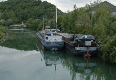
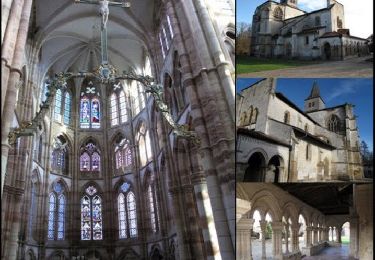
Cette vélo-promenade balisée au départ de l'Office de Tourisme de Châlons vous emmènera en direction de l'Epine où la basilique inscrite à l'Unesco vous attend.  Placée sous le signe de la culture cette promenade n'en n'est pas moins source de nature en longeant les cours d'eau du Mau dans un charmant parc arboré ou la Vesle, véritable couloir vert.

Profil altimétrique

Localisation

Pays :
France
Région :
Grand Est
Département/Province :
Marne
Commune :
Châlons-en-Champagne
Localité :
Unknown
Départ:(UTM)
599576 ; 5423511 (31U) N.

Randonnées à proximité

Randonnée V.T.T. Châlons-en-Champagne - Vallée et Champagne crayeuse - Photo
V.T.T.
tracegps

V.T.T.

Moyen
(1)
Châlons-en-Champagne, Grand Est, Marne, France
35 km | 38 km-effort
2h 30min
Oui
Randonnée Vélo électrique Châlons-en-Champagne - Chalons en Champagne Vitry le François  - Photo
Vélo électrique
FPortier

Vélo électrique

Très facile
Châlons-en-Champagne, Grand Est, Marne, France
32 km | 34 km-effort
3h 25min
Non
Randonnée Marche Châlons-en-Champagne - La Via Francigena - Châlons en Champagne- Vitry le François - Photo
Marche
tracegps

Marche

Moyen
Châlons-en-Champagne, Grand Est, Marne, France
45 km | 49 km-effort
10h 0min
Non
Randonnée Marche Châlons-en-Champagne - Chemin de Compostelle, Voie de Vézelay GR654® De Châlons en Champagne à La Chaussée sur Marne - Photo
Marche
tracegps

Marche

Difficile
Châlons-en-Champagne, Grand Est, Marne, France
24 km | 26 km-effort
4h 49min
Non
Randonnée Marche Châlons-en-Champagne - Via Columbani 10 du 14.06.2024 - Photo
Marche
bene_dictus77

Marche

Facile
Châlons-en-Champagne, Grand Est, Marne, France
25 km | 26 km-effort
7h 17min
Non
Randonnée Marche nordique Châlons-en-Champagne - Châlons en Champagnbe 10 620m +54m - Photo
Marche nordique
DanielROLLET

Marche nordique

Facile
Châlons-en-Champagne, Grand Est, Marne, France
10,6 km | 11,3 km-effort
2h 20min
Oui
Randonnée Cyclotourisme Châlons-en-Champagne - Chalons - Sainte-Marie du Lac 62 km - Photo
Cyclotourisme
GUIDE
jeanmarcMasson

Cyclotourisme

Très difficile
Châlons-en-Champagne, Grand Est, Marne, France
62 km | 66 km-effort
4h 31min
Non
Randonnée Vélo Châlons-en-Champagne - 20070610Arcis - Photo
Vélo
gpstracks

Vélo

Très facile
Châlons-en-Champagne, Grand Est, Marne, France
62 km | 68 km-effort
Inconnu
Non
Randonnée Marche Châlons-en-Champagne - L'Epine 19 500m +130m - Photo
Marche
DanielROLLET

Marche

Très difficile
Châlons-en-Champagne, Grand Est, Marne, France
19,5 km | 21 km-effort
4h 41min
Oui


Fermer
Mes abonnements