![](/images/other/stat-length.png)
![Randonnée Marche Unknown - Lavardin - Chemin de la roue des Carriers - Photo](https://media.geolcdn.com/t/1900/400/e44cda87-93d4-4d06-b6ec-b3c61a83f120.jpg&format=pjpeg&maxdim=2)
Lavardin - Chemin de la roue des Carriers
guydu41
Utilisateur
![Longueur](/images/other/stat-length.png)
![Altitude max](https://static1.geolcdn.com/siteimages/upload/files/1508320355ic_sort_altitude_max_24dp.png)
![Dénivelé positif](https://static1.geolcdn.com/siteimages/upload/files/1508320355ic_sort_den_pos_24dp.png)
![Km-Effort](/images/other/stat-length.png)
![Altitude min](https://static1.geolcdn.com/siteimages/upload/files/1508320355ic_sort_altitude_min_24dp.png)
![Dénivelé négatif](https://static1.geolcdn.com/siteimages/upload/files/1508320355ic_sort_den_neg_24dp.png)
![Boucle](https://static1.geolcdn.com/siteimages/upload/files/16400158638029165_repeat_loop_refresh_sync_direction_icon.png)
![Marche](https://static1.geolcdn.com/sitytour/trail-icons/101.png)
3h31
Difficulté : Moyen
![Scannez ce code QR pour ouvrir la randonnée dans l'application SityTrail](https://capi.geolives.com/qq0zvz2zws4bq2lad0pu/sitytour/trails/4207398/qr.png?size=200)
Application GPS de randonnée GRATUITE
À propos
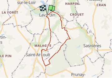
Randonnée Marche de 12,9 km à découvrir à Centre-Val de Loire, Loir-et-Cher. Cette randonnée est proposée par guydu41.
Description
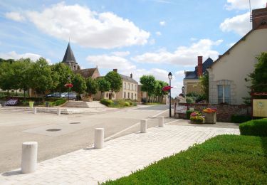
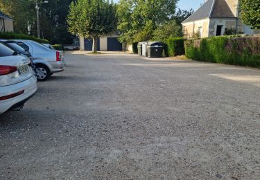
Le circuit démarre depuis le parking Place du château, Rue de la Fontaine, 41800 Lavardin.
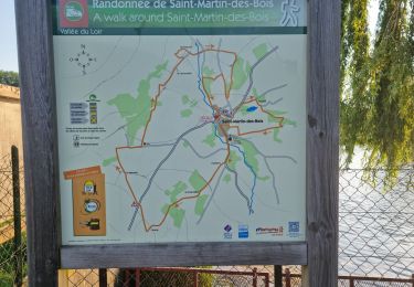
Un panneau avec une carte montre le plan de l'itinéraire balisé jaune qui se parcourt dans le sens antihoraire.
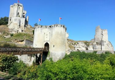
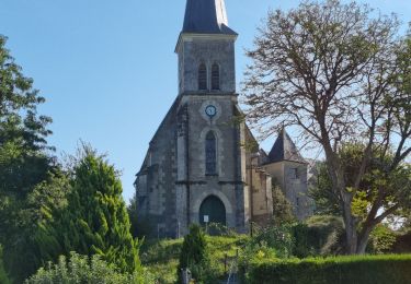
Le début du parcours permet d'admirer le château depuis plusieurs endroits.
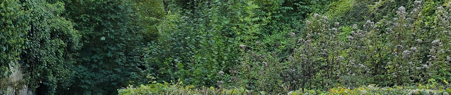
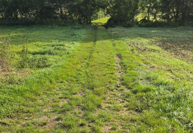
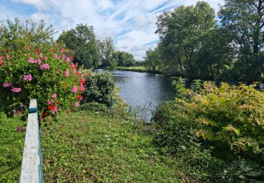
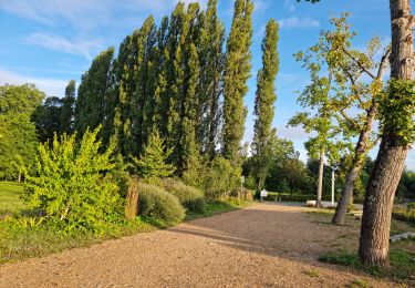
Le circuit quitte la vallée du Loir, descend vers la vallée du Langeron, traverse la Forêt de Prunay, redescend à nouveau vers la vallée du Langeron pour revenir au point de départ en longeant des habitations troglodytes sur les hauteurs du coteau.
Localisation
Commentaires
Randonnées à proximité
![Randonnée Marche Saint-Martin-des-Bois - Saint-Martin-des-Bois - Entre plateau et vallée - 18.1km 225m 4h10 (30mn) - 2019 07 21 - Photo](https://media.geolcdn.com/t/375/260/d4983462-7810-4ac7-979c-9bd62e7c40a3.jpg&format=jpg&maxdim=2)
![Marche Marche](https://static1.geolcdn.com/sitytour/trail-icons/101.png)
Marche
![](/images/other/stat-length.png)
![](https://static1.geolcdn.com/siteimages/upload/files/16400158638029165_repeat_loop_refresh_sync_direction_icon.png)
![Randonnée Marche - Lavardin - Vallée du Loir - 25.2km 410m 6h00 (40mn) - 2015 08 22 - Photo](https://media.geolcdn.com/t/375/260/9217c5be-6f6a-4a6f-89e4-63f2df152ec7.jpg&format=jpg&maxdim=2)
![Marche Marche](https://static1.geolcdn.com/sitytour/trail-icons/101.png)
Marche
![](/images/other/stat-length.png)
![](https://static1.geolcdn.com/siteimages/upload/files/16400158638029165_repeat_loop_refresh_sync_direction_icon.png)
![Randonnée Marche Villavard - Villavard - Bois et champs - Photo](https://media.geolcdn.com/t/375/260/4d475905-90ac-4961-b085-7edf726aaef9.jpg&format=jpg&maxdim=2)
![Marche Marche](https://static1.geolcdn.com/sitytour/trail-icons/101.png)
Marche
![](/images/other/stat-length.png)
![](https://static1.geolcdn.com/siteimages/upload/files/16400158638029165_repeat_loop_refresh_sync_direction_icon.png)
![Randonnée Marche Saint-Rimay - Saint-Rimay - Photo](https://media.geolcdn.com/t/375/260/4102077f-f972-4a74-9982-90e370a0028d.jpg&format=jpg&maxdim=2)
![Marche Marche](https://static1.geolcdn.com/sitytour/trail-icons/101.png)
Marche
![](/images/other/stat-length.png)
![](https://static1.geolcdn.com/siteimages/upload/files/16400158638029165_repeat_loop_refresh_sync_direction_icon.png)
![Randonnée Marche Houssay - Houssay - Photo](https://media.geolcdn.com/t/375/260/3bd1239e-bd99-41e7-b552-6fe8c8fd81df.jpg&format=jpg&maxdim=2)
![Marche Marche](https://static1.geolcdn.com/sitytour/trail-icons/101.png)
Marche
![](/images/other/stat-length.png)
![](https://static1.geolcdn.com/siteimages/upload/files/16400158638029165_repeat_loop_refresh_sync_direction_icon.png)
![Randonnée Marche Les Roches-l'Évêque - Les Roches-l'Evêque - Photo](https://media.geolcdn.com/t/375/260/dca20853-d794-4c8a-9c81-2319f41b2890.jpg&format=jpg&maxdim=2)
![Marche Marche](https://static1.geolcdn.com/sitytour/trail-icons/101.png)
Marche
![](/images/other/stat-length.png)
![](https://static1.geolcdn.com/siteimages/upload/files/16400158638029165_repeat_loop_refresh_sync_direction_icon.png)
![Randonnée Marche Sasnières - Sasnières - Forêt de Prunay - Photo](https://media.geolcdn.com/t/375/260/943c2533-1ac2-4bd6-afd5-01cab0555dce.jpg&format=jpg&maxdim=2)
![Marche Marche](https://static1.geolcdn.com/sitytour/trail-icons/101.png)
Marche
![](/images/other/stat-length.png)
![](https://static1.geolcdn.com/siteimages/upload/files/16400158638029165_repeat_loop_refresh_sync_direction_icon.png)
![Randonnée Marche Sasnières - Sasnières Nord - Photo](https://media.geolcdn.com/t/375/260/284a3961-0328-4eb2-973d-94855c25ddde.jpg&format=jpg&maxdim=2)
![Marche Marche](https://static1.geolcdn.com/sitytour/trail-icons/101.png)
Marche
![](/images/other/stat-length.png)
![](https://static1.geolcdn.com/siteimages/upload/files/16400158638029165_repeat_loop_refresh_sync_direction_icon.png)
![Randonnée Marche Saint-Martin-des-Bois - Saint-Martin-des-Bois - Photo](https://media.geolcdn.com/t/375/260/946cf3bb-e8a1-4d4f-8ed4-26663faea156.jpg&format=jpg&maxdim=2)
![Marche Marche](https://static1.geolcdn.com/sitytour/trail-icons/101.png)
Marche
![](/images/other/stat-length.png)
![](https://static1.geolcdn.com/siteimages/upload/files/16400158638029165_repeat_loop_refresh_sync_direction_icon.png)