![](/images/other/stat-length.png)
![Randonnée Marche Stavelot - RF-Lg-14_Stavelot - Photo](https://media.geolcdn.com/t/1900/400/ext.pjpeg?maxdim=2&url=https%3A%2F%2Fstatic1.geolcdn.com%2Fsiteimages%2Fupload%2Ffiles%2F1553511878bg_sport_marche.png)
RF-Lg-14_Stavelot
GR Rando
Randonnez sur et autour des GR ® wallons (Sentiers de Grande Randonnée). PRO
![Longueur](/images/other/stat-length.png)
![Altitude max](https://static1.geolcdn.com/siteimages/upload/files/1508320355ic_sort_altitude_max_24dp.png)
![Dénivelé positif](https://static1.geolcdn.com/siteimages/upload/files/1508320355ic_sort_den_pos_24dp.png)
![Km-Effort](/images/other/stat-length.png)
![Altitude min](https://static1.geolcdn.com/siteimages/upload/files/1508320355ic_sort_altitude_min_24dp.png)
![Dénivelé négatif](https://static1.geolcdn.com/siteimages/upload/files/1508320355ic_sort_den_neg_24dp.png)
![Boucle](https://static1.geolcdn.com/siteimages/upload/files/16400158638029165_repeat_loop_refresh_sync_direction_icon.png)
![Marche](https://static1.geolcdn.com/sitytour/trail-icons/101.png)
2h02
Difficulté : Moyen
![Scannez ce code QR pour ouvrir la randonnée dans l'application SityTrail](https://capi.geolives.com/qq0zvz2zws4bq2lad0pu/sitytour/trails/420177/qr.png?size=200)
Application GPS de randonnée GRATUITE
À propos
Randonnée Marche de 6 km à découvrir à Wallonie, Liège, Stavelot. Cette randonnée est proposée par GR Rando.
Description
RF-Lg-14 Sur les crêtes de l’Amblève : Stavelot.
Dans quel type de paysage randonnons-nous?
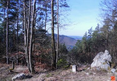
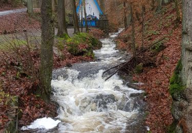
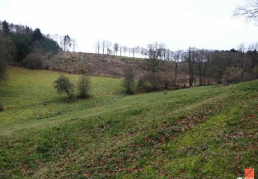
Cette randonnée assez aérienne va nous conduire à travers de belles forêts qui s’ouvrent à tout bout de champ sur de magnifiques panoramas.
Difficultés ?
Le départ de la balade est assez raide. Deux autres côtes pas bien méchantes.
Combien de kilomètres ?
6 km.
Sur quel GR randonnons-nous ?
Après avoir zigzagué à travers le versant nord de la vallée de l’Amblève, nous rejoignons Stavelot en compagnie des balises du GR 5 «Mer du Nord – Méditerranée».
Où démarrons-nous ?
Place Saint-Remacle, la jolie place au perron du centre de Stavelot (carte Michelin n° 534, pli U/20).
Comment y arriver ?
Autoroute E42, puis N68 jusqu’à Stavelot. Ou bien rejoindre Stavelot au départ de Trois-Ponts. En venant de l’E42 ou de Francorchamps, prendre la direction «Centre» au rond-point à l’entrée de Stavelot, puis par la rue Ferdinand Nicolay et, à droite, par la rue Général Jacques, arriver à la place Saint-Remacle.
En arrivant de Trois-Ponts, prendre la direction «Centre» au rond-point à l’entrée du bourg, puis, par la rue Neuve et la rue Henri Massange, ensuite par la rue Général Jacques à gauche, atteindre la place Saint-Remacle.
Que découvrons-nous aujourd’hui ?
Le musée du Circuit de Francorchamps à l’abbaye de Stavelot en séduira plus d’un.
Quelle est la carte IGN de référence ?
Carte IGN au 1:20 000: «Malmedy – Stavelot», 50/5-6.
Transports en commun ?
Arrêt «Stavelot - Écoles», à 250 mètres du point de départ : Bus TEC n° 294 Verviers – Stavelot – Trois-Ponts (tous les jours) ; Bus TEC n° 745 Trois-Ponts – Waimes – Büllingen (tous les jours, services nombreux).
Localisation
Commentaires
Randonnées à proximité
![Randonnée Marche Trois-Ponts - RB-Lg-29_Wanne - Photo](https://media.geolcdn.com/t/375/260/ext.jpg?maxdim=2&url=https%3A%2F%2Fservices.sitytrail.com%2FGeolivesWS%2FDownloadMedia.ashx%3FTrailID%3D402097%26Media%3Dd4589c74-2522-4a62-866b-b5d0038bf075.jpg)
![Marche Marche](https://static1.geolcdn.com/sitytour/trail-icons/101.png)
![Randonnée Marche Trois-Ponts - RB-Lg-27_Trois-Ponts - Photo](https://media.geolcdn.com/t/375/260/ext.jpg?maxdim=2&url=https%3A%2F%2Fservices.sitytrail.com%2FGeolivesWS%2FDownloadMedia.ashx%3FTrailID%3D402090%26Media%3Ddb9e80d9-8efc-4045-abb6-cee4f6885ea2.jpg)
![Marche Marche](https://static1.geolcdn.com/sitytour/trail-icons/101.png)
Marche
![](/images/other/stat-length.png)
![](https://static1.geolcdn.com/siteimages/upload/files/16400158638029165_repeat_loop_refresh_sync_direction_icon.png)
![Randonnée Marche Stavelot - Extratrail_stavelot_13km_new - Photo](https://media.geolcdn.com/t/375/260/acb4a21b-3ac7-4958-9a44-c1358ae78040.jpg&format=jpg&maxdim=2)
![Marche Marche](https://static1.geolcdn.com/sitytour/trail-icons/101.png)
Marche
![](/images/other/stat-length.png)
![](https://static1.geolcdn.com/siteimages/upload/files/16400158638029165_repeat_loop_refresh_sync_direction_icon.png)
![Randonnée Marche Stavelot - Stavelot - Photo](https://media.geolcdn.com/t/375/260/8b34c446-55a9-478c-88d7-9cb986b390fb.jpg&format=jpg&maxdim=2)
![Marche Marche](https://static1.geolcdn.com/sitytour/trail-icons/101.png)
Marche
![](/images/other/stat-length.png)
![](https://static1.geolcdn.com/siteimages/upload/files/16400158638029165_repeat_loop_refresh_sync_direction_icon.png)
![Randonnée Marche Trois-Ponts - RB-Lg-27_Trois-Ponts_via-racc - Photo](https://media.geolcdn.com/t/375/260/ext.jpg?maxdim=2&url=https%3A%2F%2Fservices.sitytrail.com%2FGeolivesWS%2FDownloadMedia.ashx%3FTrailID%3D402091%26Media%3Ddb9e80d9-8efc-4045-abb6-cee4f6885ea2.jpg)
![Marche Marche](https://static1.geolcdn.com/sitytour/trail-icons/101.png)
Marche
![](/images/other/stat-length.png)
![](https://static1.geolcdn.com/siteimages/upload/files/16400158638029165_repeat_loop_refresh_sync_direction_icon.png)
![Randonnée Marche Stavelot - Chemin des Sources |étape n°3 STAVELOT – HOCKAI - Photo](https://media.geolcdn.com/t/375/260/77791607-24fa-4b91-a259-1d28dbfa8616.jpg&format=jpg&maxdim=2)
![Marche Marche](https://static1.geolcdn.com/sitytour/trail-icons/101.png)
Marche
![](/images/other/stat-length.png)
![](https://static1.geolcdn.com/siteimages/upload/files/16400158638029165_repeat_loop_refresh_sync_direction_icon.png)
![Randonnée Trail Stavelot - Extra Trail - Stavelot (rouge) 23km - Photo](https://media.geolcdn.com/t/375/260/e53e9997-9f75-44d1-82da-8b0ea05ce39d.jpg&format=jpg&maxdim=2)
![Trail Trail](https://static1.geolcdn.com/sitytour/trail-icons/104.png)
Trail
![](/images/other/stat-length.png)
![](https://static1.geolcdn.com/siteimages/upload/files/16400158638029165_repeat_loop_refresh_sync_direction_icon.png)
![Randonnée Trail Stavelot - Extra Trail - Stavelot (bleu) 13km - Photo](https://media.geolcdn.com/t/375/260/5430f923-8847-4982-8f77-551b984d4068.jpg&format=jpg&maxdim=2)
![Trail Trail](https://static1.geolcdn.com/sitytour/trail-icons/104.png)
Trail
![](/images/other/stat-length.png)
![](https://static1.geolcdn.com/siteimages/upload/files/16400158638029165_repeat_loop_refresh_sync_direction_icon.png)
![Randonnée Trail Stavelot - Extratrail - Stavelot (vert) 9km - Photo](https://media.geolcdn.com/t/375/260/9bfee553-8e48-41c4-b7d0-2265cc8c3fde.jpg&format=jpg&maxdim=2)
![Trail Trail](https://static1.geolcdn.com/sitytour/trail-icons/104.png)
Trail
![](/images/other/stat-length.png)
![](https://static1.geolcdn.com/siteimages/upload/files/16400158638029165_repeat_loop_refresh_sync_direction_icon.png)