![](/images/other/stat-length.png)
![Randonnée Marche Saint-Jean-Lasseille - ST-JEAN-LASSEILLE 66 - terroirs des Aspres - Photo](https://media.geolcdn.com/t/1900/400/ext.pjpeg?maxdim=2&url=https%3A%2F%2Fservices.sitytrail.com%2FGeolivesWS%2FDownloadMedia.ashx%3FTrailID%3D419934%26Media%3D20150512183916.jpg)
ST-JEAN-LASSEILLE 66 - terroirs des Aspres
jeff66
Utilisateur
![Longueur](/images/other/stat-length.png)
![Altitude max](https://static1.geolcdn.com/siteimages/upload/files/1508320355ic_sort_altitude_max_24dp.png)
![Dénivelé positif](https://static1.geolcdn.com/siteimages/upload/files/1508320355ic_sort_den_pos_24dp.png)
![Km-Effort](/images/other/stat-length.png)
![Altitude min](https://static1.geolcdn.com/siteimages/upload/files/1508320355ic_sort_altitude_min_24dp.png)
![Dénivelé négatif](https://static1.geolcdn.com/siteimages/upload/files/1508320355ic_sort_den_neg_24dp.png)
![Boucle](https://static1.geolcdn.com/siteimages/upload/files/16400158638029165_repeat_loop_refresh_sync_direction_icon.png)
![Marche](https://static1.geolcdn.com/sitytour/trail-icons/101.png)
2h06
Difficulté : Facile
![Scannez ce code QR pour ouvrir la randonnée dans l'application SityTrail](https://capi.geolives.com/qq0zvz2zws4bq2lad0pu/sitytour/trails/419934/qr.png?size=200)
Application GPS de randonnée GRATUITE
À propos
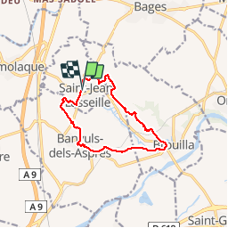
Randonnée Marche de 12,2 km à découvrir à Occitanie, Pyrénées-Orientales, Saint-Jean-Lasseille. Cette randonnée est proposée par jeff66.
Description
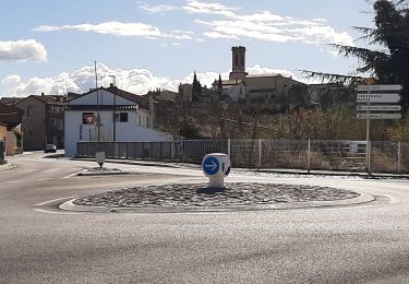
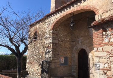
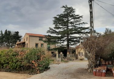
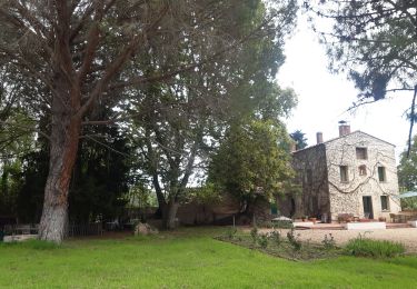
ST-JEAN-LASSEILLE 66 - chateau Montana - par les vignes - Banyuls dels Aspres - église St André - place de la République - cave Coop - vue sur les Albères - Brouilla par la plaine et le vignoble - passages à gué - école - salle polyvalente - cimetière - vue sur brouilla la plaine les Albères - panorama sur Perpignan - chateau Planères - St jean lasseille - cimetière
Localisation
Commentaires
Randonnées à proximité
![Randonnée Quad Montescot - Villeneuve-de-la-Raho-Collioure (Septembre/Juin) - Photo](https://media.geolcdn.com/t/375/260/4ff70784-96c3-45ae-a310-36bc0ac2c85e.jpg&format=jpg&maxdim=2)
![Quad Quad](https://static1.geolcdn.com/sitytour/trail-icons/404.png)
Quad
![](/images/other/stat-length.png)
![](https://static1.geolcdn.com/siteimages/upload/files/16400158638029165_repeat_loop_refresh_sync_direction_icon.png)
![Randonnée Marche Montescot - 66 VILLENEUVE-DE-LA-RAHO grand tour du lac en Sens horaire - Photo](https://media.geolcdn.com/t/375/260/ext.jpg?maxdim=2&url=https%3A%2F%2Fservices.sitytrail.com%2FGeolivesWS%2FDownloadMedia.ashx%3FTrailID%3D526864%26Media%3D20160209171243.jpg)
![Marche Marche](https://static1.geolcdn.com/sitytour/trail-icons/101.png)
Marche
![](/images/other/stat-length.png)
![](https://static1.geolcdn.com/siteimages/upload/files/16400158638029165_repeat_loop_refresh_sync_direction_icon.png)
![Randonnée Marche Montesquieu-des-Albères - MONTESQUIEU-DES-ALBERES 66 - Les Agouillous - les chemins de l'eau dans les Albères - Photo](https://media.geolcdn.com/t/375/260/ext.jpg?maxdim=2&url=https%3A%2F%2Fservices.sitytrail.com%2FGeolivesWS%2FDownloadMedia.ashx%3FTrailID%3D451257%26Media%3D20150728182708.jpg)
![Marche Marche](https://static1.geolcdn.com/sitytour/trail-icons/101.png)
Marche
![](/images/other/stat-length.png)
![](https://static1.geolcdn.com/siteimages/upload/files/16400158638029165_repeat_loop_refresh_sync_direction_icon.png)
![Randonnée Marche Le Boulou - Bataille du Boulou (1793 - 1794) - Photo](https://media.geolcdn.com/t/375/260/e8fd6dc5-027d-40cc-9239-020c7f056093.jpg&format=jpg&maxdim=2)
![Marche Marche](https://static1.geolcdn.com/sitytour/trail-icons/101.png)
Marche
![](/images/other/stat-length.png)
![](https://static1.geolcdn.com/siteimages/upload/files/16400158638029165_repeat_loop_refresh_sync_direction_icon.png)
![Randonnée Marche Brouilla - RP66 BROUILLA - BANYULS DELS ASPRES - par les bords de Tech et Vignobles - le 31.03.2017 - Photo](https://media.geolcdn.com/t/375/260/ext.jpg?maxdim=2&url=https%3A%2F%2Fstatic1.geolcdn.com%2Fsiteimages%2Fupload%2Ffiles%2F1553511878bg_sport_marche.png)
![Marche Marche](https://static1.geolcdn.com/sitytour/trail-icons/101.png)
Marche
![](/images/other/stat-length.png)
![](https://static1.geolcdn.com/siteimages/upload/files/16400158638029165_repeat_loop_refresh_sync_direction_icon.png)
![Randonnée Marche Passa - prieuré du monastir del camp - Photo](https://media.geolcdn.com/t/375/260/2f11251e-2581-4e40-bd8c-78a770a8d6dd.jpg&format=jpg&maxdim=2)
![Marche Marche](https://static1.geolcdn.com/sitytour/trail-icons/101.png)
Marche
![](/images/other/stat-length.png)
![](https://static1.geolcdn.com/siteimages/upload/files/16400158638029165_repeat_loop_refresh_sync_direction_icon.png)
![Randonnée Marche Ortaffa - 20240229 Ortoffa-Banuyls-des-Aspres-Brouillas - Photo](https://media.geolcdn.com/t/375/260/8a963ef0-6d13-4d81-8de9-6fe58ffb1d32.jpg&format=jpg&maxdim=2)
![Marche Marche](https://static1.geolcdn.com/sitytour/trail-icons/101.png)
Marche
![](/images/other/stat-length.png)
![](https://static1.geolcdn.com/siteimages/upload/files/16400158638029165_repeat_loop_refresh_sync_direction_icon.png)
![Randonnée Marche Passa - monastur del camp different - Photo](https://media.geolcdn.com/t/375/260/ac13774c-cacb-49c7-a139-82bd309e4ca6.jpg&format=jpg&maxdim=2)
![Marche Marche](https://static1.geolcdn.com/sitytour/trail-icons/101.png)
Marche
![](/images/other/stat-length.png)
![](https://static1.geolcdn.com/siteimages/upload/files/16400158638029165_repeat_loop_refresh_sync_direction_icon.png)
![Randonnée Marche Montesquieu-des-Albères - montesquieu-des-alberes entre canaux, rivières et tech - Photo](https://media.geolcdn.com/t/375/260/fa027b65-39b4-40bd-b6bb-c353432adb88.jpg&format=jpg&maxdim=2)
![Marche Marche](https://static1.geolcdn.com/sitytour/trail-icons/101.png)
Marche
![](/images/other/stat-length.png)
![](https://static1.geolcdn.com/siteimages/upload/files/16400158638029165_repeat_loop_refresh_sync_direction_icon.png)