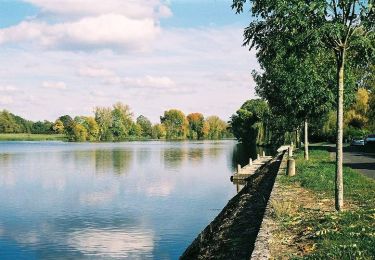
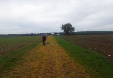
Randonnée Marche Crézançay-sur-Cher - CREZANCAY 10km - Photo
 fanthou
fanthou

Utilisateur

© OpenStreetMap contributors
Longueur
Longueur
10,1 km
Altitude max
Altitude max
180 m
Dénivelé positif
Dénivelé positif
93 m
Km-Effort
Km-Effort  
11,4 km
Altitude min
Altitude min
135 m
Dénivelé négatif
Dénivelé négatif
93 m
Boucle
Boucle
Oui
Date de création :
2024-09-16 16:06:08.651
Dernière modification :
2024-09-16 16:06:48.078

(0 Avis)

Marche
Marche
2h35
Difficulté : Moyen

Scannez ce code QR pour ouvrir la randonnée dans l'application SityTrail

Application GPS de randonnée GRATUITE

Logo SityTrail SityTrail

IGN / Instituts géographiques

Télécharger SityTrail sur l'App Store Télécharger SityTrail sur Google Play

Logo SityTrail SityTrail World

Le monde est à vous

Télécharger SityTrail sur l'App Store Télécharger SityTrail sur Google Play Télécharger SityTrail sur Huawei AppGallery

À propos

Randonnée Marche de 10,1 km à découvrir à Centre-Val de Loire, Cher, Crézançay-sur-Cher. Cette randonnée est proposée par fanthou.

Profil altimétrique

Points d'intérêt

Point d'intérêt Crézançay-sur-Cher - Retour à la mairie - Photo
fanthou
CRÉZANÇAY-SUR-CHER 
Point d'intérêt Crézançay-sur-Cher - Bifurction sur route goudronnée - Photo
fanthou
CRÉZANÇAY-SUR-CHER 
Point d'intérêt Vallenay - Bois les Ordons - Photo
fanthou
VALLENAY 
Point d'intérêt Vallenay - Lieu-dit le Ferty - Photo
fanthou
Point d'intérêt Vallenay - Route direction Bigny - Photo
fanthou
Point d'intérêt Crézançay-sur-Cher - Longer le bois de la grange - sur votre gauche - Photo
fanthou
CRÉZANÇAY-SUR-CHER 
Point d'intérêt Crézançay-sur-Cher - Direction les Arditails - Photo
fanthou
CRÉZANÇAY-SUR-CHER 
Point d'intérêt Crézançay-sur-Cher -  Direction les Arditails - Photo
fanthou
CRÉZANÇAY-SUR-CHER 
Point d'intérêt Crézançay-sur-Cher - Bifurcation en direction des Breteaux - Photo
fanthou
CRÉZANÇAY-SUR-CHER 
Point d'intérêt Crézançay-sur-Cher - Second passage sur la voie ferrée - Photo
fanthou
CRÉZANÇAY-SUR-CHER 
Point d'intérêt Crézançay-sur-Cher - Passage sur la voie ferrée - Photo
fanthou
CRÉZANÇAY-SUR-CHER 
Point d'intérêt Crézançay-sur-Cher - Départ face à la mairie - Photo
fanthou
CRÉZANÇAY-SUR-CHER 

Localisation

Pays :
France
Région :
Centre-Val de Loire
Département/Province :
Cher
Commune :
Crézançay-sur-Cher
Localité :
Unknown
Départ:(Dec)
Départ:(UTM)
450993 ; 5184530 (31T) N.

Randonnées à proximité

Randonnée Marche Châteauneuf-sur-Cher - Le Cher majestueux à Châteauneuf sur Cher - Photo
Marche
tracegps

Marche

Difficile
(1)
Châteauneuf-sur-Cher, Centre-Val de Loire, Cher, France
23 km | 25 km-effort
5h 30min
Oui
Randonnée Cheval Châteauneuf-sur-Cher - Le Cher majestueux à Châteauneuf sur Cher - Photo
Cheval
tracegps

Cheval

Difficile
(1)
Châteauneuf-sur-Cher, Centre-Val de Loire, Cher, France
23 km | 25 km-effort
4h 0min
Oui
Randonnée V.T.T. Châteauneuf-sur-Cher - Le Cher majestueux à Châteauneuf sur Cher - Photo
V.T.T.
tracegps

V.T.T.

Difficile
Châteauneuf-sur-Cher, Centre-Val de Loire, Cher, France
23 km | 25 km-effort
2h 30min
Oui
Randonnée Trail Châteauneuf-sur-Cher - Châteauneuf sur cher - Photo
Trail
levequejef

Trail

Très facile
Châteauneuf-sur-Cher, Centre-Val de Loire, Cher, France
17,7 km | 20 km-effort
2h 17min
Oui
Randonnée Marche Venesmes - VENESMES 15km - Photo
Marche
fanthou

Marche

Difficile
Venesmes, Centre-Val de Loire, Cher, France
14,6 km | 16,3 km-effort
3h 42min
Oui
Randonnée Marche Vallenay - Le Clos Saint-Martin à Vallenay - Photo
Marche
fanthou

Marche

Moyen
Vallenay, Centre-Val de Loire, Cher, France
9,1 km | 10,2 km-effort
2h 19min
Oui
Randonnée Marche Saint-Symphorien - SAINT SYMPHORIEN 12km - Photo
Marche
fanthou

Marche

Difficile
Saint-Symphorien, Centre-Val de Loire, Cher, France
12,5 km | 13,9 km-effort
3h 8min
Oui
Randonnée Marche Saint-Loup-des-Chaumes - SAINT LOUP DES CHAUMES 11km - Photo
Marche
fanthou

Marche

Difficile
Saint-Loup-des-Chaumes, Centre-Val de Loire, Cher, France
11,6 km | 12,6 km-effort
2h 51min
Oui
Randonnée Marche Chavannes - Le Marais de Chavannes - Photo
Marche
fanthou

Marche

Moyen
Chavannes, Centre-Val de Loire, Cher, France
10,9 km | 11,6 km-effort
2h 37min
Oui


Fermer
Mes abonnements