![](/images/other/stat-length.png)
![Randonnée Marche Herbeumont - Les Burzais - départ du gite Le bout des bois - Photo](https://media.geolcdn.com/t/1900/400/ext.pjpeg?maxdim=2&url=https%3A%2F%2Fservices.sitytrail.com%2FGeolivesWS%2FDownloadMedia.ashx%3FTrailID%3D419104%26Media%3Dfix__20140609121902.jpg)
Les Burzais - départ du gite Le bout des bois
EclecticMargins
Utilisateur
![Longueur](/images/other/stat-length.png)
![Altitude max](https://static1.geolcdn.com/siteimages/upload/files/1508320355ic_sort_altitude_max_24dp.png)
![Dénivelé positif](https://static1.geolcdn.com/siteimages/upload/files/1508320355ic_sort_den_pos_24dp.png)
![Km-Effort](/images/other/stat-length.png)
![Altitude min](https://static1.geolcdn.com/siteimages/upload/files/1508320355ic_sort_altitude_min_24dp.png)
![Dénivelé négatif](https://static1.geolcdn.com/siteimages/upload/files/1508320355ic_sort_den_neg_24dp.png)
![Boucle](https://static1.geolcdn.com/siteimages/upload/files/16400158638029165_repeat_loop_refresh_sync_direction_icon.png)
![Marche](https://static1.geolcdn.com/sitytour/trail-icons/101.png)
1h30
Difficulté : Moyen
![Scannez ce code QR pour ouvrir la randonnée dans l'application SityTrail](https://capi.geolives.com/qq0zvz2zws4bq2lad0pu/sitytour/trails/419104/qr.png?size=200)
Application GPS de randonnée GRATUITE
À propos
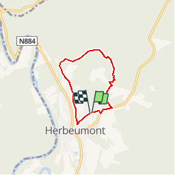
Randonnée Marche de 4,2 km à découvrir à Wallonie, Luxembourg, Herbeumont. Cette randonnée est proposée par EclecticMargins.
Description
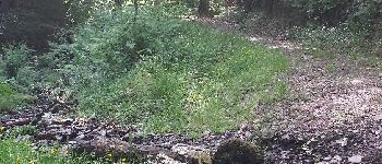
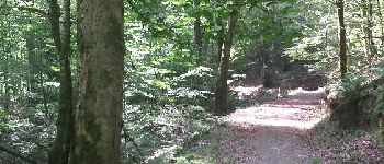
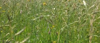
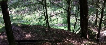
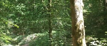
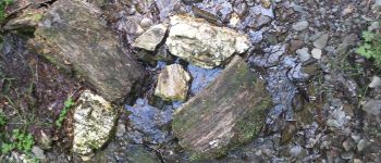
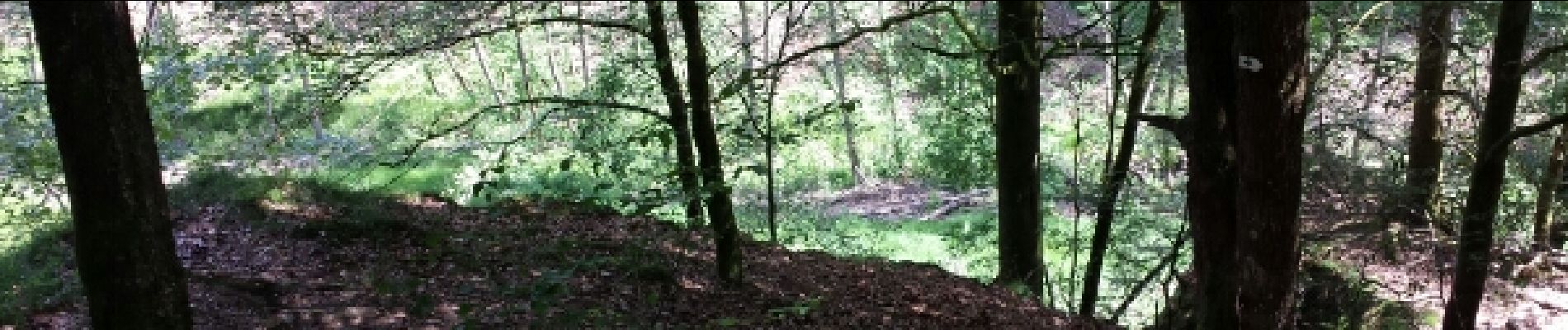
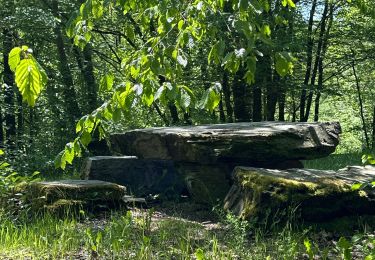
Balade très agréable et variée dans une vallée mystérieuse. Le sentier serpente dans la vallée du ruisseau des Burzais avec un passage entre les rochers et des passages à gué, des traversées de pâturages et retour par le village.
*** Prévoir un bâton de marche et de bonnes chaussures pour le passage entre rochers. * Idéalement à faire par temps sec. Si il a fait humide les jours précédents, prévoir de bonnes chaussures bien étanches (passages à gué et chemins qui peuvent être boueux).
* Ne convient pas aux poussettes
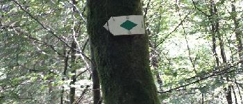
* Balisage : carré vert sur pointe
*** Photographies et textes : Annick Stélandre - Eclectic Margins
* Trace 9/6/14 - màj 7/5/16 et 25/6/16
Points d'intérêt
Localisation
Commentaires
Randonnées à proximité
![Randonnée Autre activité Bertrix - BX08 - Photo](https://media.geolcdn.com/t/375/260/ext.jpg?maxdim=2&url=https%3A%2F%2Fstatic1.geolcdn.com%2Fsiteimages%2Fupload%2Ffiles%2F1545311037marcheuse_200dpi.jpg)
![Autre activité Autre activité](https://static1.geolcdn.com/sitytour/trail-icons/900.png)
Autre activité
![](/images/other/stat-length.png)
![](https://static1.geolcdn.com/siteimages/upload/files/16400158638029165_repeat_loop_refresh_sync_direction_icon.png)
![Marche Marche](https://static1.geolcdn.com/sitytour/trail-icons/101.png)
Marche
![](/images/other/stat-length.png)
![](https://static1.geolcdn.com/siteimages/upload/files/16400158638029165_repeat_loop_refresh_sync_direction_icon.png)
![Marche Marche](https://static1.geolcdn.com/sitytour/trail-icons/101.png)
Marche
![](/images/other/stat-length.png)
![](https://static1.geolcdn.com/siteimages/upload/files/16400158638029165_repeat_loop_refresh_sync_direction_icon.png)
![Randonnée Marche Bertrix - Bertrix arboretum - Photo](https://media.geolcdn.com/t/375/260/aec43457-0ac5-47ef-8414-fdada4cc2fd7.jpg&format=jpg&maxdim=2)
![Marche Marche](https://static1.geolcdn.com/sitytour/trail-icons/101.png)
Marche
![](/images/other/stat-length.png)
![](https://static1.geolcdn.com/siteimages/upload/files/16400158638029165_repeat_loop_refresh_sync_direction_icon.png)
![Marche Marche](https://static1.geolcdn.com/sitytour/trail-icons/101.png)
Marche
![](/images/other/stat-length.png)
![](https://static1.geolcdn.com/siteimages/upload/files/16400158638029165_repeat_loop_refresh_sync_direction_icon.png)
![Randonnée Marche Florenville - rando les epioux 15/09/2020 - Photo](https://media.geolcdn.com/t/375/260/f418135f-9d94-414f-b063-7d7f558c9ced.jpg&format=jpg&maxdim=2)
![Marche Marche](https://static1.geolcdn.com/sitytour/trail-icons/101.png)
Marche
![](/images/other/stat-length.png)
![](https://static1.geolcdn.com/siteimages/upload/files/16400158638029165_repeat_loop_refresh_sync_direction_icon.png)
![Randonnée Marche Florenville - 14km St Cécile vers Herbeumont - Photo](https://media.geolcdn.com/t/375/260/ext.jpg?maxdim=2&url=https%3A%2F%2Fservices.sitytrail.com%2FGeolivesWS%2FDownloadMedia.ashx%3FTrailID%3D1023598%26Media%3Dfix__20180817123348.jpg)
![Marche Marche](https://static1.geolcdn.com/sitytour/trail-icons/101.png)
Marche
![](/images/other/stat-length.png)
![](https://static1.geolcdn.com/siteimages/upload/files/16400158638029165_repeat_loop_refresh_sync_direction_icon.png)
![Randonnée Marche Herbeumont - RSIH - Herbeumont - Les Épioux - Photo](https://media.geolcdn.com/t/375/260/ca0e741e-0f45-4c3d-9414-5f2e5834b9ce.jpg&format=jpg&maxdim=2)
![Marche Marche](https://static1.geolcdn.com/sitytour/trail-icons/101.png)
Marche
![](/images/other/stat-length.png)
![](https://static1.geolcdn.com/siteimages/upload/files/16400158638029165_repeat_loop_refresh_sync_direction_icon.png)
![Randonnée Course à pied Herbeumont - herbeumont libaipire - Photo](https://media.geolcdn.com/t/375/260/ext.jpg?maxdim=2&url=https%3A%2F%2Fservices.sitytrail.com%2FGeolivesWS%2FDownloadMedia.ashx%3FTrailID%3D356345%26Media%3Dfix__20141022103733.jpg)
![Course à pied Course à pied](https://static1.geolcdn.com/sitytour/trail-icons/103.png)
Course à pied
![](/images/other/stat-length.png)
![](https://static1.geolcdn.com/siteimages/upload/files/16400158638029165_repeat_loop_refresh_sync_direction_icon.png)
Sympa, faire attention au chemin au retour car il n’est pas facile à voir. Pas de souci avec un chien.
Toute la partie dans la forêt est super sympa et jolie, attention les tiques et araignées. Par contre certains chemins ne sont pas à jour, il suffit de suivre les balises vertes
A refaire. Parfait